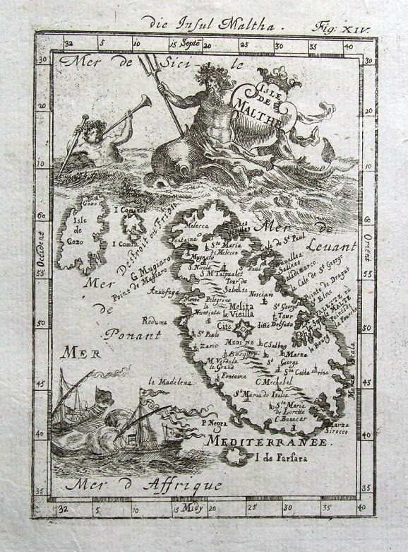
MALTA, Allain Mallet original illustrated antique map 1719
ISLE DE MALTHE
by
Alain Manesson Mallet.
Published Frankfurt 1719 in "Beschreibung des ganzen Welt Kreises....", a German translation of Mallet's "Description de L'Univers."
An attractive copper engraved antique map of the island of Malta. The title cartouche features Neptune astride a sea monster and the map is further illustrated with sailing ships and a sea nymph. The neighbouring islands of Gozo, Comina and Filfla (Farfara) are also included.
Fine condition, printed on hand laid paper, blank verso.
Approx. 5.5" x 4" (140mm x 110mm) printed area only with good margins beyond.
ALLAIN MANESSON MALLET (1630 - 1706)
Mallet started out as a soldier serving King Louis XIV as an inspector of fortifications but later was appointed as mathematics teacher at the King's court. He is chiefly remembered however for his publications of "Description de L'Univers" (1683) in 5 volumes, and "Les Travaux de Mars ou l'Art de la Guerre" (1684) in 3 volumes.
A GENUINE ANTIQUE MAP GUARANTEED OVER 290 YEARS OLD FROM LINDISFARNE PRINTS
T85714
We do not deal in reproductions, facsimiles or modern copies of any kind.
Two items shipped for a single postage charge.
Free shipping worldwide if three items or more purchased
|