THIS USED GPS IS IN EXCELLENT CONDITION GARMIN
GPSMap 60CSx
COLOR Handheld GPS 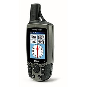 - Portable, easy to use, robust, waterproof to IPX-7 standards (withstands 30 minutes under water up to 1 meter (3 feet) deep)
- Large, easy to read color display with background illumination (256 colors, 160x240 pixel)
- Easy to use thanks to its rocker key and push buttons and its user friendly, graphical interface
- Multilingual user interface in Croatian, Czech, Danish, Dutch, English, Finnish, French, German, Hungarian, Italian, Norwegian, Polish, Portuguese, Spanish, and Swedish
- Integrated 12 channel GPS receiver with very sensitive built-in antenna
(the GPSMAP60CSx is equipped with the even more powerful SiRFstar III GPS antenna) - Integrated world map (overview) with countries of all continents including major cities
- Integrated base map of Europe, Africa and the near East with countries, waters, towns, highways, major roads and city maps. Navigational information are available for the following countries: country list
- Memory to store additional, even more detailed maps with roads, crossings and addresses of restaurants, public buildings, points of interest etc. from a PC:
- GPSMAP60CSx: Slot for standard micro SD memory card INCLUDED (2mb)
- Electronic compass to check heading while not moving¹ (can be turned off so safe power, accuracy ±5°, resolution ±1°)
- Barometrical altimeter for precise elevation recording², range -610..9144 m (-2000..+30000 feet); accuracy ±3 m (10 feet), resolution ±30 cm (1 foot)
- Powered by batteries (2x AA, last about 20 h) or by an external 12 V power source, e.g. from a car's cigarette lighter
- Short time to first fix (TTFF³: approx. 15 seconds after a warm start, meaning there are valid coordinates of the satellites available, or approx. 45 seconds after a cold start, meaning there are no valid coordinates of the satellites available)
- Supports the following protocols for data exchange with PC: NMEA 0183 with 4800 Baud, GARMIN, GARMIN DGPS, Text, RTCM IN, RTCM/NMEA and RTCM/TEXT
- Supports WAAS (improves accuracy of position indication from typical better than 15 m (49 feet) to typical better than 3 m (10 feet))
- DGPS (Differential GPS) ready (GARMIN differential receiver available as an option)
- Supports more than 100 different datum (coordinate systems)
- Supports various display formats include the Swiss Grid
- Firmware stored in Flash-Memory, can be updated by the user
- Operating temperatures -15 .. 70°C (5° .. 158°F)
- USB and serial interface RS-232 (USB connection cable included)
- Dimensions: 180x61x33 mm (2.4x6.1x1.3 inches)
- Weight: 150 g (5.3 ounces, without batteries)
- ¹) In order to check the heading with a GPS, a minimal movement with a speed of at least 5..8 km/h (3..5 mi/h) is required. Where no movement is not possible, a compass is needed.
- ²) Even though a GPS provides accurate elevation information, the value slightly varies continuously. A barometrical altimeter is therefore more accurate, especially when summarizing elevation changes.
- ³) TTFF: Time To First Fix, time until the first information about the current position is acquired.
THIS GPS WILL LET YOU ENTER COORDINATES FOR GEOCACHING MANUALLY OR FROM PROGRAMS LIKE EASYGPS HERE IS WHAT YOU GET
- GPSMAP 60CSx GPS™
- microSD CARD 2MB
|