See our ratings  Add this shop to my favorites  |
||
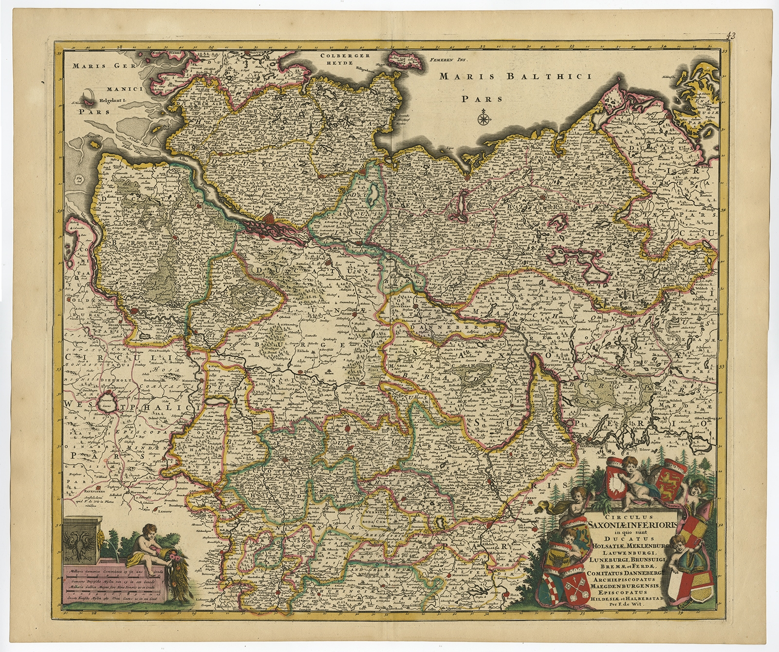 |
Antique Map of the Saxony Region of Germany by De Wit (c.1680) $ 1,941.87 instead of Availability: in stock Condition : Very good, given age. Original/contemporary hand coloring. Original middle fold as issued. General age-related toning and/or occasional minor defects from handling. Blank verso. Please study image carefully. Date : c.1680 Overall size : 63.8 x 53.5 cm. Image size : 56.9 x 49.1 cm. Description: Antique map titled 'Circulus Saxoniae Inferioris in quo sunt Ducatus holsatiae, Meklenburg, Lauwenburgi, Luneburgi, Brunsuigi, Bremae et Ferdae (..)'. Large and detailed map filled with information and hundreds of villages and towns. Dozens of fortified cities are shown, including Berlin, Bremen, Hamburg, Osnabruck, Minden, and Magdeburg. Two decorative title cartouches adorn the map surrounded by cherubs, putti, and coats of arms of the major cities in Germany. Source unknown, to be determined. Artists and Engravers: Frederik/Frederick de Wit (Amsterdam 1630-1706), was a famous engraver and publisher in Amsterdam. He acquired many of the printing plates of Blaeu and Janssonius when it came to auction. His map were very popular because of the quality of the engravings and the beautiful colouring. After his death his work was re-issued by Pieter Mortier and Covens & Mortier. |
|