See our ratings  Add this shop to my favorites  |
||
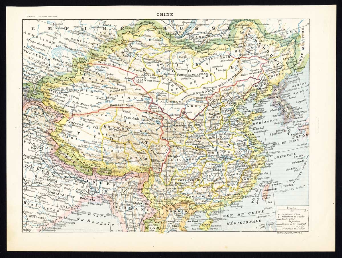 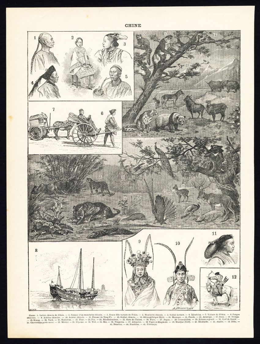 |
Antique Map of China by Larousse (1897) $ 61.79 Availability: in stock Condition : Excellent. General age related toning and occasional light staining from handling. Please study image carefully. Date : 1897 Overall size : 23 x 30.5 cm. Image size : 20 x 27 cm. Description: Sheet: Front: 'Chine.' (China map). Verso: 'China.' (China views, nature, animals, costume). This rare early lithographic print originates from: 'Nouveau Larousse Illustre en sept volumes.', Directeur Claude Auge, Paris, published 1897-1904, with a supplement addedin 1907. The Nouveau Larousse illustre (New Larousse Illustrated) was an illustrated French language encyclopedia published by Larousse between 1897-1904, in 7 volumes and a supplement. It was essentially a scaled-down version of the 'Grand dictionnaire universel du XIXe siècle.' (Great universal dictionary of the 19th century) of Pierre Larousse, but updated and written in a more neutral, scientific style under the editorship of Claude Auge. |
|