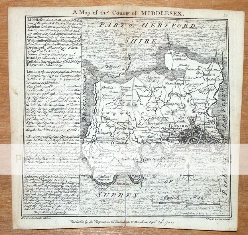
| A map of the county of MIDDLESEX by T.Badeslade (drawn) & W.H.Toms (engraved) Published by Badeslade & Toms London 1741 in "Chorographia Brittaniae" A fine copper engraved mid 18th century county map of Middlesex, mostly present day Greater London. The Badeslade miniature county maps are flanked on the left with informative notes on the major towns, in this case mostly London, giving details of market days, fairs, parliamentary members and other points of interest, which add to their appeal and make them highly collectable. Dated and credited in the plate. Patchy browning as seen, and some splitting to the original centre fold has been repaired verso. Centre fold as issued. Approx. 6" x 6" (150mm x 150mm) printed area only with margins beyond.
GENUINE ANTIQUE MAP GUARANTEED OVER 250 YEARS OLD FROM LINDISFARNE PRINTS We do not deal in reproductions, facsimiles or copies of any kind.
SHIPPING
Two items combined for shipping. Free shipping worldwide if three items or more purchased
T481111 |