TOPO Australia & New Zealand Featuring HEMA (MicroSD) Hema are Australia’s premium 4WD mapping producers. There is a good reason for this – they actually go out and drive the 4WD tracks to map them, so they know them first hand. Covering all the classic Australian 4WD adventures such as the Simpson Desert, Birdsville, Cape York, Fraser Island, the Kimberly, Victorian High Country and more, Hema maps are finally available for use on selected Garmin GPS units. Available stand alone or combined with Garmin’s powerful topo mapping (this product) so you can switch between mapping styles depending on the situation. Get enhanced topographic detail on your compatible device whether you're in the outback or on a main boulevard in the city. This map provides a wide array of HERE topographic information from terrain contours, elevations and summits to coverage of perennial and intermittent lakes, rivers and streams in Australia and New Zealand as well as HEMA 72K Raster and HEMA POIs information for Australia. zumo XT owners please note: HEMA POIs do not show full detail on the zumo XT, and to use TOPO v6 the CITY NAV & Topographic Layer must be disabled. Screenshots (Montana 680t) Previous Next Hema provide a broad overview map and more detailed mapping for 4WD areas to allow you to get an at a glance outline of the routes you can take as well as extra information such if permits are required, if the track is impassable in wet weather and distances. The Hema mapping is a raster based map, so just like a paper based map it comes in various scales and the Garmin will automatically switch to the more detailed scale as you zoom in. The Garmin topo map is a vector based map which doesn’t have a set scale, but will change the information displayed depending on your zoom level. Switching between the two different styles of map will ensure you get the maximum level of detail and don’t miss a thing. As well as comprehensive four wheel drive track coverage these maps also have spots to camp, things to see, where to get fuel and more. Provides terrain contours and summit points at 10 m intervals for a more detailed view of the terrain Contains more than 105,000 km of tracks, roads and outback trails; also displays 4WD destinations and hydrographic features: lake/river shorelines and perennial and seasonal streams Includes built-in DEM data with 3-D shading and route elevation profiles on compatible devices so you can estimate terrain difficulty Offers updated and new searchable HERE and HEMA points of interest in urban, rural and outback areas, including lodging, restaurants, homesteads, parks, shopping and camping locations Displays updated routable road content, by HERE, to give you turn-by-turn directions to your destination HEMA 72K Raster is great for caravanning, trekking & hiking, camping, geocaching 4WD, and other outdoor activities. Easily Switch Between Hema Raster and Garmin Topo Mapping $(window).load(function () { $(".twentytwenty-container[data-orientation!='vertical']").twentytwenty({ default_offset_pct: 0.3 }); $(".twentytwenty-container[data-orientation='vertical']").twentytwenty({ default_offset_pct: 0.3, orientation: 'vertical' }); }); $('#topo-hema-map-photos').slick({ centerPadding: '100px', slidesToShow: 1, fade: true, responsive: [ { breakpoint: 768, settings: { arrows: false, centerMode: true, centerPadding: '40px', slidesToShow: 1 } }, { breakpoint: 480, settings: { arrows: false, centerMode: true, centerPadding: '40px', slidesToShow: 1 } } ] });
HEMA and Garmin Topo Map Card (010-C1159-00)
TOPO Australia & New Zealand Featuring HEMA (MicroSD)
Hema are Australia’s premium 4WD mapping producers. There is a good reason for this – they actually go out and drive the 4WD tracks to map them, so they know them first hand. Covering all the classic Australian 4WD adventures such as the Simpson Desert, Birdsville, Cape York, Fraser Island, the Kimberly, Victorian High Country and more, Hema maps are finally available for use on selected Garmin GPS units. Available stand alone or combined with Garmin’s powerful topo mapping (this product) so you can switch between mapping styles depending on the situation.
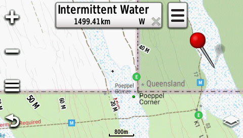
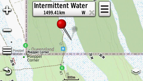
Get enhanced topographic detail on your compatible device whether you're in the outback or on a main boulevard in the city. This map provides a wide array of HERE topographic information from terrain contours, elevations and summits to coverage of perennial and intermittent lakes, rivers and streams in Australia and New Zealand as well as HEMA 72K Raster and HEMA POIs information for Australia.
zumo XT owners please note: HEMA POIs do not show full detail on the zumo XT, and to use TOPO v6 the CITY NAV & Topographic Layer must be disabled.
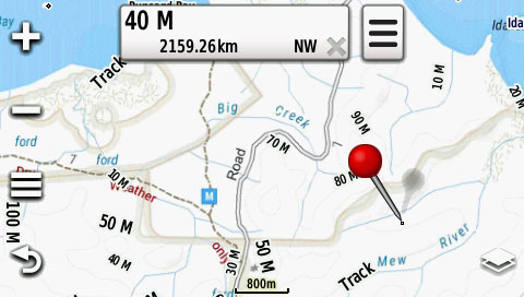
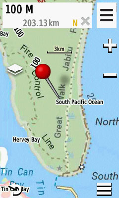
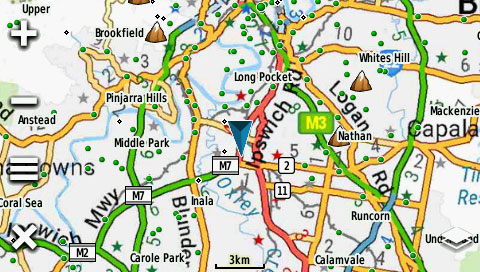
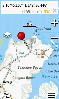
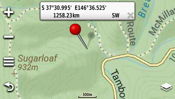
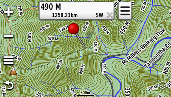
Screenshots (Montana 680t)
Hema provide a broad overview map and more detailed mapping for 4WD areas to allow you to get an at a glance outline of the routes you can take as well as extra information such if permits are required, if the track is impassable in wet weather and distances. The Hema mapping is a raster based map, so just like a paper based map it comes in various scales and the Garmin will automatically switch to the more detailed scale as you zoom in. The Garmin topo map is a vector based map which doesn’t have a set scale, but will change the information displayed depending on your zoom level. Switching between the two different styles of map will ensure you get the maximum level of detail and don’t miss a thing. As well as comprehensive four wheel drive track coverage these maps also have spots to camp, things to see, where to get fuel and more.
Provides terrain contours and summit points at 10 m intervals for a more detailed view of the terrain
Contains more than 105,000 km of tracks, roads and outback trails; also displays 4WD destinations and hydrographic features: lake/river shorelines and perennial and seasonal streams
Includes built-in DEM data with 3-D shading and route elevation profiles on compatible devices so you can estimate terrain difficulty
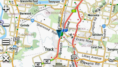
Offers updated and new searchable HERE and HEMA points of interest in urban, rural and outback areas, including lodging, restaurants, homesteads, parks, shopping and camping locations
Displays updated routable road content, by HERE, to give you turn-by-turn directions to your destination
HEMA 72K Raster is great for caravanning, trekking & hiking, camping, geocaching 4WD, and other outdoor activities.
Easily Switch Between Hema Raster and Garmin Topo Mapping


 Additional Information


 Additional delivery notes
