S. PONTAULT DE BEAULIEU (*1612), Karte der Schlacht von Courtrai, 1694, Radieru
1200.00 EUR*
*inkl. MwSt. (Differenzbesteuerung gem. §25a UStG, Kunstgegenstände/Sonderregelung)
Kostenloser Versand innerhalb Deutschlands
- kostenloser Versand innerhalb Deutschlands
- besonders sichere Verpackung
- 1 Monat Rückgaberecht
- kostenloser Rückversand
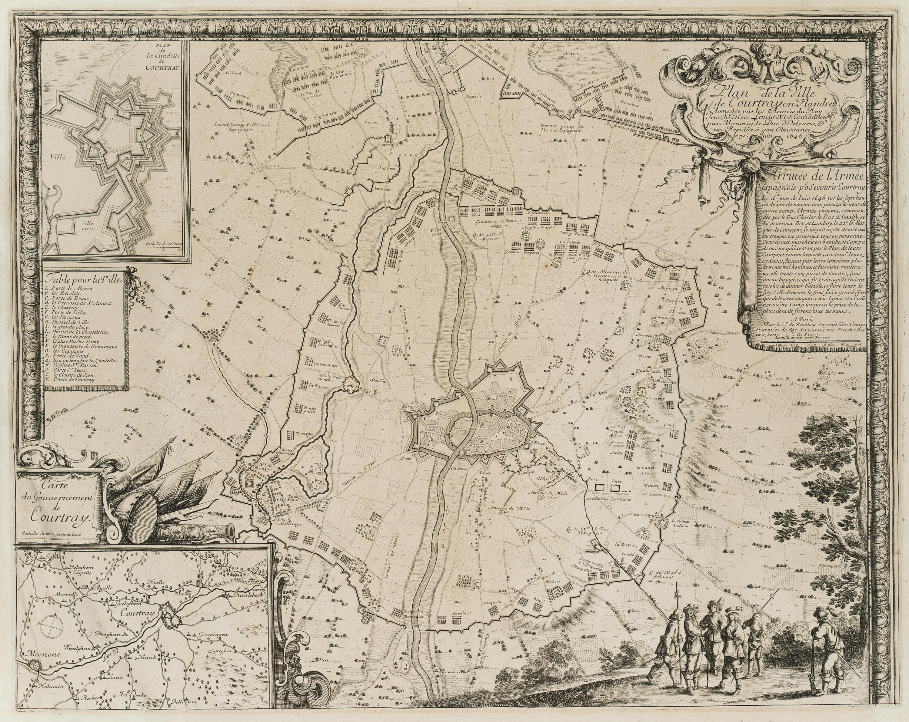
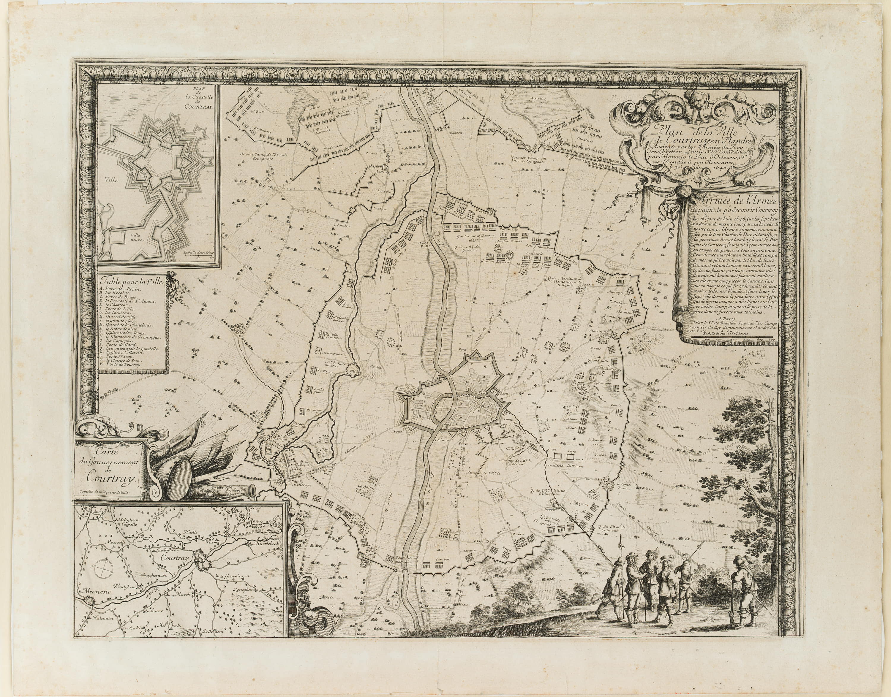
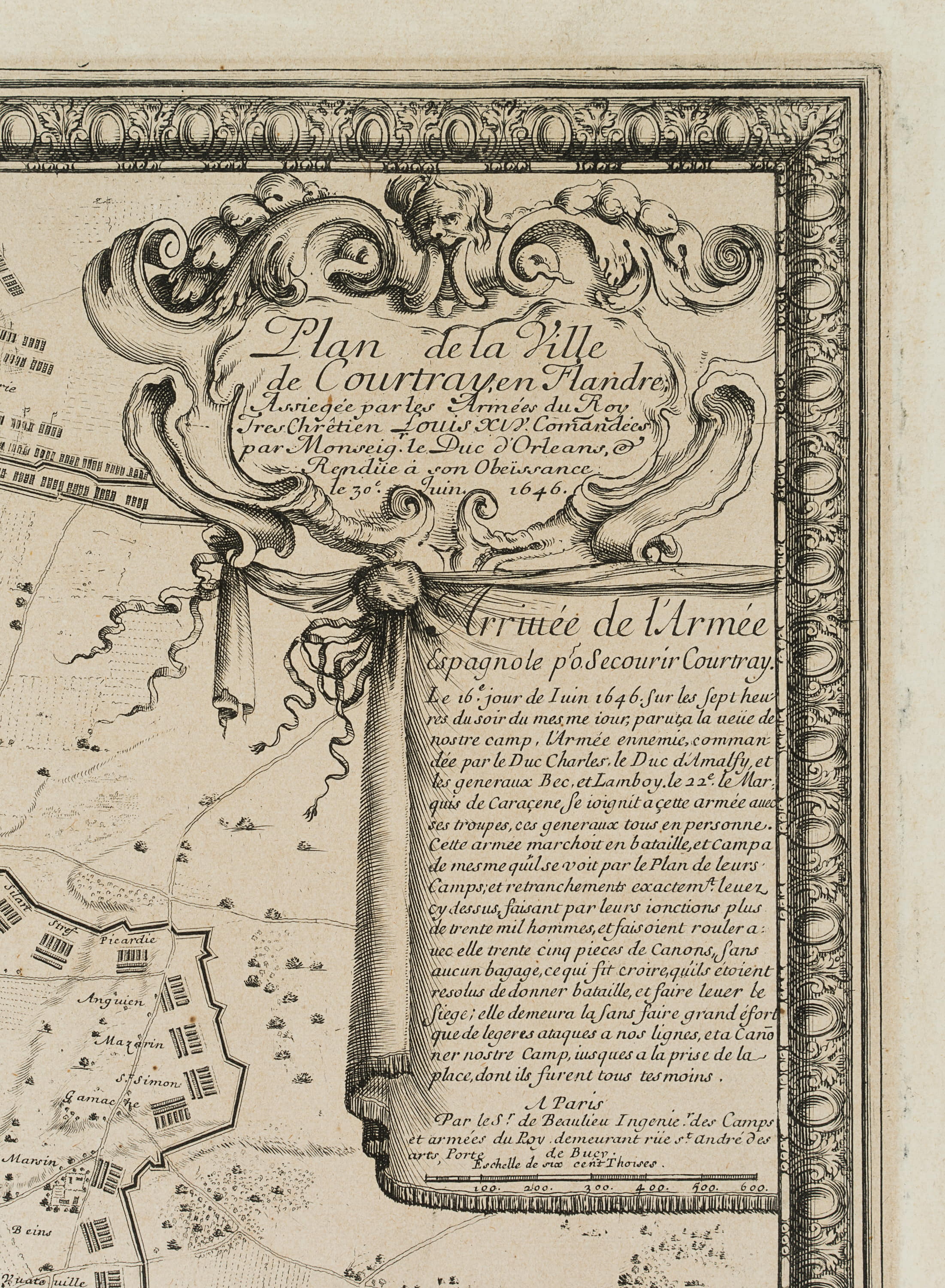
Sébastien de Pontault de Beaulieu (um 1612 - 1674 ebd.), Karte der Schlacht von Courtrai in Flandern, 1694, Radierung
- Technik: Radierung auf Papier
- Bezeichnung: Unten im Druck signiert: "A Paris Par le Sr. de Beaulieu Ingenier. des Camps et armées du Roy". Im Druck bezeichnet: "Plan de la Ville de Courtray en Flandre.".
- Datierung: 1694
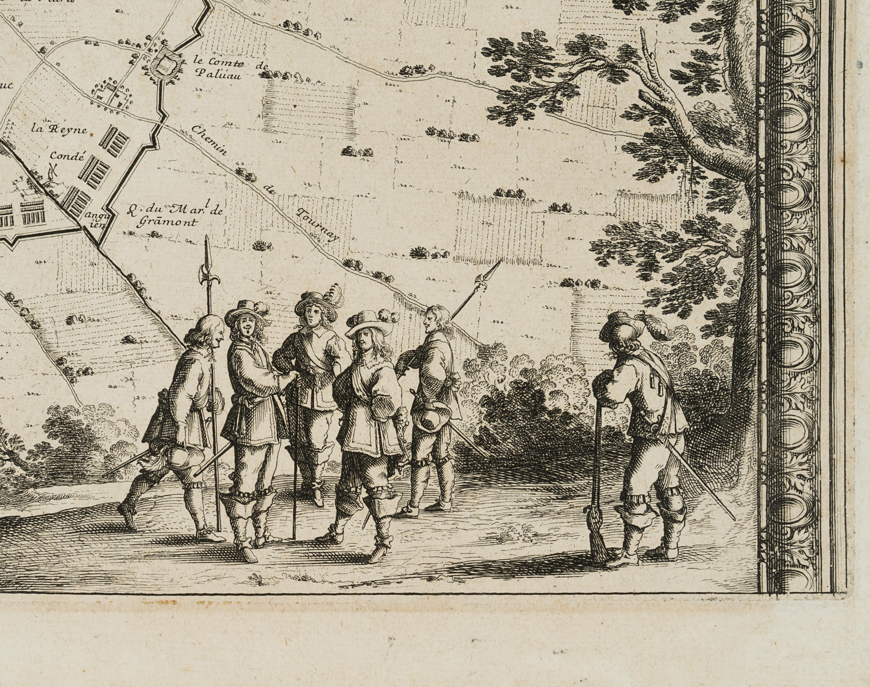
- Beschreibung: Sehr seltene und bedeutende Karte des berühmten Sébastien Pontault de Beaulieu, die Schlacht Ludwig XIV. bei Courtrai in Flandern zeigend. Pontault de Beaulieu gilt als Erfinder der militärischen Kartographie, Aus dem Band: "Les glorieuses Conquêtes de Louis-le-Grand: ou Recueil, de Plans et Vues des places assiegeés, et de celles ou se sont douneés des batailles…", erstmals publiziert 1694. | Wasserzeichen: "IHS" mit Kreuz
- Schlagworte: Topographie, Karte, Schlacht, König, Lageplan, Belagerung, Armee, Festung, Krieg, Militär, Landkarten, Frankreich, Barock, 1650-1699
- Größe: Papier: 49.8 cm x 62.8 cm
- Zustand: Guter Zustand. Minimal fleckig und gebräunt (meist in den Rändern), kleiner restaurierter Einriss im unteren weißen Rand, kleine Quetschfalte im oberen weißen Rand. Verso mit Resten einer alten Randverklebung. Papier minimal wellig.
English Version:
Sébastien de Pontault de Beaulieu (around 1612 - 1674 ibid.), Map of the Battle of Courtrai in Flanders, 1694, Etching
- Technique: Etching on Paper
- Inscription: At the lower part signed in the printing plate: "A Paris Par le Sr. de Beaulieu Ingenier. des Camps et armées du Roy". Inscribed in the printing plate: "Plan de la Ville de Courtray en Flandre.".
- Date: 1694
- Description: Very rare and important map by the famous Sébastien Pontault de Beaulieu, showing the battle of Louis XIV at Courtrai in Flanders. Pontault de Beaulieu is considered the inventor of military cartography, From the volume: "Les glorieuses Conquêtes de Louis-le-Grand: ou Recueil, de Plans et Vues des places assiegeés, et de celles ou se sont douneés des batailles...", first published 1694. | Watermark: "IHS" with cross
- Keywords: Topography, map, battle, king, map, siege, army, fortress, war, 17th century, Baroque, Military, France,
- Size: Paper: 49.8 cm x 62.8 cm (19.6 x 24.7 in)
- Condition: Good condition. Minimally stained and browned (mostly in margins), small restored tear in lower white margin, small box pleat in upper white margin. Verso with remains of an old marginal glue. Paper minimally wavy.
For international customers outside the European Union: eBay will charge an "Internet Sales Tax". As of January 1, 2020, 38 states in the US, Australia and New Zealand require the collection of sales tax. Further states and countries may be included in this procedure. In such cases, eBay collects and remits Internet Sales Tax on your behalf. In these states, the way taxable transactions are processed, is as follows: 1. In states where eBay is required to collect Internet Sales Tax from buyers, order totals sent for processing will reflect the gross order amount inclusive of tax, if your shipping location is in one of these countries. The tax rate varies from state to state. 2. Once settled, the tax amount will be automatically deducted for remittance to the applicable taxing authority. This tax is to be paid by the buyer. Each state’s legislation dictates if shipping and handling are taxable or not. In those states where eBay is collecting tax, the tax on shipping and handling will be collected where applicable.
Furhter information can be found at this eBay customer service page.
Furhter information can be found at this eBay customer service page.
© 2022 Buchprojekt1 / powered by createyourtemplate