|
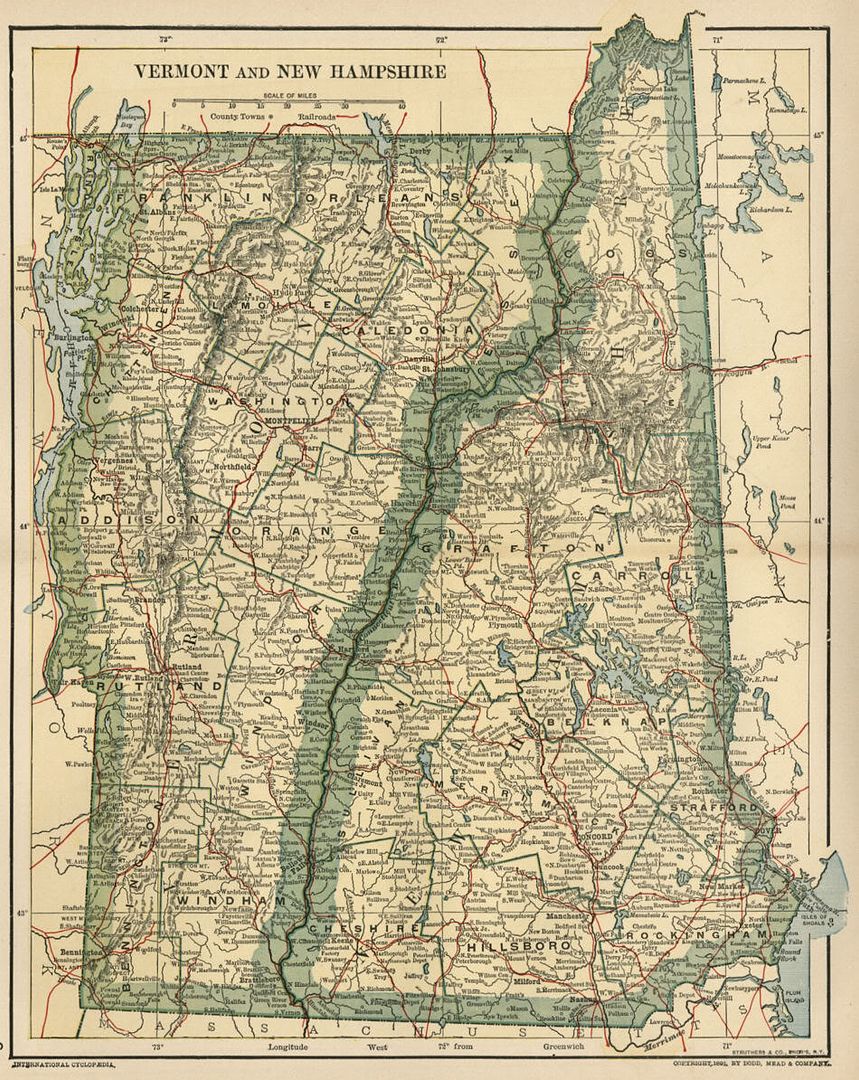
This color map of Vermont and New Hampshire is dated 1891 on the face. It was engraved and printed by the Struthers & Company Engravers, New York, to accompany a set of reference material published in 1891 and 1896. Counties, County Seats, Cities; many Small Towns and Villages; Ports, Military Airfields and Forts; Rivers, Streams, and Lakes; and other topographical features are located on this map. Most of the state's railroads and all of the major railroads are shown in red.
The map is printed on a sheet of medium weight paper measuring 11 5/8" x 9 5/8", with a fold in the center (as issued). The bordered map area is about 10.5" x 8.25" with blank margins of between 1/2" to 1 inch all the way around to allow convenient matting.
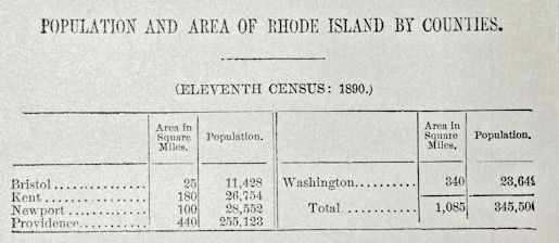
On the back of the map, as issued by the lithographer (not subsequently printed), there are two printed tables containing "Area and State Population By Counties" data for each state, derived from the Eleventh Census (1890). County area (in square miles) is included, as well as population figures for each of the counties that were organized and officially recognized when the Eleventh Census was conducted. A sample of this table (from the Rhode Island map) is shown in one of the photos below. According to this map, the 1890 population of Washington County (Montpelier, VT) was 103,394, and the total state populations of Vermont and New Hampshire were 332,422 and 376,530, respectively.
This is a very attractive older map and would look beautiful matted and framed. If you want a detailed map showing the state as it was over 130 years ago, this is a good one.
The copyright date of "COPYRIGHT, 1891, by Dodd, Mead & Company." appears on the face of this map, just below the border in the lower-right corner.
Please check my listings for other possible versions of this map. One of the delightful and interesting results of the engraving and ink transfer process in lithography is that there can be color variants of the maps which look distinct from each other, even though they were produced by the same engraved plates on the same press. This may be a result of additional passes by one color or another, subtle differences in the ink tone, varying pressure from the pressing of the plates, slight variation in the position of each color plate, or other choices made by the engravers or the printers. The result is that each map's appearance is truly unique.
1) The first image shows the map cropped without its full margins. The full, blank margins are actually between 1/2" and 1" all the way around.
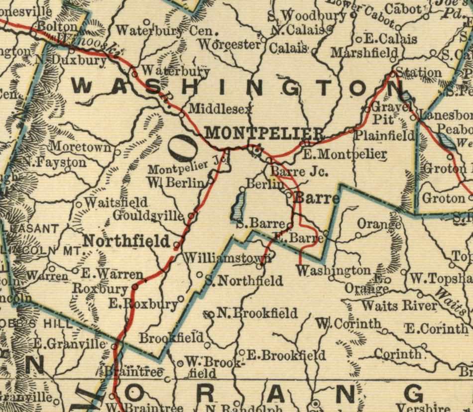
2) The second image is a closeup of the area around Montpelier, to show the quality and detail of the engraving.
|