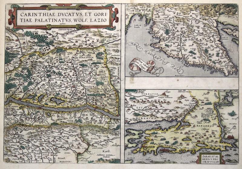
Istria Zadar Carinthia Original Copperplate Map Ortelius 1606
The description of this item has been automatically translated. If you have any questions, please feel free to contact us.
ISTRIA (Istria) - ZADAR (Zara) - CARINTHIA: Kst.-karte, after Wolfgang Lazius from , 'Carinthiae dvcatvs, et Goritiae palatinatvs ..' and 'Histriae tabula Petro Coppo deser. ' and 'Zarae, et Sebenici descriptio',
with border and surface coloring, 1606, 33 x 48
Van den Broecke, No. 143 A - C. ( English edition ) - With 3 maps on one sheet. The title of each map in an orig. Cartridge. Also shows Gorizia (Gorizia). The left card (33 x 24 cm. ) shows Carinthia with the Drau in the middle of the picture. In the south the principality of Gorizia ( Gorizia ). In the right part 2 maps, each 15 x 23.5 cm. Above depiction of the Istrian peninsula ( Istria / Istra ), below the Dalmatian coast with Zadar ( Zara ) and Sibenik ( Sebenico ).
Article number: 308501