Map of Japan - Plate 19 disbound from 1958 Mid-Century Times Atlas of the World, with Iwo Jima and Okinawa and inset plan of Tokyo Bay
Mid-Century Edition Softcover The Times Publishing Company Ltd., 1958 Very Good Condition


Book Publishing Details
| Author: | John Bartholomew |
| Full title: | Map of Japan - Plate 19 disbound from 1958 Mid-Century Times Atlas of the World, with Iwo Jima and Okinawa and inset plan of Tokyo Bay |
| Publisher: | The Times Publishing Company Ltd., 1958 |
| Edition: | Mid-Century Edition |
| Binding: | Softcover |
| ISBN: | No ISBN |
| Book ID: | 45021024043 |
Comments & Item Features
Mid-Century Edition. First printing of this edition. Category: Maps, China, Japan, Nepal & Tibet. Language: English. ISBN: No ISBN.
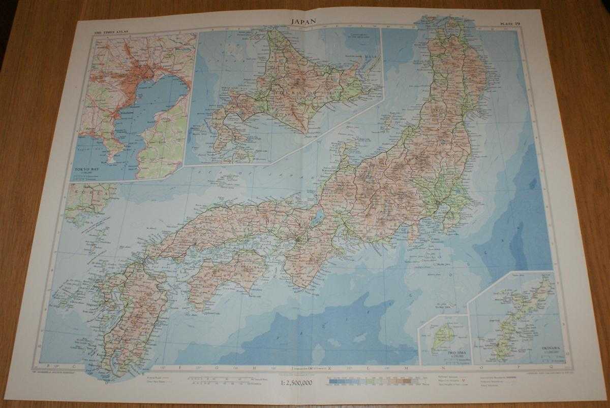
Single disbound map sheet from 'The Times Atlas of the World, Mid-Century Edition; Volume I The World, Australia & East Asia' suitable for framing. Map is in colour and has vertical centre fold. Approx sheet size is 49 x 61cm. Sheet is clean, bright and crisp. Map covers Japan, with Hokkaido included as an inset contiuation panel. Sheet contains small inset plans showing Iwo Jima and Okinawa at closer scales and a plan of Tokyo Bay (including Tokyo, Yokohama, Kawasaki, Yokosuka and Chiba). Road and railway routes are shown.
Single disbound map sheet from 'The Times Atlas of the World, Mid-Century Edition; Volume I The World, Australia & East Asia' suitable for framing. Map is in colour and has vertical centre fold. Approx sheet size is 49 x 61cm. Sheet is clean, bright and crisp. Map covers Japan, with Hokkaido included as an inset contiuation panel. Sheet contains small inset plans showing Iwo Jima and Okinawa at closer scales and a plan of Tokyo Bay (including Tokyo, Yokohama, Kawasaki, Yokosuka and Chiba). Road and railway routes are shown.
Book Condition Report
Book Condition: Very Good Condition. Dust Jacket: No Dust Jacket.
Size of Item & Shipped Weight
Shipped Weight: under 1 kg.
Multiple Purchases
If you are considering ordering multiple items from us, please contact us so that we can offer you a discount on the total price including delivery.
Images
If you would like to see an additional/ different image of this item, please contact us.
More books and maps and sheet music.....
We have many more items in our ebay shop, please view by clicking on the ebay shop icon above.
Keywords and Associated Terms
BZDB4 Maps; Geology, geography, mineralogy, environment; China, Japan, Nepal & Tibet. John Bartholomew Map of Japan - Plate 19 disbound from 1958 Mid-Century Times Atlas of the World, with Iwo Jima and Okinawa and inset plan of Tokyo Bay