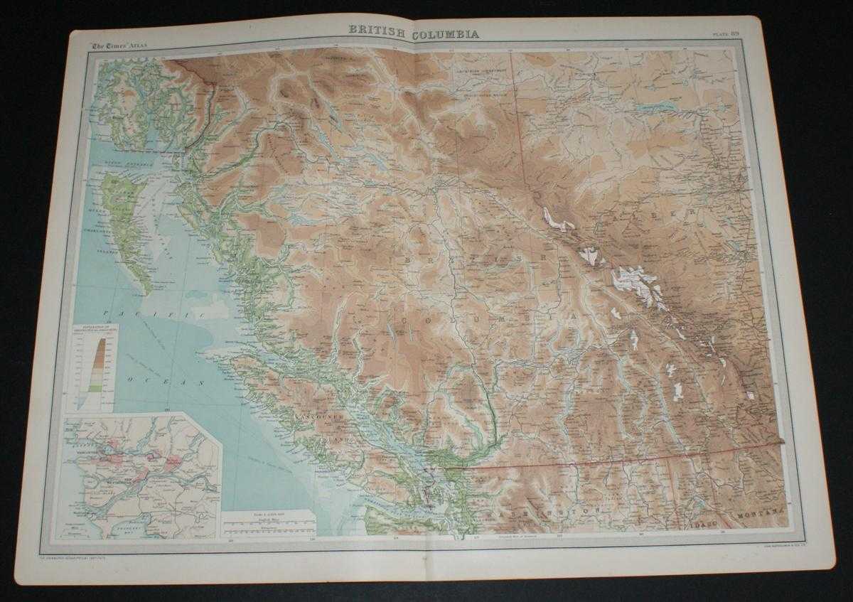
Map of British Columbia, Canada from the 1920 Times Survey Atlas (Plate 89) including part of Alberta, Vancouver Island, Queen Charlotte Islands and Prince of Wales Island etc.
First Edition Softcover The Times, 1920 Very Good Condition


Book Publishing Details
| Author: | The Times and J. G. Bartholomew |
| Full title: | Map of British Columbia, Canada from the 1920 Times Survey Atlas (Plate 89) including part of Alberta, Vancouver Island, Queen Charlotte Islands and Prince of Wales Island etc. |
| Publisher: | The Times, 1920 |
| Edition: | First Edition |
| Binding: | Softcover |
| ISBN: | No ISBN |
| Book ID: | 45020034018 |
Comments & Item Features
First Edition. Category: Maps, USA & Canada. Language: English. ISBN: No ISBN.
Disbound single sheet with vertical centre fold from the 1920 "The Times Survey Atlas of the World". Map is in colour and suitable for framing. Colour on both land and sea according to contour. Map at scale 1:2,500,000. Map covers; British Columbia (as far North as Zarembo Island), Alberta (part), Rocky Mountains, Vancouver Island, US Border, Washington (part), Idaho (part), Montana (part), Calgary, Edmonton, Lesser Slave Lake, Graham Island, Hecate Strait, Strait of Juan de Fuca, Fraser River, etc. Sheet contains small inset map of Vancouver and New Westminster at 1:500,000. Slightly darkened edges and occasional light foxing in margins but sheet is otherwise clean and crisp.
Disbound single sheet with vertical centre fold from the 1920 "The Times Survey Atlas of the World". Map is in colour and suitable for framing. Colour on both land and sea according to contour. Map at scale 1:2,500,000. Map covers; British Columbia (as far North as Zarembo Island), Alberta (part), Rocky Mountains, Vancouver Island, US Border, Washington (part), Idaho (part), Montana (part), Calgary, Edmonton, Lesser Slave Lake, Graham Island, Hecate Strait, Strait of Juan de Fuca, Fraser River, etc. Sheet contains small inset map of Vancouver and New Westminster at 1:500,000. Slightly darkened edges and occasional light foxing in margins but sheet is otherwise clean and crisp.
Book Condition Report
Book Condition: Very Good Condition. Dust Jacket: No Dust Jacket. Map. Single sheet map/chart which is suitable for framing and will be shipped rolled and in a cardboard tube.
Size of Item & Shipped Weight
Shipped Weight: under 1 kg.
Multiple Purchases
If you are considering ordering multiple items from us, please contact us so that we can offer you a discount on the total price including delivery.
Images
If you would like to see an additional/ different image of this item, please contact us.
More books and maps and sheet music.....
We have many more items in our ebay shop, please view by clicking on the ebay shop icon above.
Keywords and Associated Terms
BZDB4 Maps; World History; USA & Canada. The Times and J. G. Bartholomew Map of British Columbia, Canada from the 1920 Times Survey Atlas (Plate 89) including part of Alberta, Vancouver Island, Queen Charlotte Islands and Prince of Wales Island etc.