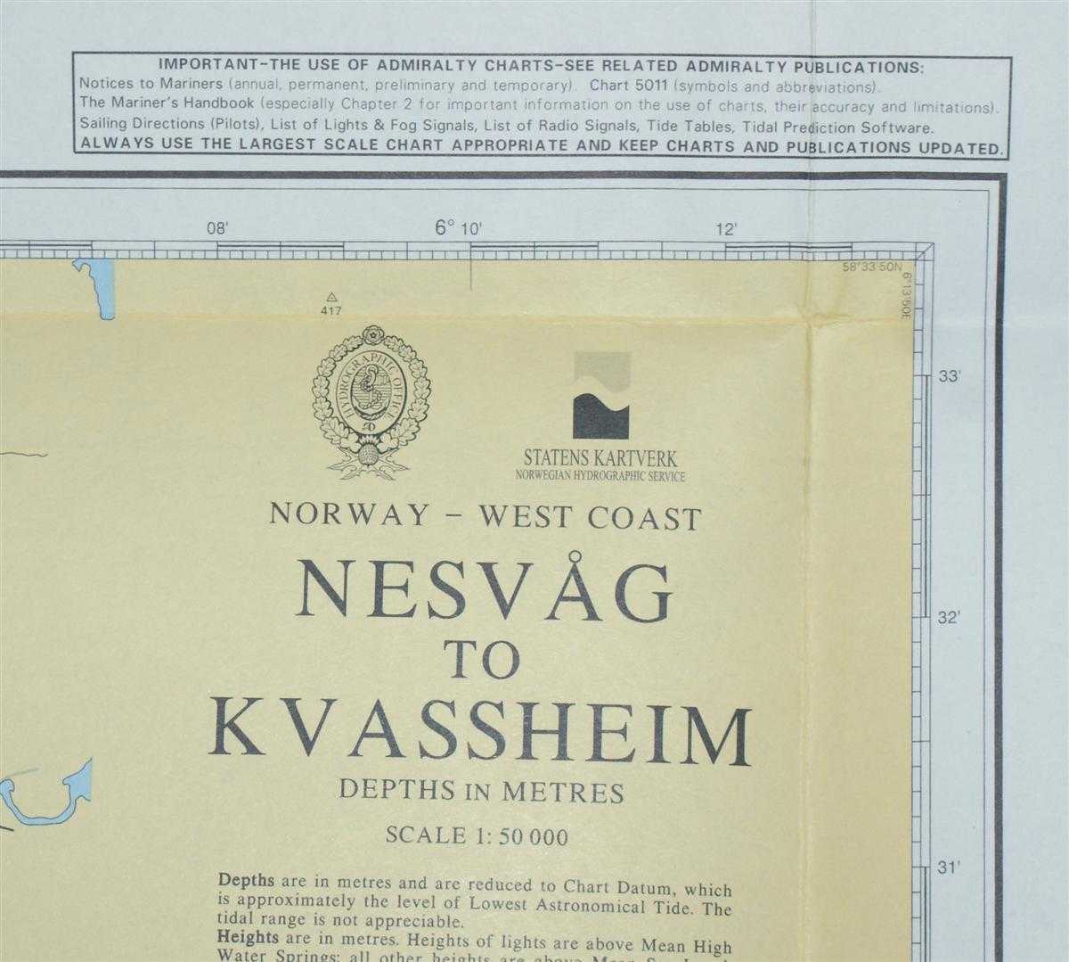
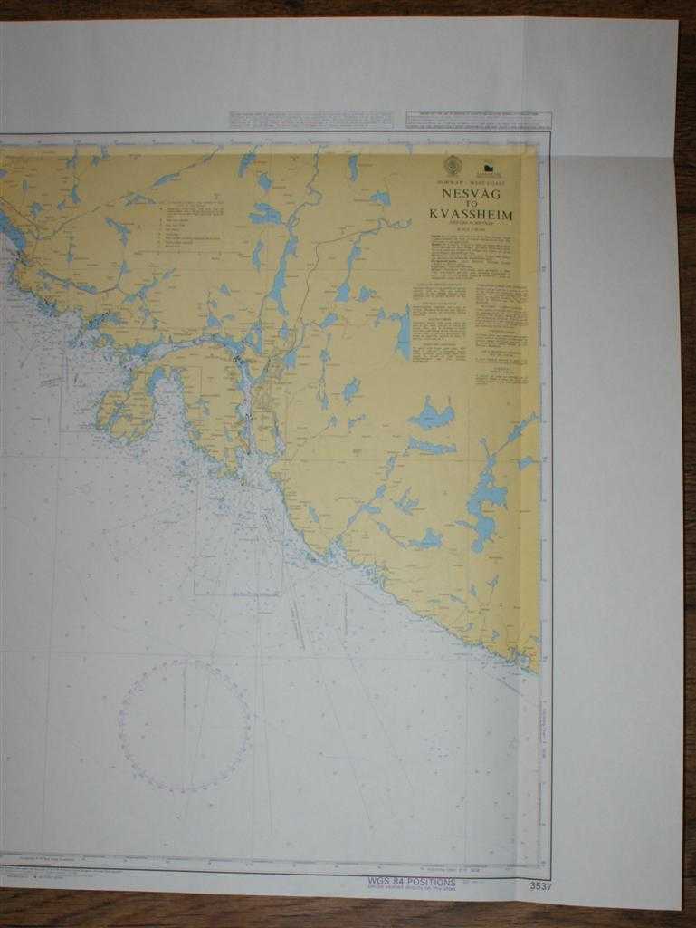
Nautical Chart No. 3537 Norway - West Coast, Nesvag to Kvassheim
Revised Edition Softcover Admiralty, 2005 Very Good Condition

For more pictures of this item scroll down to bottom ....
Book Publishing Details
| Author: | Admiralty |
| Full title: | Nautical Chart No. 3537 Norway - West Coast, Nesvag to Kvassheim |
| Publisher: | Admiralty, 2005 |
| Edition: | Revised Edition |
| Binding: | Softcover |
| ISBN: | No ISBN |
| Size: | 84x119cm |
| Book ID: | 45517114055 |
Comments & Item Features
Revised Edition. Category: Maps, naval, naval history, maritime, ships, boats. Language: English. ISBN: No ISBN.
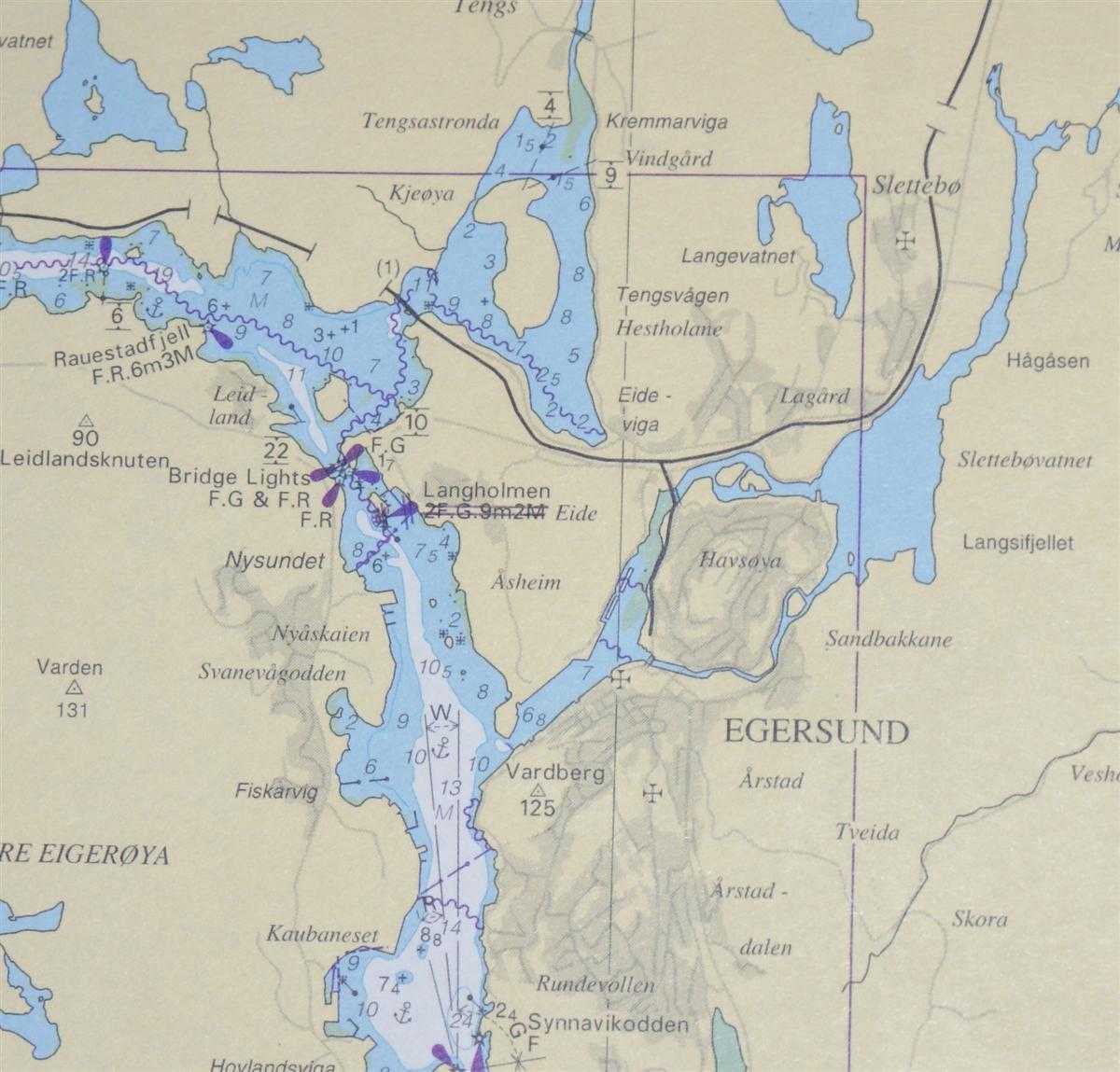
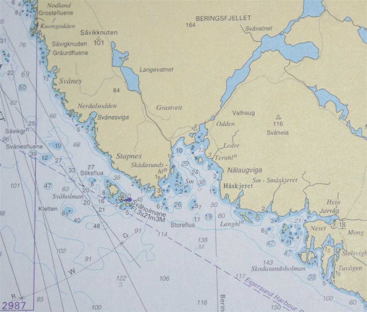
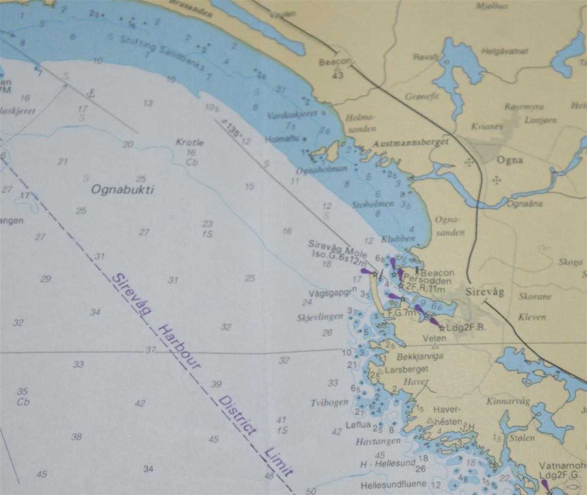
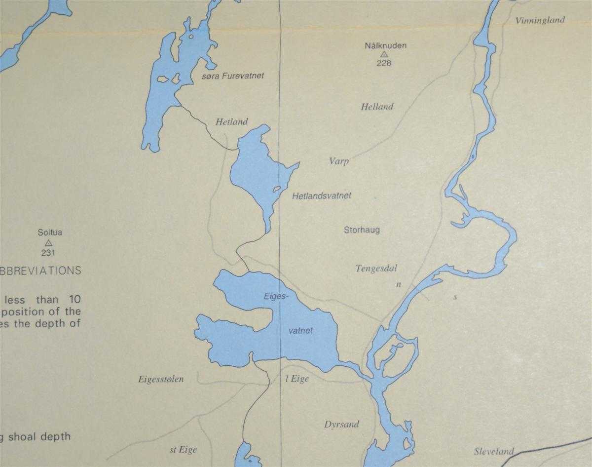
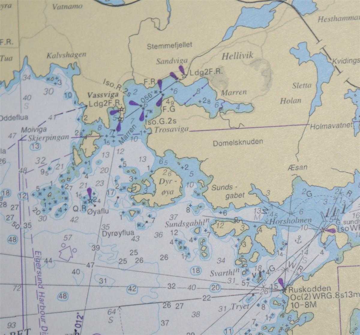
Clean and crisp colour chart with two vertical and one horizontal folds. Nautical Chart No. 3537 Norway - West Coast, Nesvag to Kvassheim. Published in 2003 with notices to 2005. Scale 1:50,000. Area Covered: Norway (part), Egersund, Sore Eigeroya, Norde Eigeroya, Dyrnesodden, Haskjeret, Hellivik, Sirevag, Ogna, Brusand, Nordegabet, SoraGabet, Lundarviga, Ognabukti, Hadyr.
Clean and crisp colour chart with two vertical and one horizontal folds. Nautical Chart No. 3537 Norway - West Coast, Nesvag to Kvassheim. Published in 2003 with notices to 2005. Scale 1:50,000. Area Covered: Norway (part), Egersund, Sore Eigeroya, Norde Eigeroya, Dyrnesodden, Haskjeret, Hellivik, Sirevag, Ogna, Brusand, Nordegabet, SoraGabet, Lundarviga, Ognabukti, Hadyr.
Book Condition Report
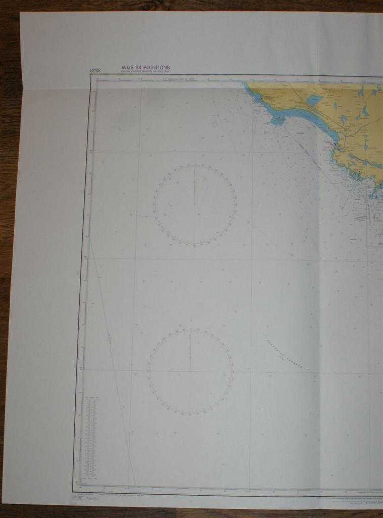
Book Condition: Very Good Condition. Dust Jacket: No Dust Jacket. Single sheet map/chart which is suitable for framing and will be shipped rolled and in a cardboard tube.
Size of Item & Shipped Weight
Size: 84x119cm. Shipped Weight: under 1 kg.
Multiple Purchases
If you are considering ordering multiple items from us, please contact us so that we can offer you a discount on the total price including delivery.
Images
If you would like to see an additional/ different image of this item, please contact us.
More books and maps and sheet music.....
We have many more items in our ebay shop, please view by clicking on the ebay shop icon above.
Keywords and Associated Terms
BZDB4 Maps; Scandinavia; naval, naval history, maritime, ships, boats. Admiralty Nautical Chart No. 3537 Norway - West Coast, Nesvag to Kvassheim