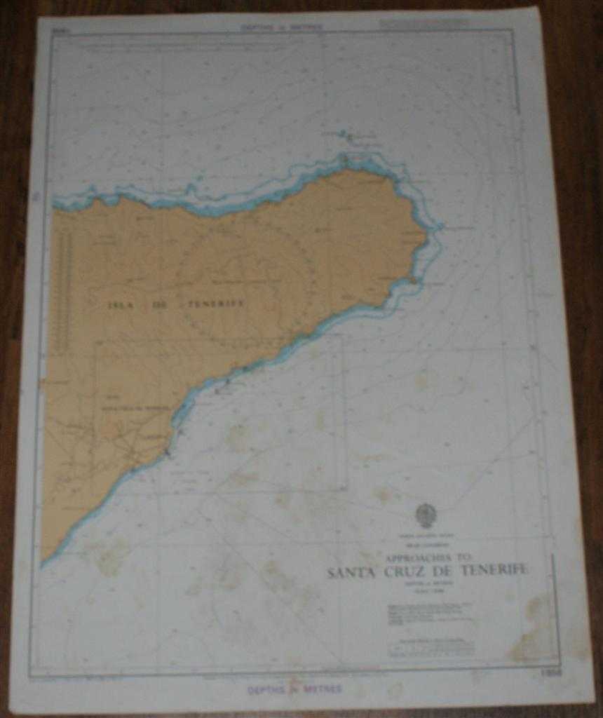
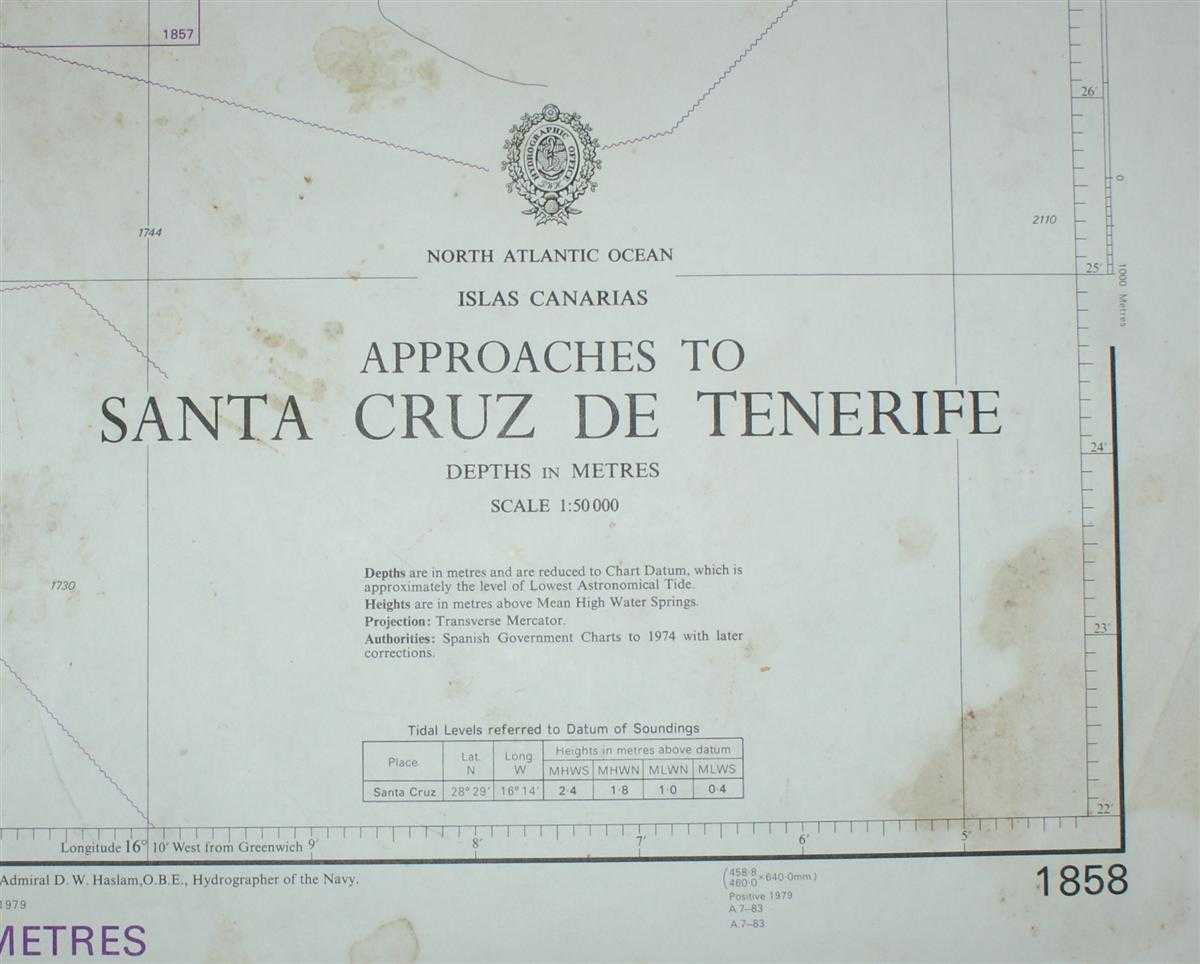
Nautical Chart No. 1858 North Atlantic Ocean - Islas Canarias, Approaches to Santa Cruz de Tenerife
Revised Edition Softcover Admiralty, 1985 Fair Condition
For more pictures of this item scroll down to bottom ....
Book Publishing Details
| Author: | Admiralty |
| Full title: | Nautical Chart No. 1858 North Atlantic Ocean - Islas Canarias, Approaches to Santa Cruz de Tenerife |
| Publisher: | Admiralty, 1985 |
| Edition: | Revised Edition |
| Binding: | Softcover |
| ISBN: | No ISBN |
| Size: | 71x52cm |
| Book ID: | 45517021409 |
Comments & Item Features
Revised Edition. Category: Maps, naval, naval history, maritime, ships, boats. Language: English. ISBN: No ISBN.
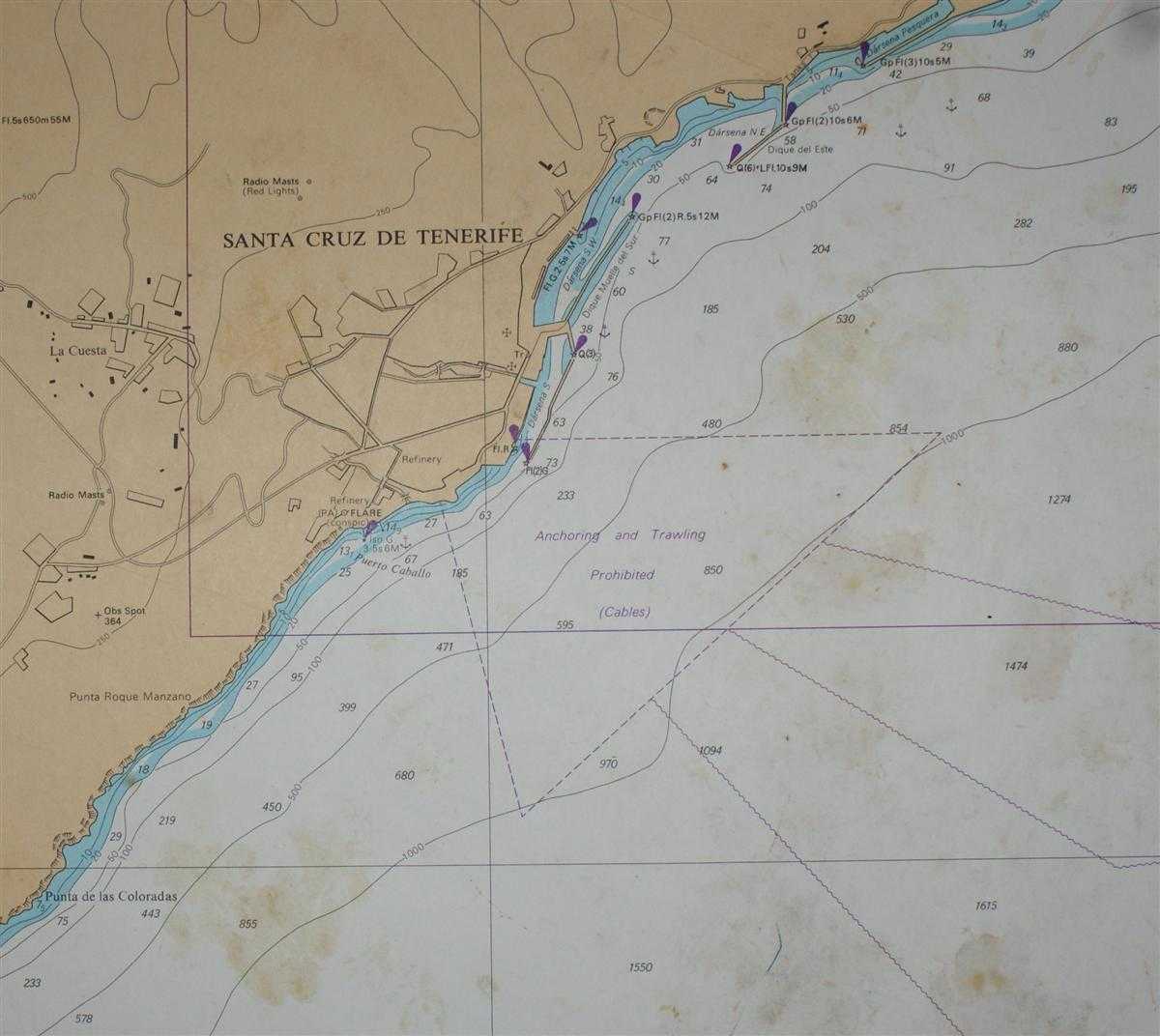
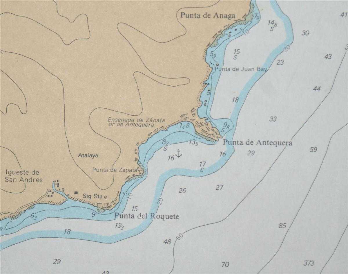
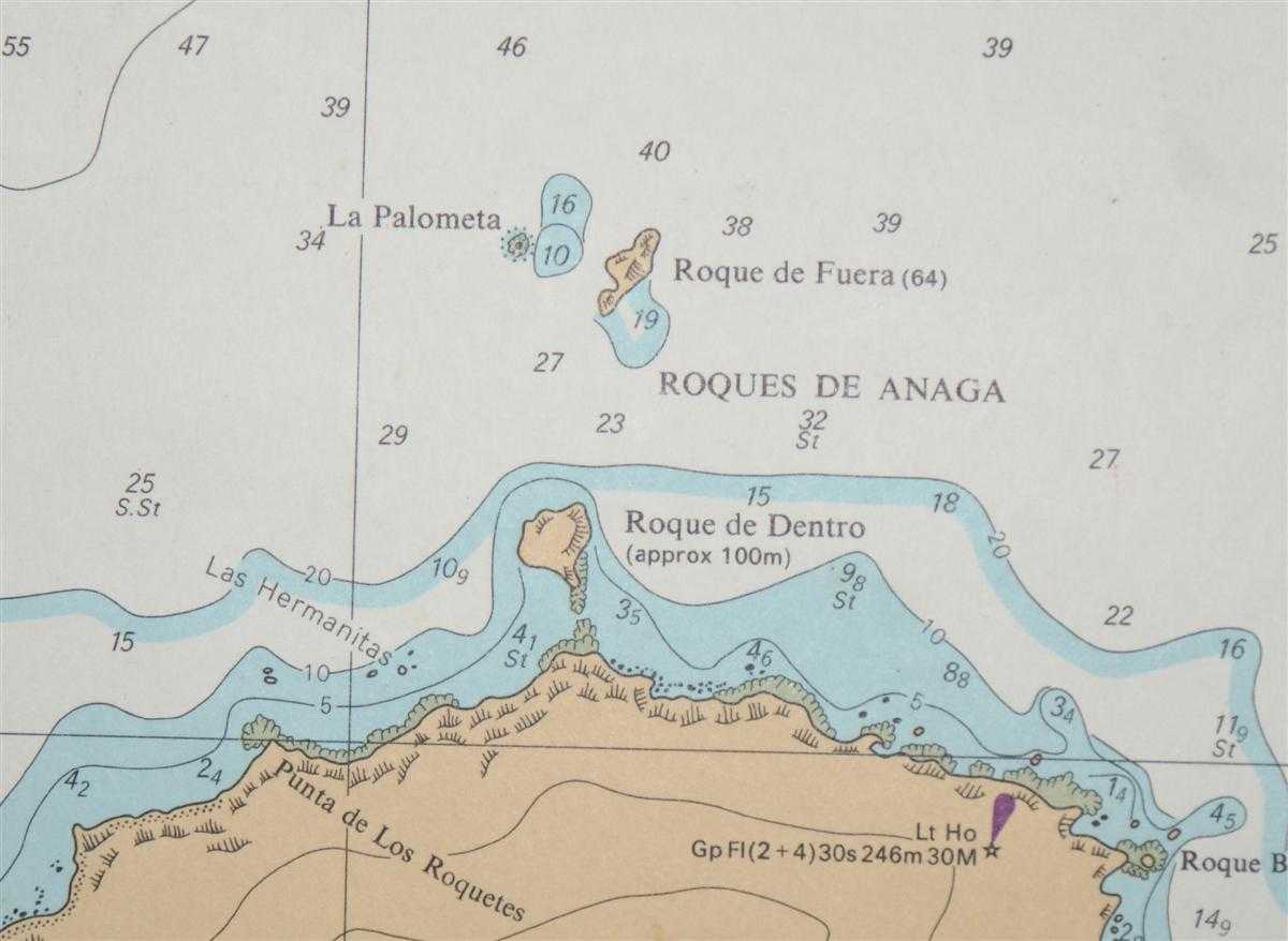
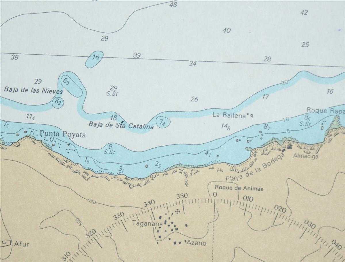
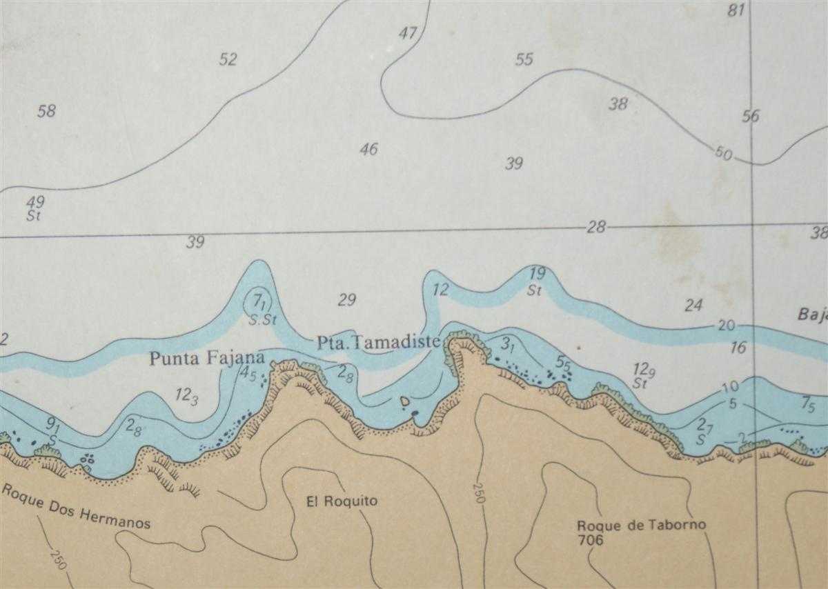
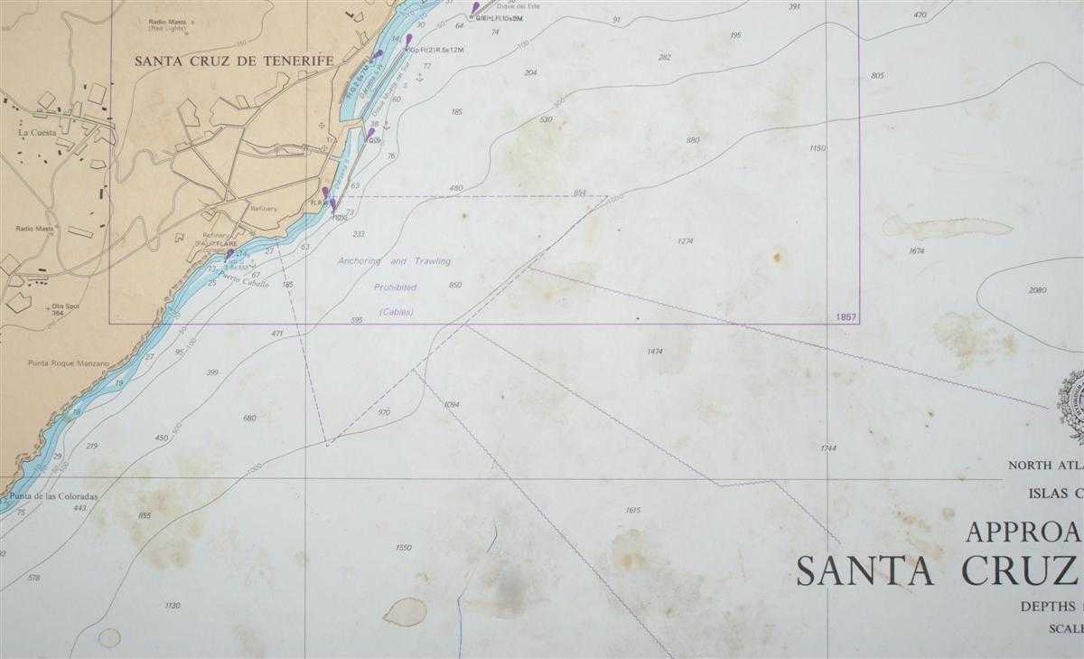
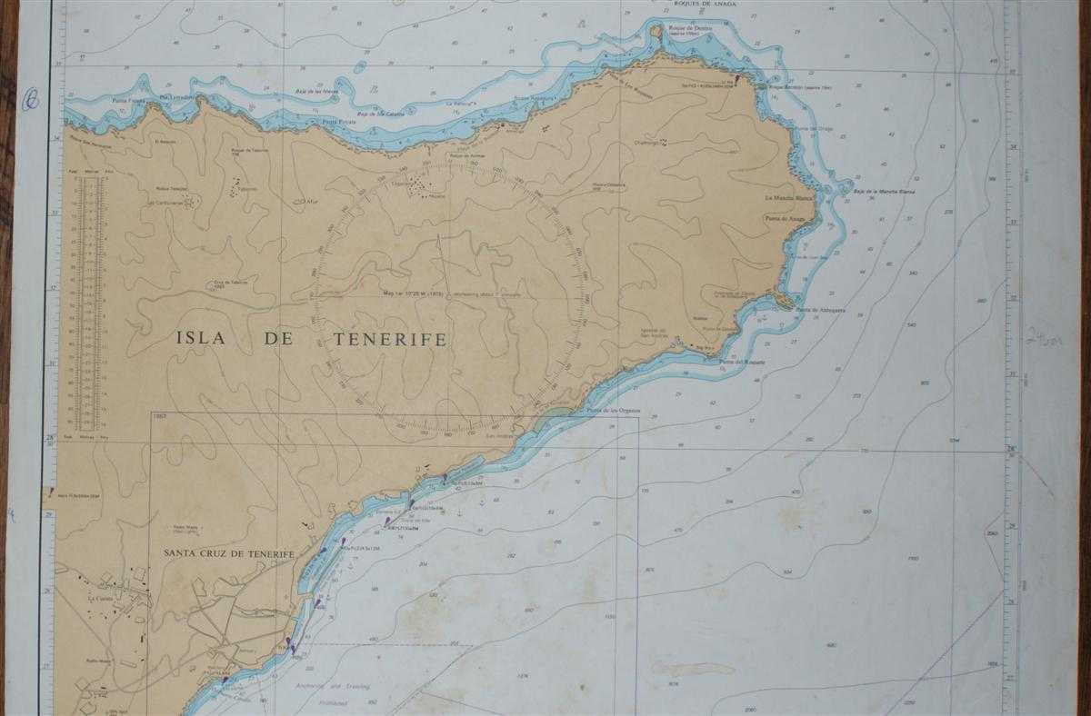
Colour chart with no formal fold. Sheet is marked and stained with some light creasing. Edges are a little rubbed and worn. Nautical Chart No. 1858 North Atlantic Ocean - Islas Canarias, Approaches to Santa Cruz de Tenerife. Copyright 1979 with small corrections to 1985. Scale 1:50,000 Area Covered: Isla de Tenerife (part), Santa Cruz de Tenerife, La Cuesta, Punta de las Coloradas, Roques de Anaga, Las Carboneras, Punta Fajana
Colour chart with no formal fold. Sheet is marked and stained with some light creasing. Edges are a little rubbed and worn. Nautical Chart No. 1858 North Atlantic Ocean - Islas Canarias, Approaches to Santa Cruz de Tenerife. Copyright 1979 with small corrections to 1985. Scale 1:50,000 Area Covered: Isla de Tenerife (part), Santa Cruz de Tenerife, La Cuesta, Punta de las Coloradas, Roques de Anaga, Las Carboneras, Punta Fajana
Book Condition Report
Book Condition: Fair Condition. Dust Jacket: No Dust Jacket. Map. No dust jacket, as published. Single sheet map/chart which is suitable for framing and will be shipped rolled and in a cardboard tube..
Size of Item & Shipped Weight
Size: 71x52cm. Shipped Weight: under 1 kg.
Multiple Purchases
If you are considering ordering multiple items from us, please contact us so that we can offer you a discount on the total price including delivery.
Images
If you would like to see an additional/ different image of this item, please contact us.
More books and maps and sheet music.....
We have many more items in our ebay shop, please view by clicking on the ebay shop icon above.
Keywords and Associated Terms
BZDB4 Maps; Spain and Portugal, Spanish & Portuguese Language; naval, naval history, maritime, ships, boats. Admiralty Nautical Chart No. 1858 North Atlantic Ocean - Islas Canarias, Approaches to Santa Cruz de Tenerife