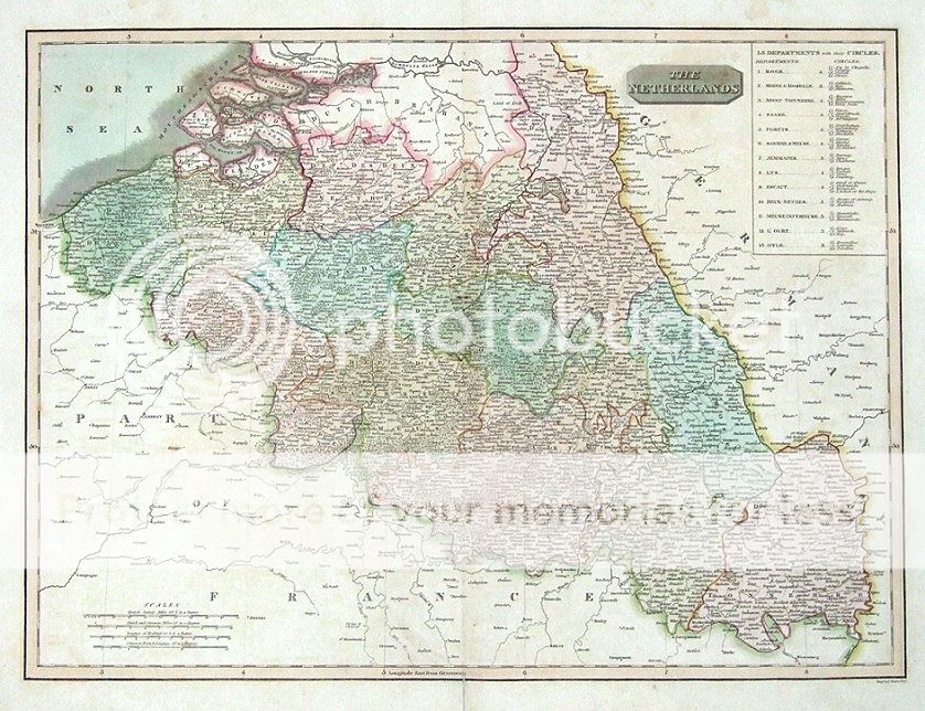
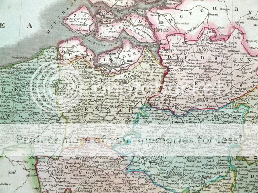
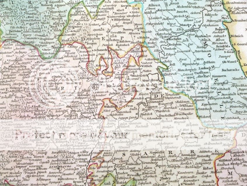
| THE NETHERLANDS by John Thomson Published Edinburgh 1817 in Thomson's "New General Atlas". An attractive large format copper engraved antique map of The Netherlands covering present day Netherlands, Belgium and Luxembourg. Enhanced with original hand colouring. Some splitting to the original centre fold has been reinforced verso and some minor dampstaining to the outer margins can be seen. Printed on heavy grade paper, blank verso. Approx. 22" x 16.5" (560mm x 410mm) printed area only with margins beyond. Please see close up images.
A GENUINE ANTIQUE MAP GUARANTEED OVER 190 YEARS OLD FROM LINDISFARNE PRINTS D413 We do not deal in reproductions, facsimiles or copies of any kind.
SHIPPING Within UK £7.95 via Royal Mail Special Delivery (next day). Europe - £9.95 via Royal Mail International Signed For Airmail. Rest of the world - £10.95 via Royal Mail International Signed For Airmail.
|