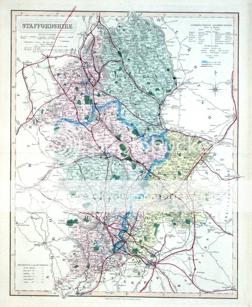
STAFFORDSHIRE
by
J. & C. Walker
Published originally by J & C Walker.
This edition published 1877 by James Wyld in
"The British Atlas....".
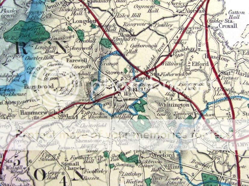
A most attractive and decorative county map of Staffordshire with contemporary hand colouring. Features a scale of English miles, reference to the Hundreds & Divisions, Boroughs and Polling places. The high level of detail is outstanding, and includes roads, railways, canals, parks and relief.
In fine, virtually unmarked condition . Centrefold as issued, blank verso. The map would present very well indeed when framed.
Measuring approx. 17.5" x 14.5" (450mm x 370mm) overall.
Please see further images.
GENUINE ANTIQUE MAP GUARANTEED OVER 130 YEARS OLD FROM LINDISFARNE PRINTS
We do not deal in reproductions, facsimiles or modern copies of any kind.
D1114