Vintage Cartographics
Illinois Maps ∙ Antique Prints ∙ Bargain Bin ∙ Browse Nearby Sheets
1918
La Harpe
Illinois
USGS TOPOGRAPHIC MAP
first-year print in very good condition
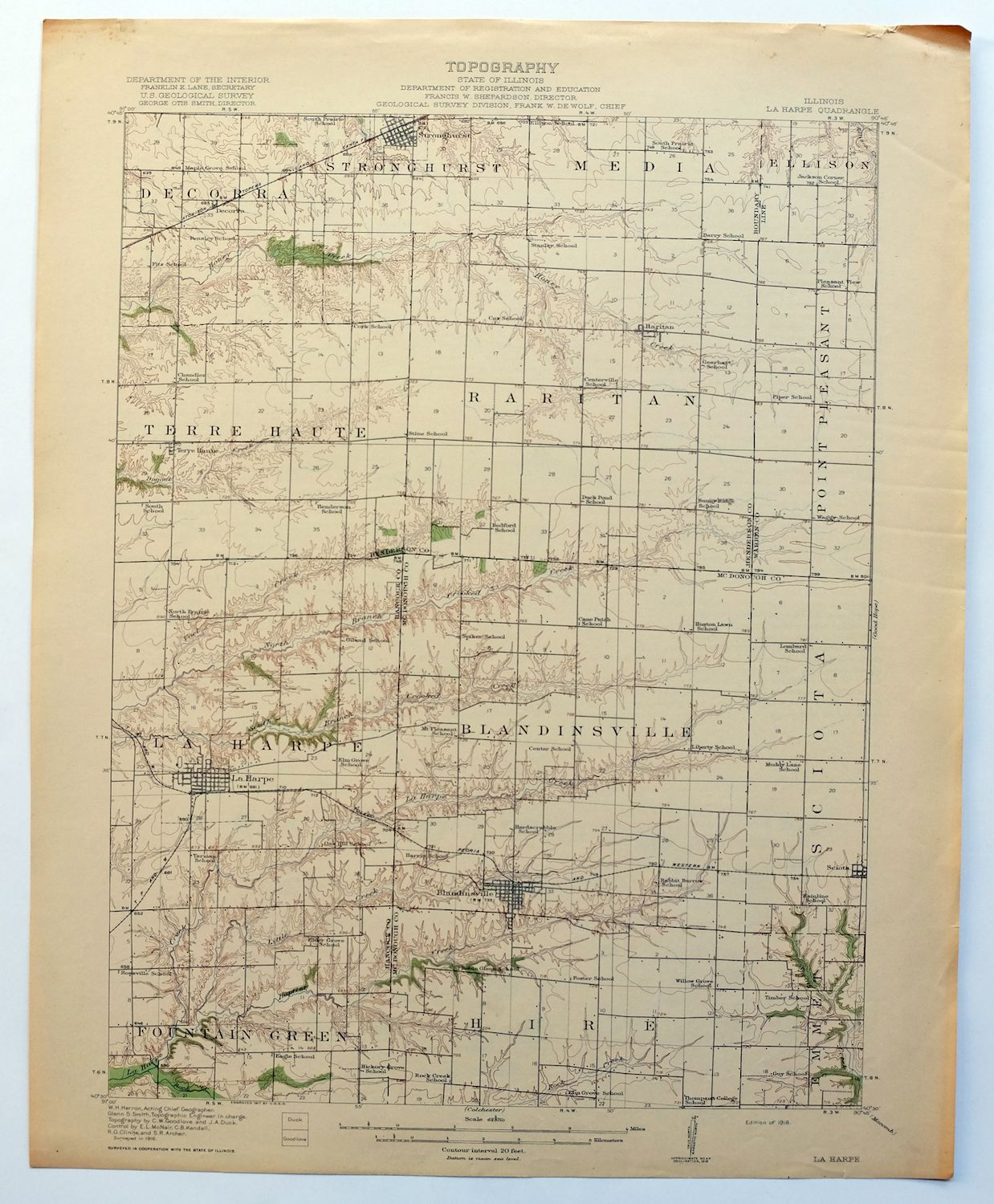
For sale is the 1918 edition of the La Harpe 15-minute map. This map would be ideal for framing or display, historical reference or research, genealogy studies, adding to your collection, treasure hunting, a nice conversation piece, a gift for a history or map enthusiast, or for anyone interested in this area.
This sheet includes the first survey produced by the United States Geological Survey for the La Harpe 15-minute quadrangle. The map is an original 1918 USGS print. This rare 103-year-old-year-old sheet is a first-year printing and is in very good condition.
The La Harpe 15-minute map shows all roads, paths, towns, railroads, rivers, creeks, elevation contour lines, public land survey lines, county, state, and other administrative boundaries as they existed at the time of the survey in 1916. All known structures (houses, businesses, churches, schools, barns, cabins, etc) are also shown, with exceptions in some urban areas, where only landmark buildings may be shown.
The La Harpe map was field surveyed before aerial photography methods were widely used in map data gathering. It was drawn by cartographers based on plane table field survey information as well as information gathered from local residents in the area. It displays the remarkable abilities of early government map makers, who placed a strong emphasis on creating complete, accurate, and cartographically appealing maps.
Maps from the 15-minute series for the continental United States are no longer produced or printed by the USGS and original prints are becoming increasingly difficult to find. They are a valuable historical record for an area, as they contain many placenames and features that have been dropped from more recent maps.
MAP DETAILS

Title
LA HARPE
State
Illinois
Series
15-minute
Surveyed
1916 Field Survey
Geographer
W.H. Herron
Engraved
1917
Edition
1918
Printed
1918, thick paper stock
Woodland Tint
Yes
Scale
1:62500
Contour Interval
20 Foot
Sheet Dimensions
16 1/2 x 20 inches (approximate)
Map Dimensions
13 1/4 x 17 1/2 inches
Coverage Area
13 x 17 miles
SHEET CONDITION
For maps of this vintage, effort is made to note all visible flaws, no matter how minor.
Overall Condition
VERY GOOD
Sheet Notes
lightly handled, never folded
Map Area
flawless map area
Collar Area
very minor wear, no markings, no blemishes
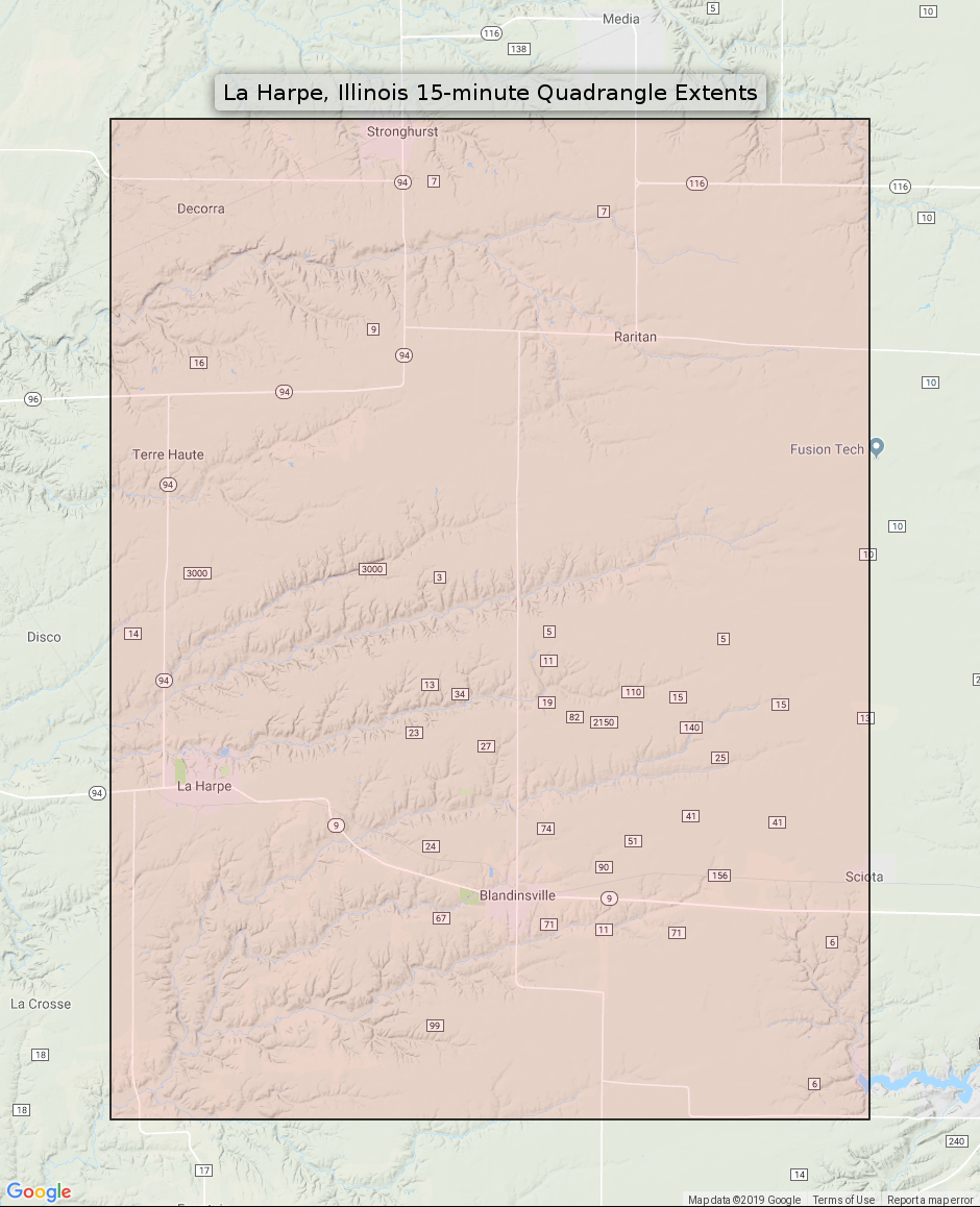
MAP COVERAGE
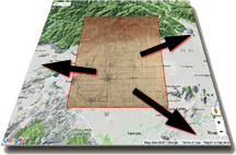
Quadrangle extent overlaid on current basemap.
PLACENAMES
Depending on map series and survey date, all of the features listed below may not be shown on this map. This list contains features that currently exist or historically existed within the area covered by this map. The list can be used as a reference to determine if this map covers your area of interest. Placenames are listed alphabetically next to each feature type.
Cities and Towns (current)
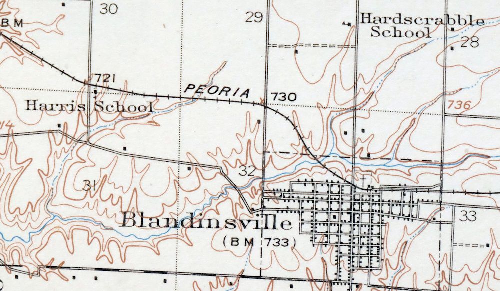
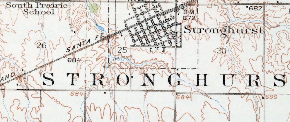
Blandinsville, La Harpe, Macomb, Raritan, Sciota, and Stronghurst
Counties Covered
Hancock, Henderson, McDonough, and Warren
Rivers and Streams
Baptist Creek, Dixson Creek, Dugout Creek, Ellison Creek, Honey Creek, La Harpe Creek, La Moine River, Marshall Branch, Middle Creek, Nichols Run, Rock Creek, South Branch La Moine River, Spring Creek, and Voel Creek
Water Bodies
Spring Lake
Locations: Boston Corners, Jacksons Corners, and Twin Oaks Country Club. Administrative Boundaries: Township of Blandinsville, Township of Fountain Green, Township of Hire, Township of La Harpe, Township of Raritan, and Township of Terre Haute. Parks: La Harpe Historic District and Mayor Memorial Park. Drainages: Baptist Creek, Horse Branch, Little Creek, Rock Creek, and Voel Creek. Churches: Blandinsville United Methodist Church, First Baptist Church of Blandinsville, First Christian Church, Old Bedford Christian Church, and Saint Patricks Church. Buildings: Blandinsville-Hire Community Center and Hire Townhall. Dams: Blandinsville City Lake Dam. Airports: Clover Landing Strip, Housewright Airport, Neff Airport, and Willow Grove Landing Strip. Schools: La Harpe High School, Northwestern High School, Northwestern Junior High School, Southern Elementary School, and Southern High School. Reservoirs and Tanks: Blandinsville City Reservoir.
BACKSIDE LEGEND
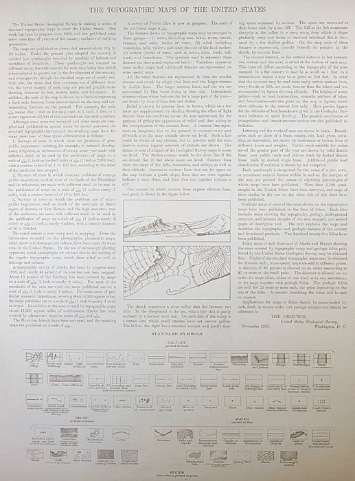
A map summary is printed on the back side of the La Harpe sheet similar to the one shown in the picture. It outlines the history, purpose, and status of the USGS mapping program at the time of the printing in 1918. It also provides instructions on how to read contour lines and a description of how they are used to depict the terrain. At the bottom of the page is a legend showing all of the symbols used to represent the cultural, relief, and water features found on the map.
SHIPPING AND RETURNS
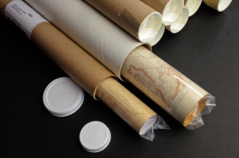
This map sheet will be carefully rolled in a sturdy tube and shipped via the US Postal Service. Shipping and handling costs are included in the purchase price.
If you find that the sheet you receive is not as described in the listing, you may ship it back to us for a refund of the purchase price.
15~5892 15~5893 15~5894 15~5895 15~6110 15~6111 15~6112 15~6113 15~6114 15~6322 15~6323 15~6324 15~6325 15~6326 15~6327 15~6532 15~6533 15~6534 15~6535 15~6536 15~6537 15~6738 15~6739 15~6740 15~6741 15~6742 30~1739 30~1742 75~22704 75~22705 75~22706 75~22707 75~23113 75~23114 75~23115 75~23116 75~23117 75~23118 75~23541 75~23542 75~23543 75~23544 75~23545 75~23546 75~23547 75~23548 75~23960 75~23961 75~23962 75~23963 75~23964 75~23965 75~23966 75~23967 75~24373 75~24374 75~24375 75~24376 75~24377 75~24378 75~24775 75~24776 75~24777 75~24778