Vintage Cartographics
Indiana Maps ∙ Antique Prints ∙ Bargain Bin ∙ Browse Nearby Sheets
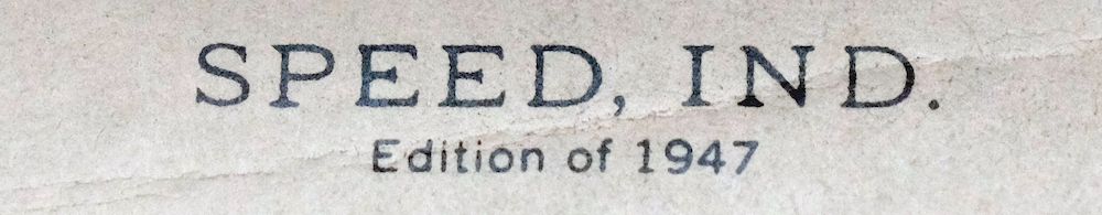
1947
Speed
Indiana
USGS TOPOGRAPHIC MAP
first-year print in good condition
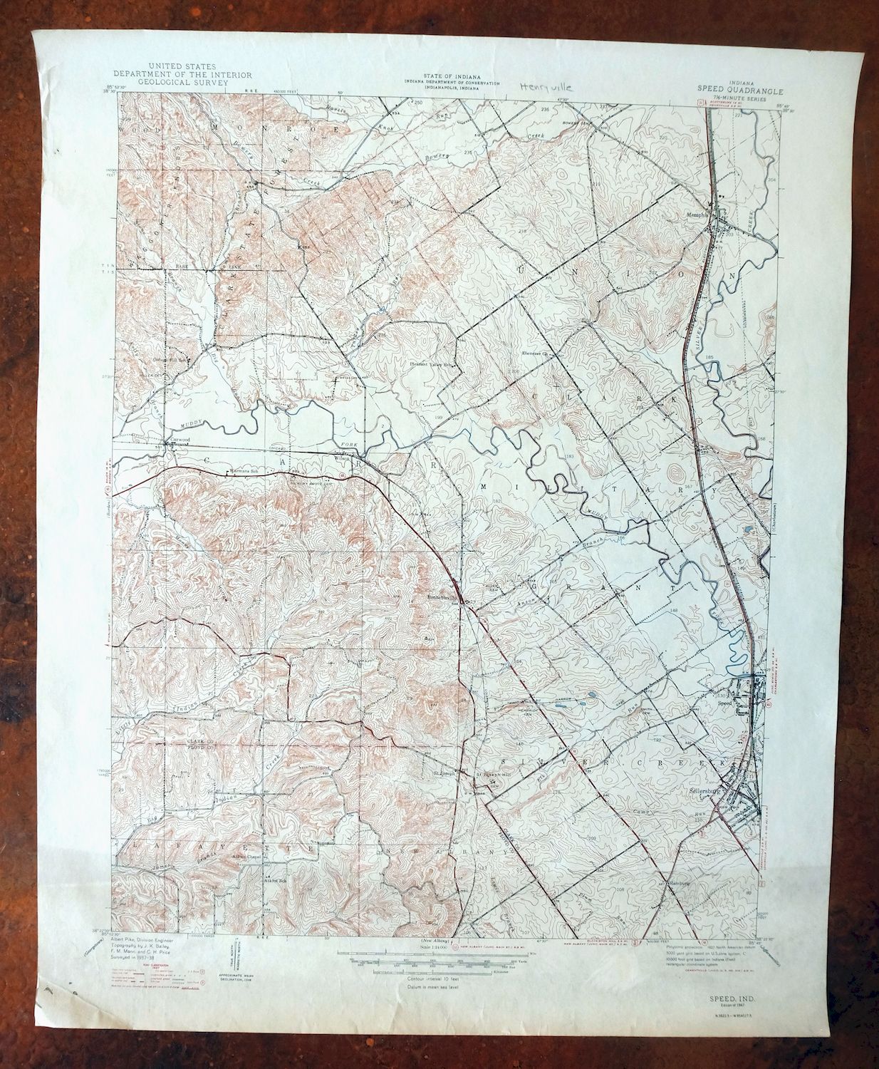
For sale is the 1947 edition of the Speed 7.5-minute map. This map would be ideal for historical reference or research, genealogy studies, collectors, would make a nice conversation piece, a gift for a history or map enthusiast, framing or display, or for anyone interested in the area.
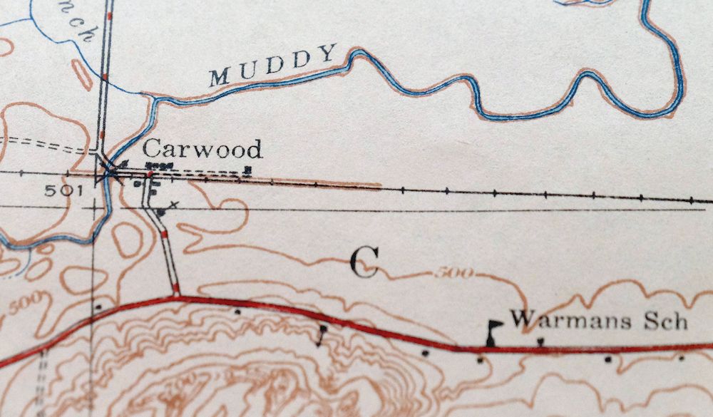
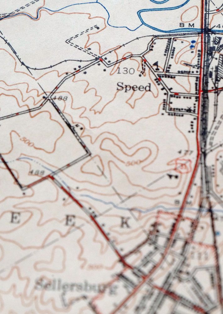
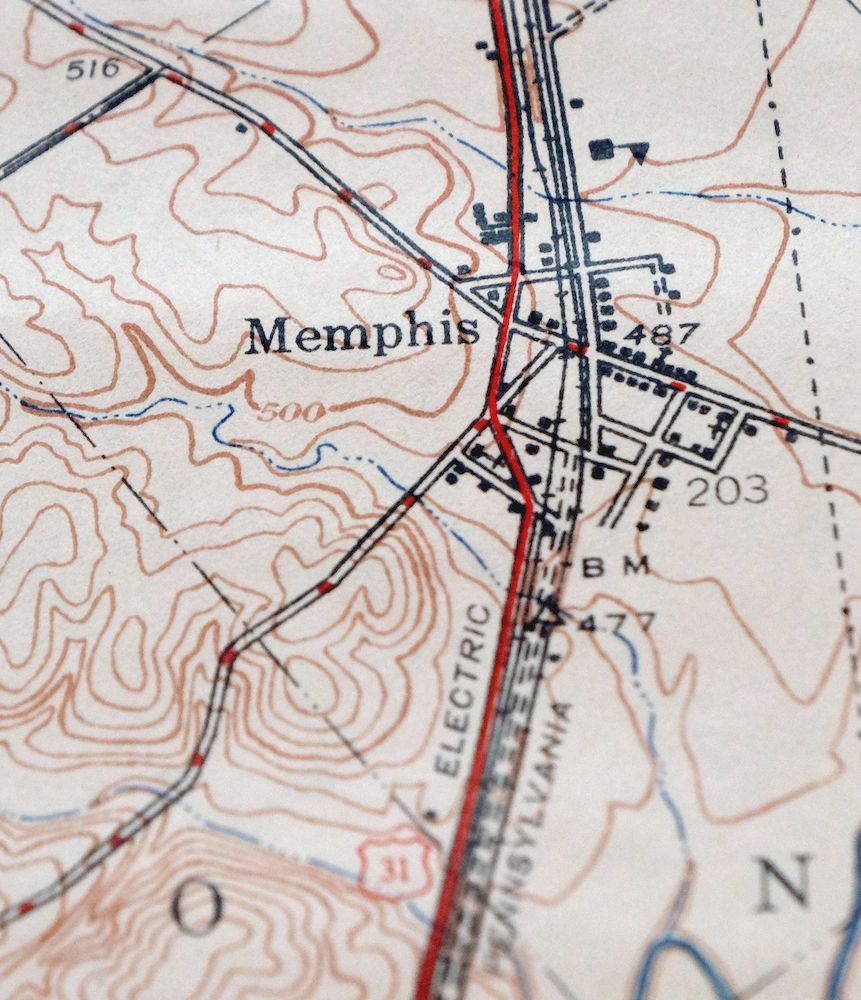
The Speed 7.5-minute map shows all roads, paths, towns, railroads, rivers, creeks, elevation contour lines, public land survey lines, county, state, and other administrative boundaries as they existed at the time of the survey. All known structures (houses, businesses, churches, schools, barns, cabins, etc) are also shown.
The Speed map was field surveyed before aerial photography methods were widely used in map data gathering. It was drawn by cartographers based on plane table field survey information as well as information gathered from local residents in the area. It displays the remarkable abilities of early government map makers, who placed a strong emphasis on creating complete, accurate, and cartographically appealing maps.
This map is from the 7.5-minute series, the most detailed series that is widely available from the USGS. The 1947 Speed map is a valuable historical record for the area. It contains some placenames and features that have been dropped from more recent maps.
MAP DETAILS
Title
Speed
State
Indiana
Series
7.5-minute
Surveyed
1937 and 1938 Field Survey
Geographer
Albert Pike
Edition
1947
Printed
1947, thick paper stock
Woodland Tint
No
Scale
1:24000
Contour Interval
10 Foot
Sheet Dimensions
21 7/8 x 26 7/8 inches
Map Dimensions
17 7/8 x 22 3/4 inches
Coverage Area
7 x 9 miles
SHEET CONDITION
For maps of this vintage, effort is made to note all visible flaws, no matter how minor.
Overall Condition
GOOD
Sheet Notes
moderately handled, never folded, age-toned in bottom portion of map
Map Area
no wear, no markings
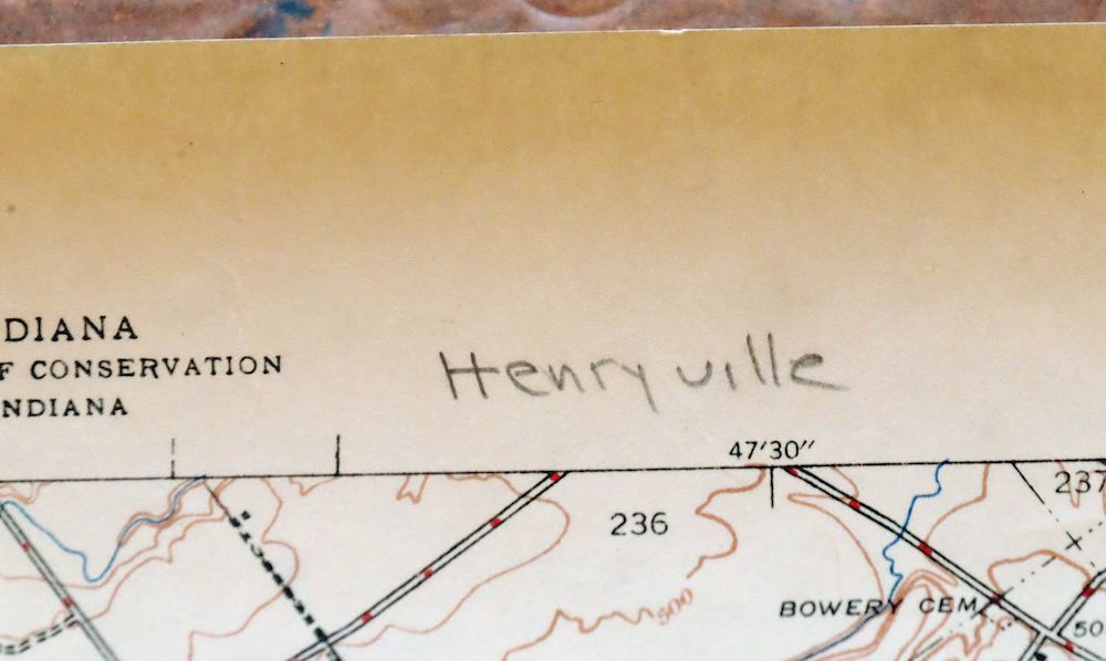
Collar Area
no wear, pencilled notation in top collar
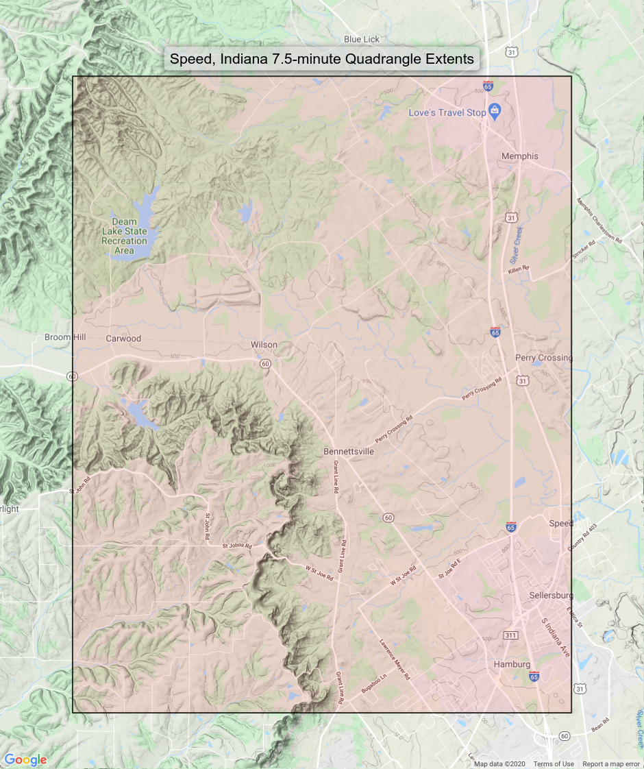
MAP COVERAGE
Quadrangle extent overlaid on current basemap.
PLACENAMES
Depending on map series and survey date, all of the features listed below may not be shown on this map. This list contains features that currently exist or historically existed within the area covered by this map. The list can be used as a reference to determine if this map covers your area of interest. Placenames are listed alphabetically next to each feature type.
Cities and Towns (current)
Clarksville, Memphis, Saint Joseph, and Sellersburg
Counties Covered
Clark and Floyd
Rivers and Streams
Anson Branch, Big Run, Blue Lick Creek, Camp Run, Indian Creek, James Branch, Kelly Branch, Lewis Branch, Little Indian Creek, Muddy Fork, Plum Run, Silver Creek, and Turkey Run
Water Bodies
Deam Lake, Lake Hideaway, and Ulrich Lake
Locations: Silver Creek Conservation Club and White Oak Public Fishing Area. Administrative Boundaries: Township of Carr, Township of Silver Creek, and Township of Union. Mountains, Peaks, and Summits: Saint Joseph Hill. Valleys and Canyons: Money Hollow. Parks: Camp Honor Bright and Deam Lake State Recreation Area. Drainages: Anson Branch, Bartle Knob Run, Big Run, Bowery Creek, Elk Run, James Branch, Kelly Branch, Stone Branch, Thomas Branch, and Turkey Run. Churches: Atkins Chapel. Dams: Dream Lake Dam, Lake Hideaway Dam, Southern Hills Lake Dam, and Ulrich Lake Dam. Schools: Memphis Elementary School, Silver Creek High School, Silver Creek Junior High School, and Stout Elementary School. Ridges: Waggoner Knobs. Reservoirs and Tanks: Deam Lake, Dream Lake, Lake Hideaway, and Ulrich Lake.
BACKSIDE LEGEND
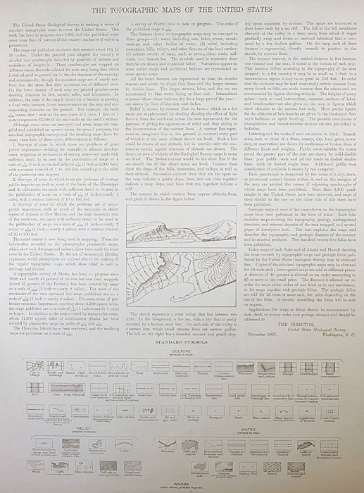
A map summary is printed on the back side of the Speed sheet similar to the one shown in the picture. It outlines the history, purpose, and status of the USGS mapping program at the time of the printing in 1947. It also provides instructions on how to read contour lines and a description of how they are used to depict the terrain. At the bottom of the page is a legend showing all of the symbols used to represent the cultural, relief, and water features found on the map.
SHIPPING AND RETURNS

This map sheet will be carefully rolled in a sturdy tube and shipped via the US Postal Service. Shipping and handling costs are included in the purchase price.
If you find that the sheet you receive is not as described in the listing, you may ship it back to us for a refund of the purchase price.
15~7965 15~8159 15~8160 15~8161 15~8352 15~8353 15~8354 15~8355 75~29996 75~29997 75~29998 75~29999 75~30000 75~30384 75~30385 75~30386 75~30387 75~30388 75~30389 75~30390 75~30770 75~30771 75~30772 75~30773 75~30774 75~30775 75~30776 75~31155 75~31156 75~31157 75~31158 75~31159 75~31160 75~31161 75~31539 75~31540 75~31541 75~31542 75~31543