Vintage Cartographics
Arizona Maps ∙ Antique Prints ∙ Bargain Bin ∙ Browse Nearby Sheets
1919
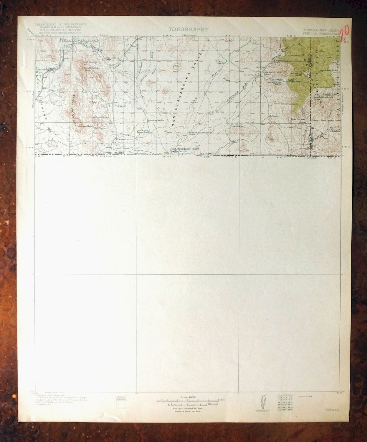
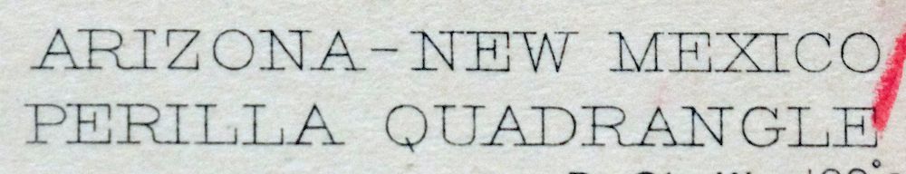
Perilla
Arizona, New Mexico
USGS TOPOGRAPHIC MAP
first-year print in very good condition
For sale is the 1919 edition of the Perilla 30-minute map. This map would be great for framing or display, historical reference or research, genealogy studies, adding to a collection, treasure hunting, a nice conversation piece, a gift for a history or map enthusiast, or for anyone interested in this area.
This sheet includes the only survey produced by the United States Geological Survey for the Perilla 30-minute quadrangle. The map is an original 1919 USGS print. This rare 102-year-old-year-old sheet is a first-year printing and is in very good condition.
The Perilla 30-minute map shows roads, paths, towns, railroads, rivers, creeks, elevation contour lines, public land survey lines, county, state, and other administrative boundaries, and many structures (houses, churches, schools, barns, etc.) as they existed at the time of the survey in 1917.
The Perilla map was field surveyed before aerial photography methods were widely used in map data gathering. It was drawn by cartographers based on plane table field survey information as well as information gathered from local residents in the area. It displays the remarkable abilities of early government map makers, who placed a strong emphasis on creating complete, accurate, and cartographically appealing maps.
Maps from the USGS 30-minute series have been out of print for many years. They have never been common and original prints are increasingly difficult to find. For areas where the 30-minute map was produced, it is usually the first large-scale survey done by the USGS for that area. These are a valuable historical record, as they contain many placenames and features that have been dropped from more recent series' and editions.
MAP DETAILS
Title
Perilla
State
Arizona, New Mexico
Series
30-minute
Surveyed
1917 Field Survey
Geographer
R.B. Marshall
Engraved
1918
Edition
1919
Printed
1919, thick paper stock
Woodland Tint
Yes
Scale
1:125000
Contour Interval
100 Foot
Sheet Dimensions
17 x 21 inches
Map Dimensions
15 x 17 1/2 inches
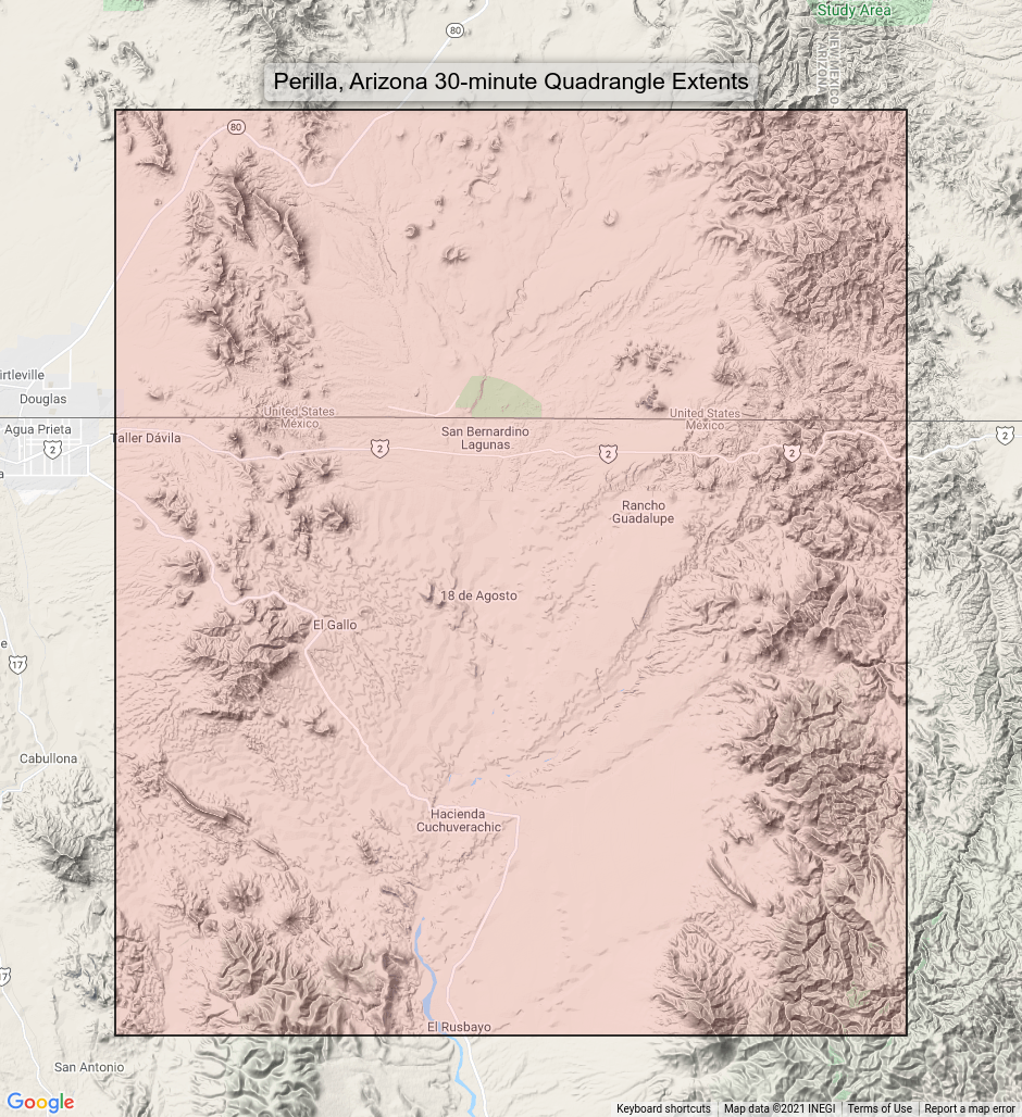
Coverage Area
30 x 35 miles
Notes
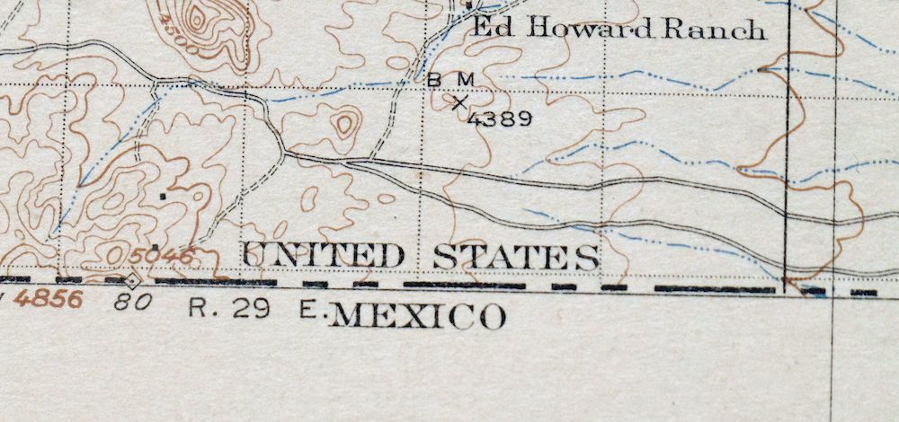
fascinating snapshot of the Arizona / New Mexico borderlands from the Perilla Mounains eastward to the Guadalupe Mountains, includes placenames like Lee Siding and College Peak, as well as Guadalupe Canyon and the San Bernardino Grant, surveyed before the modern highway system existed, includes historical travel routes, rail lines, and placenames, Mexico side of border unsurveyed, from the vintage map collection of Art Christiansen, Tempe, Arizona
SHEET CONDITION
For maps of this vintage, effort is made to note all visible flaws, no matter how minor.
Overall Condition
VERY GOOD
Sheet Notes
lightly handled, never folded, lightly age-toned paper
Map Area
no wear, no markings, minor blemish in southern unsurveyed (Mexico) portion of map
Collar Area
no wear, very minor blemishes, red inventory notation in upper right collar corner
MAP COVERAGE
Quadrangle extent overlaid on current basemap.
PLACENAMES
Depending on map series and survey date, all of the features listed below may not be shown on this map. This list contains features that currently exist or historically existed within the area covered by this map. The list can be used as a reference to determine if this map covers your area of interest. Placenames are listed alphabetically next to each feature type.
Cities and Towns (current)
Douglas
Counties Covered
Cochise and Hidalgo
Federal Land Units
Baker Canyon Wilderness Study Area, Coronado National Forest, and San Bernardino National Wildlife Refuge
Rivers and Streams
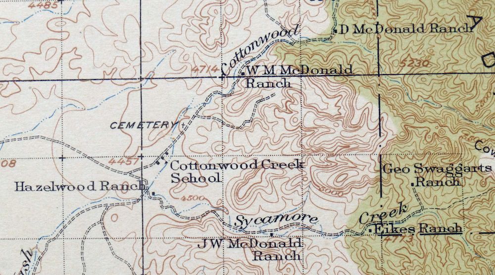
Cottonwood Creek, Danger Wash, Lion Creek, Silver Creek, and Sycamore Creek
Water Bodies
Mormon Tanks
IN ARIZONA
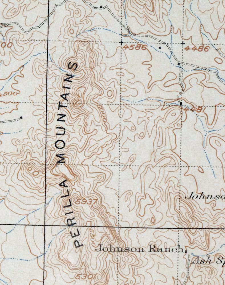
Locations: Gardner Windmill, Johnson Windmill, Lazy J Ranch, Lease Windmill, Line V Seven Ranch, Lower Hog Canyon Windmill, McDonald Ranch, New Windmill, Reasoner Windmill, San Bernardino Ranch, Steel Woods Windmill, Taylor Ranch, Turner Windmill, Watson Windmill, Watt Windmill, and Weldy Windmill. Mountain Ranges: Guadalupe Mountains and Pickhandle Hills. Mountains, Peaks, and Summits: Cinder Hill, College Peaks, D Hill, North College Peak, Outlaw Mountain, and South Collge Peak. Valleys and Canyons: Baker Canyon, Black Draw, Cottonwood Draw, Estes Canyon, Georges Canyon, Guadalupe Canyon, Hog Canyon, and San Bernardino Valley. Drainages: Cottonwood Creek, Danger Wash, Deadmans Wash, Hackberry Wash, Hay Hollow Wash, Indian Creek, Silver Creek, Sycamore Creek, and Wildcat Wash. Mines: Silvertip Mine. Gaps: Saddle Gap. Schools: Cottonwood Creek School. Ridges: Perilla Mountains. Reservoirs and Tanks: Astin Tank, Bass Tank, Casper Spring Tank, Cedar Tank, Hog Canyon Tank, Main Tank, Moore Tank, Mormon Tank, Mormon Tanks, Prospect Tank, Silo Tank, Teaque Tank, and Wells Tank. Flats: Cowboy Flat and Poverty Flat. Springs: Astin Spring, Baker Spring, Ledar Seep, Ledar Spring, Lee Howard Spring, Lower Tincup Spring, Miller Spring, Swaggart Spring, and Upper Tincup Spring.
IN NEW MEXICO
Locations: Hog Ranch. Mountains, Peaks, and Summits: Bunk Robinson Peak and Guadalupe Mountain. Valleys and Canyons: Estes Canyon and Guadalupe Canyon. Parks: Buck Robinson Wilderness Study Area. Drainages: Lion Creek and Miller Creek. Reservoirs and Tanks: Blackwater Hole. Springs: Bunk Robinson Spring, Guadalupe Spring, Indian Spring, Little Bunk Robinson Spring, Maverick Spring, and Spring of Contention.
BACKSIDE LEGEND
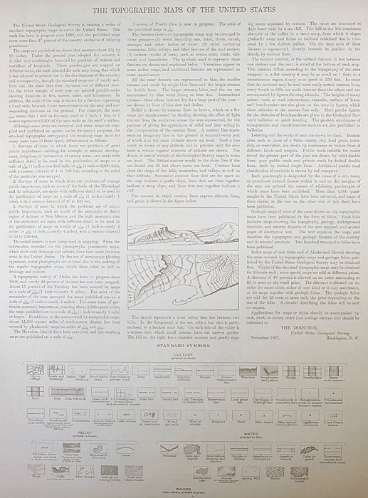
A map summary is printed on the back side of the Perilla sheet similar to the one shown in the picture. It outlines the history, purpose, and status of the USGS mapping program at the time of the printing in 1919. It also provides instructions on how to read contour lines and a description of how they are used to depict the terrain. At the bottom of the page is a legend showing all of the symbols used to represent the cultural, relief, and water features found on the map.
SHIPPING AND RETURNS
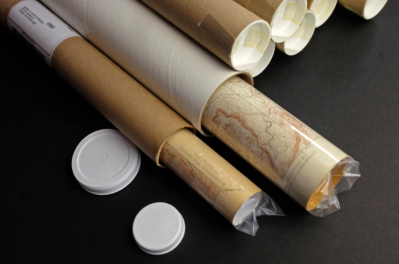
This map sheet will be carefully rolled in a sturdy tube and shipped via the US Postal Service. Shipping and handling costs are included in the purchase price.
If you find that the sheet you receive is not as described in the listing, you may ship it back to us for a refund of the purchase price.
15~12645 15~12646 15~12647 15~12648 15~12649 15~12650 15~12774 15~12775 15~12776 15~12777 15~12778 15~12779 15~12780 15~12781 15~12900 15~12901 15~12902 15~12903 15~12904 15~12905 15~12906 15~12907 30~3190 30~3191 30~3257 30~3258 30~3259 30~3260 30~3321 30~3322 30~3324 75~49269 75~49270 75~49271 75~49272 75~49273 75~49274 75~49498 75~49499 75~49500 75~49501 75~49502 75~49503 75~49504 75~49715 75~49728 75~49729 75~49730 75~49731 75~49732 75~49733 75~49937 75~49938