![]()
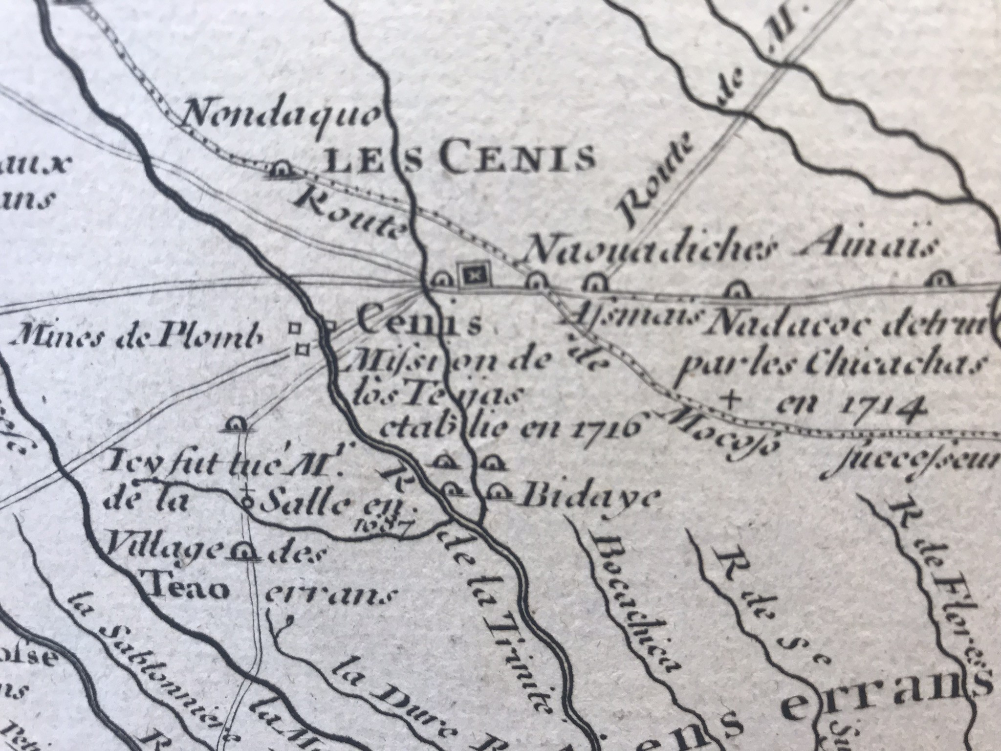
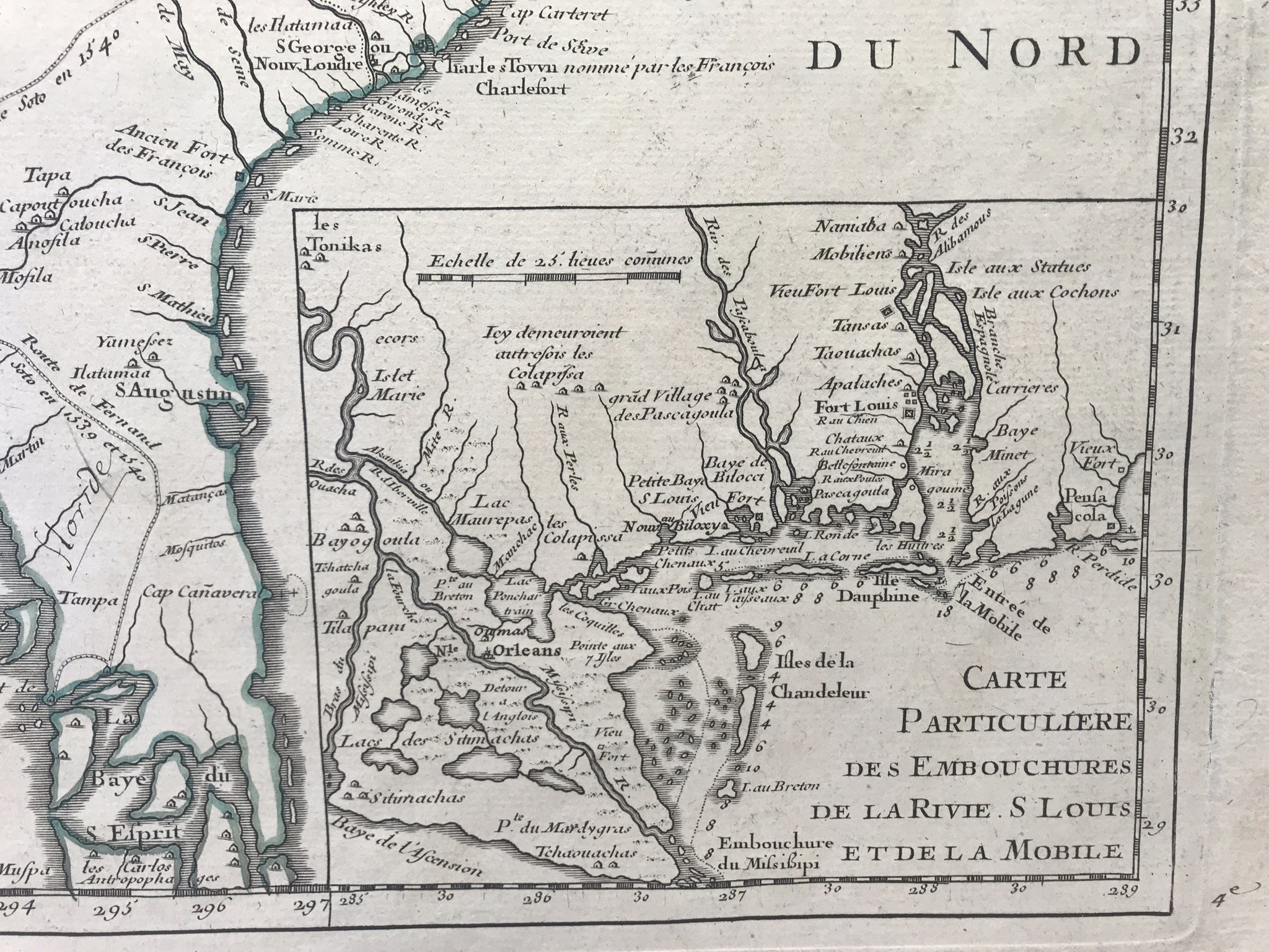
Map of Louisiana and the course of the Mississippi, G de L'ISLE, 1718 Map of Louisiana and the course of the Mississippi, Guillaume de L'ISLE, 1718 Rare map of 1718 drawn up by G.de L'IISLE of the Academy of SciencesFirst detailed map of the Gulf of Mexico and the Mississippi. For the first time Texas is mentioned (mission de las TEIJAS, established in 1710), the numerous Indian tribes appear on this map. dim of the sheet 75 X 53.5 cm, basin 65 X 50 cm, central fold, good proof

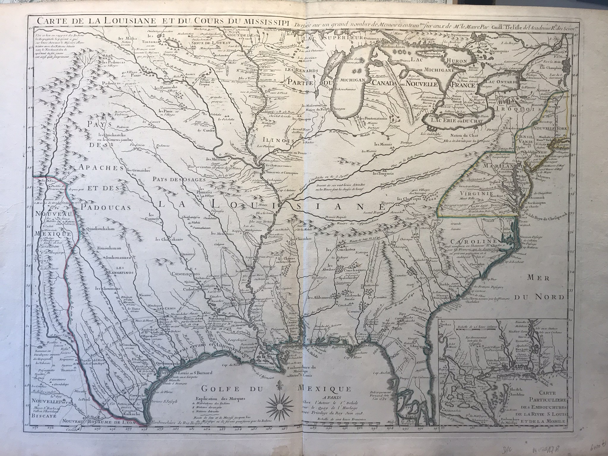
Map of Louisiana and the course of the Mississippi, G de L'ISLE, 1718
Availablity: in stock