'Allier'
Antique engraved map with original hand colour, 1876
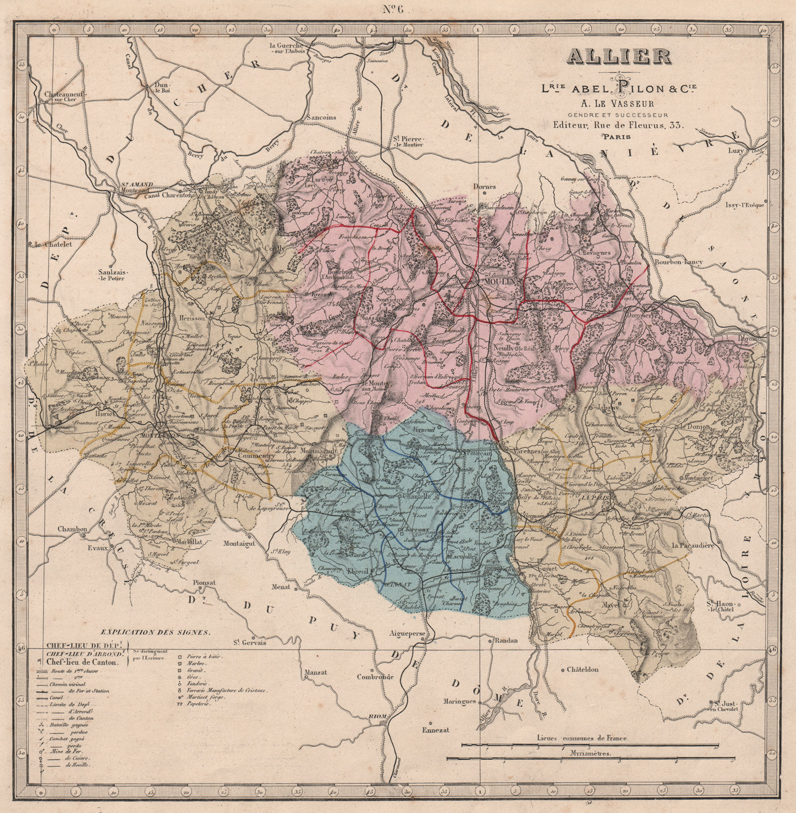
Title of map: 'Allier'
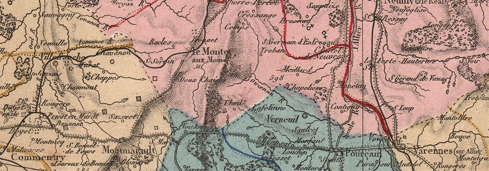
The image below shows an enlarged cross section from the centre of the map to show the level of printed detail:
The map key/legend includes symbols for the following features and resources, suggesting that one or more of each may be indicated on the map: Bataille gagnée (Battlefield (victory)); Bataille perdu (Battlefield (defeat)); Combat gagné (Skirmish (victory)); Combat perdu (Skirmish (defeat)); Route de 1re classe (1st class road); Route de 2me classe (2nd class road); Chemin vicinal (Local road); Chemin de fer et station (Railway & station); Canal (Canal); Pierre à batir (Construction stone); Marbre (Marble); Granit (Granite); Mine de Fer (Iron Mine); Mine de Ciuvre (Copper Mine); Mine de Houille (Coal mine); Vererrie manufacture de Cristaux (Crystal/glass factory); Papeterie (Paper factory); Grès (Sandstone); Fonderie (Foundry); Martinet, Forge (Forge)
DATE PRINTED: 1876
IMAGE SIZE: Approx 30.5 x 30.0cm, 12 x 11.75 inches (Large)
ARTIST/CARTOGRAPHER/ENGRAVER: Librairie Abel Pilon & Cie; A. Le Vasseur
PROVENANCE: "Grand Atlas Départemental de la France de L'Algérie et des colonies"; by H. Fisquet; Published by A. Le Vasseur, Paris [Grand atlas départmental]
TYPE: Antique engraved map with original hand colour
VERSO: There is nothing printed on the reverse side, which is plain
CONDITION: Good; suitable for framing. However, please note: The image shown may have been taken from a different example of this map than that which is offered for sale. The map you will receive is in good condition but there may be minor variations in the condition from that shown in the image which may include some light spotting.This map was coloured by hand at the time of publication. The colouring used varies slightly between different examples of the map; the colouring applied to the map you receive may differ slightly from that shown in the image. Please check the scan for any blemishes prior to making your purchase. Virtually all antiquarian maps and prints are subject to some normal aging due to use and time which is not obtrusive unless otherwise stated. I offer a no questions asked return policy - see below.
AUTHENTICITY: This is an authentic historic print, published at the date stated above. I do not offer reproductions. It is not a modern copy. The term 'original' when applied to a print means that it was printed at the first or original date of publication; it does not imply that the item is unique. 'Print' means any image created by applying an inked block to paper or card under pressure by any method including wood engraving, steel engraving, copperplate, wood cut and lithography.
REMARKS: FRANCE: Gravures et Cartes anciennes. DEUTSCHLAND: Alte Lankarten und Stadt ansichten. ITALIA: Stampe e Mappe antiche. ESPAÑA: Mapas antiquos y impresiones antiguas. E and OE. Force Majeure. English law shall apply.
RETURNS POLICY: I offer a no questions returns policy. All I ask is that you pay return shipping and mail back to me in original condition, suitably packed & insured, within 14 days of receipt.