'Holy-Head - Is most humbly dedicated to Capt. William Wright by G Collins, Hydrographer to the King'
Decorative antique eighteenth century copperplate nautical sea chart, printed on thick paper, c1774
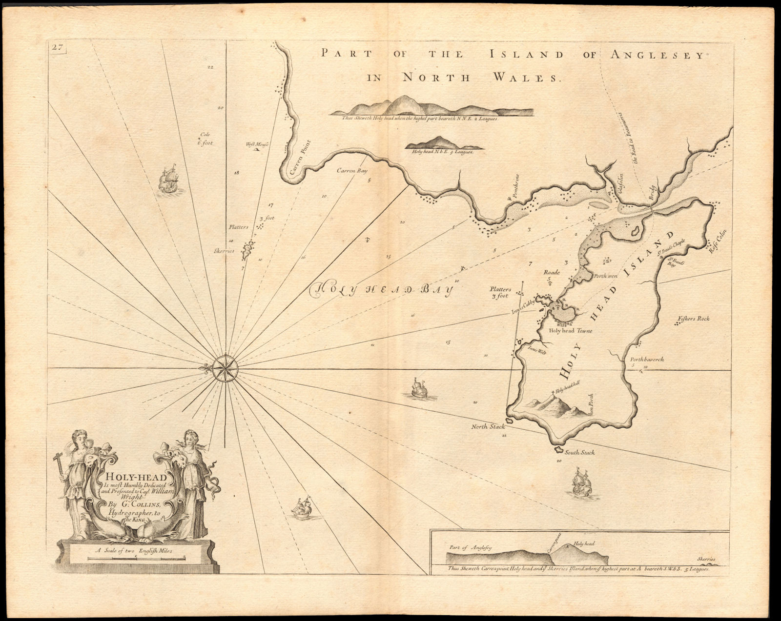
Title of map: 'Holy-Head - Is most humbly dedicated to Capt. William Wright by G Collins, Hydrographer to the King'
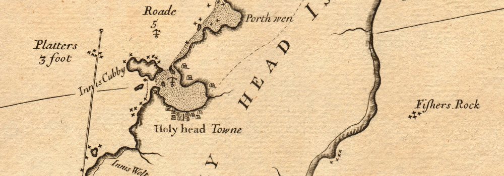
The image below shows an enlarged cross section from the centre of the map to show the level of printed detail. This map is folding hence the centrefold line may show on the image below:
Depicted in this sea chart, which is orientated towards the east, is Holy Island, the town and port of Holyhead, and the adjacent coast of Anglesey, Wales
DATE PRINTED: Published after 1774, possibly in 1792. The atlas within which this map was printed (see provenance) was first published in 1693 with a number of later editions published through the eighteenth century. The publication date stated on the title page of this edition of the atlas is "MDCCLXCII", which is unintelligible and erroneous as it does not conform to standard notation for Roman Numerals. The text within the book from which the map was extracted refers to tidal variations up to the year 1774, hence we state the publication date as after 1774. This edition of the atlas does not appear in the English Short Title Catalogue. The publisher is stated to be "Mount & Davidson", which differs from the publisher of other editions through the early part of the 18th century, which is stated to be "Mount & Page". Mount & Davidson appear to have been active as publishers in the 1780's and early 1790's. A publication date of 1792 (MDCCXCII) would be consistent with stated year of publication if the "L" had been erroneously inserted.
IMAGE SIZE: Approx 63.5 x 51.0cm, 25 x 20 inches (Large); Please note that this is a folding map.
ARTIST/CARTOGRAPHER/ENGRAVER: Captain Greenvile (or Greenville) Collins. Collins was an officer of the Royal Navy and prominent hydrographer, who was commissioned by King Charles II in 1676 and appointed by Samuel Pepys (then Secretary to the Admiralty), to chart the coasts of Great Britain. The resulting atlas - Great Britain's Coasting Pilot - was the first original sea atlas to be produced by an Englishman. Prior to publication of these maps, nautical charts were often defective, and there was no centralised system for collecting and disseminating the better maps made by experienced seamen. In 1681, Collins gained the king's preferment to survey the country's coasts. The Admiralty supplied Collins with the 8-gun yacht HMS Merlin for the first two years and later the yacht HMS Monmouth until 1686. His work was carried out under the supervision of Trinity House, who also supported the project financially. Samuel Pepys insisted that Collins be made a younger brother of Trinity House. Collins spent seven years on the survey, the first edition of which was published in 1693, as "Great Britain's Coasting Pilot". The charts, while not completely accurate, were an enormous advance on anything before them, entitling Collins to rank as not only one of the earliest, but also among the best of English hydrographers. Twenty-one further editions were published during the eighteenth century.
PROVENANCE: "Great Britain's Coasting Pilot: being a new and exact survey of the sea-coast of England and Scotland from the river of Thames to the westward and northward; with the islands of Scilly and from thence to Carlisle; likewise the islands of Orkney and Shetland, describing all the harbours, rivers, bays, roads, rocks, sands, buoys, beacons, sea-marks, depths of water, latitude, bearings and distances from place to place. The setting and flowing of the tides; with directions for the knowing of any place, and how to harbour a ship in the same with safety. with directions for coming into the Channel between England and France.", by Captain Greenville Collins, Hydrographer in ordinary to the King's most Excellent Majesty. London: printed for Mount and Davidson, on Tower-Hill, MDCCLXCII (sic) [Great Britain's Coasting Pilot]
TYPE: Decorative antique eighteenth century copperplate nautical sea chart, printed on thick paper
VERSO: There is nothing printed on the reverse side, which is plain
CONDITION: Good; suitable for framing. Please check the scan for any blemishes prior to making your purchase. Please contact us if you would like to arrange to view this map. Virtually all antiquarian maps and prints are subject to some normal aging due to use and time which is not obtrusive unless otherwise stated. I offer a no questions asked return policy - see below.
AUTHENTICITY: This is an authentic historic print, published at the date stated above. I do not offer reproductions. It is not a modern copy. The term 'original' when applied to a print means that it was printed at the first or original date of publication; it does not imply that the item is unique. 'Print' means any image created by applying an inked block to paper or card under pressure by any method including wood engraving, steel engraving, copperplate, wood cut and lithography.
REMARKS: FRANCE: Gravures et Cartes anciennes. DEUTSCHLAND: Alte Lankarten und Stadt ansichten. ITALIA: Stampe e Mappe antiche. ESPAÑA: Mapas antiquos y impresiones antiguas. E and OE. Force Majeure. English law shall apply.
RETURNS POLICY: I offer a no questions returns policy. All I ask is that you pay return shipping and mail back to me in original condition, suitably packed & insured, within 14 days of receipt.