'Europe - Naples et Sicile - No 26'
Antique folio-sized lithographic atlas map, hand coloured in outline, on conical projection. This map was published within the first atlas ever to be printed using lithography, and also the first to be printed on a uniform scale, 1827
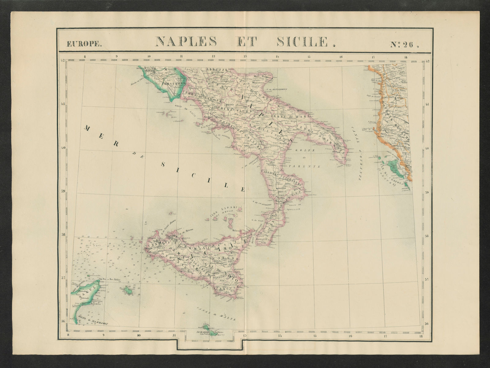
Title of map: 'Europe - Naples et Sicile - No 26 '
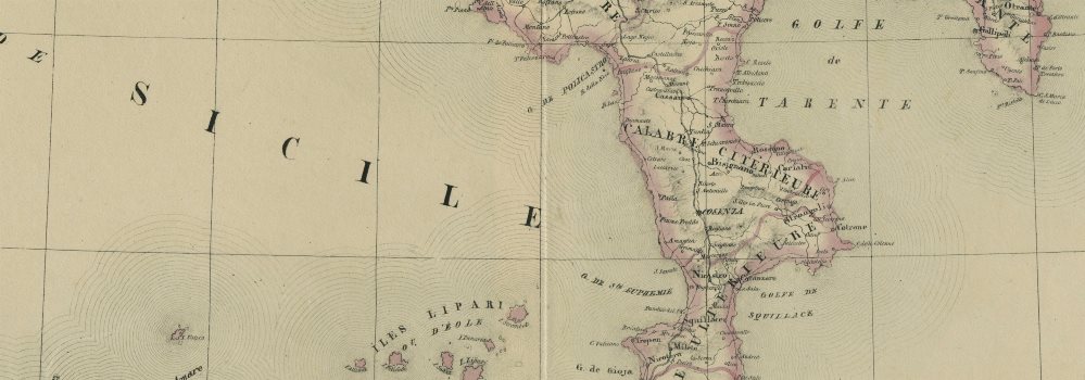
The image below shows an enlarged cross section from the centre of the map to show the level of printed detail. This map is folding hence the centrefold line may show on the image below:
Southern Italy including Sicily and Naples, and part of the adjacent coast of Albania
DATE PRINTED: 1827
IMAGE SIZE: Approx 71.0 x 52.0cm, 27.75 x 20.25 inches (Large); Please note that this is a folding map.
ARTIST/CARTOGRAPHER/ENGRAVER: Philippe Marie Guillaume Vandermaelen. Lithography by Henri Ode
PROVENANCE: "Atlas Universel de Geographie Physique, Politique, Statistique et Mineralogique", dresse par Ph. Vandermaelen - Premiere partie - Europe. Bruxelles. [This landmark atlas is remarkable as the first atlas to have been produced using the then new printing process of lithography. It is also the first atlas to show the whole world in maps using a large uniform scale; in total the 380 conically projected sheets of maps are designed to be joined into a three dimensional terrestrial globe with a diameter of approximately 7.75 metres (25 feet).]
TYPE: Antique folio-sized lithographic atlas map, hand coloured in outline, on conical projection. This map was published within the first atlas ever to be printed using lithography, and also the first to be printed on a uniform scale
VERSO: There is nothing printed on the reverse side, which is plain
CONDITION: Good; suitable for framing. Please check the scan for any blemishes prior to making your purchase. Virtually all antiquarian maps and prints are subject to some normal aging due to use and time which is not obtrusive unless otherwise stated. I offer a no questions asked return policy - see below.
AUTHENTICITY: This is an authentic historic print, published at the date stated above. I do not offer reproductions. It is not a modern copy. The term 'original' when applied to a print means that it was printed at the first or original date of publication; it does not imply that the item is unique. 'Print' means any image created by applying an inked block to paper or card under pressure by any method including wood engraving, steel engraving, copperplate, wood cut and lithography.
REMARKS: FRANCE: Gravures et Cartes anciennes. DEUTSCHLAND: Alte Lankarten und Stadt ansichten. ITALIA: Stampe e Mappe antiche. ESPAÑA: Mapas antiquos y impresiones antiguas. E and OE. Force Majeure. English law shall apply.
RETURNS POLICY: I offer a no questions returns policy. All I ask is that you pay return shipping and mail back to me in original condition, suitably packed & insured, within 14 days of receipt.