Nouvelle Carte de l'Etat de Milan avec une partie du Montferrat, du Piemont et de la Suisse: Dressée sur les lieux par an Officier General au service de S. S. Avec une carte du Mantouan À Venise par P. Santini 1780 Chez. Mr. Remondini [New map of the state of Milan with part of Montferrat, Piedmont and Switzerland]. Inset: Nouvelle carte du Duché de Mantoue [New map of the Duchy of Mantua]
Large antique 18th century atlas map, printed on thick, good quality paper with original outline hand colour/color and decorative title cartouche, 1784
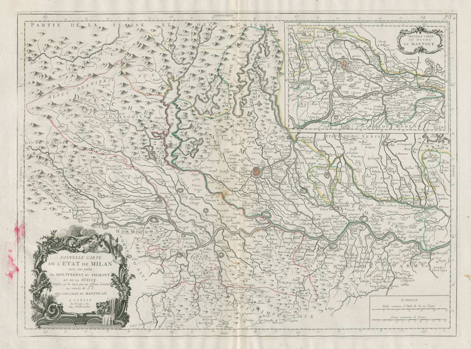
Title of map: 'Nouvelle Carte de l'Etat de Milan avec une partie du Montferrat, du Piemont et de la Suisse: Dressée sur les lieux par an Officier General au service de S. S. Avec une carte du Mantouan À Venise par P. Santini 1780 Chez. Mr. Remondini [New map of the state of Milan with part of Montferrat, Piedmont and Switzerland]. Inset: Nouvelle carte du Duché de Mantoue [New map of the Duchy of Mantua]'
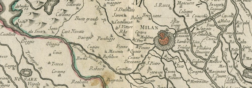
The image below shows an enlarged cross section from the centre of the map to show the level of printed detail. This map is folding hence the centrefold line may show on the image below:
A decorative 18th century map of the state of Milan with parts of Montferrat, Piedmont and Switzerland. The map area includes much of the modern day Italian provinces of Lombardy, the northern part of Piedmont, and west to the Aosta valley. Lago (Lake) Maggiore, Lago Lugano & Lago di Como are shown in the upper central part of the map. Inset at top right is a map of the Duchy of Mantua.
DATE PRINTED: 1784
IMAGE SIZE: Approx 49.5 x 67.0cm, 19.5 x 26.25 inches (Large); Please note that this is a folding map.
ARTIST/CARTOGRAPHER/ENGRAVER: Santini, Paolo
PROVENANCE: "Atlas Universel, dressé sur les meilleures cartes modernes", 1784 à Venise par P. Santini, rue Ste Justine, chez M. Remondini
TYPE: Large antique 18th century atlas map, printed on thick, good quality paper with original outline hand colour/color and decorative title cartouche
VERSO: There is nothing printed on the reverse side, which is plain
CONDITION: Fair: Red paint blotches along lower left hand border and in lower left margin. Spot. Please note any other blemishes on the scan prior to purchasing this picture. Please contact us if you would like to arrange to view this map. Virtually all antiquarian maps and prints are subject to some normal aging due to use and time which is not obtrusive unless otherwise stated. I offer a no questions asked return policy - see below.
AUTHENTICITY: This is an authentic historic print, published at the date stated above. I do not offer reproductions. It is not a modern copy. The term 'original' when applied to a print means that it was printed at the first or original date of publication; it does not imply that the item is unique. 'Print' means any image created by applying an inked block to paper or card under pressure by any method including wood engraving, steel engraving, copperplate, wood cut and lithography.
REMARKS: FRANCE: Gravures et Cartes anciennes. DEUTSCHLAND: Alte Lankarten und Stadt ansichten. ITALIA: Stampe e Mappe antiche. ESPAÑA: Mapas antiquos y impresiones antiguas. E and OE. Force Majeure. English law shall apply.
RETURNS POLICY: I offer a no questions returns policy. All I ask is that you pay return shipping and mail back to me in original condition, suitably packed & insured, within 14 days of receipt.