'A comparative view of the principal waterfalls, islands, lakes, rivers and mountains in the Eastern Hemisphere'
Antique engraved map diagram by J Rapkin, published by John Tallis. Decorative border, 1851
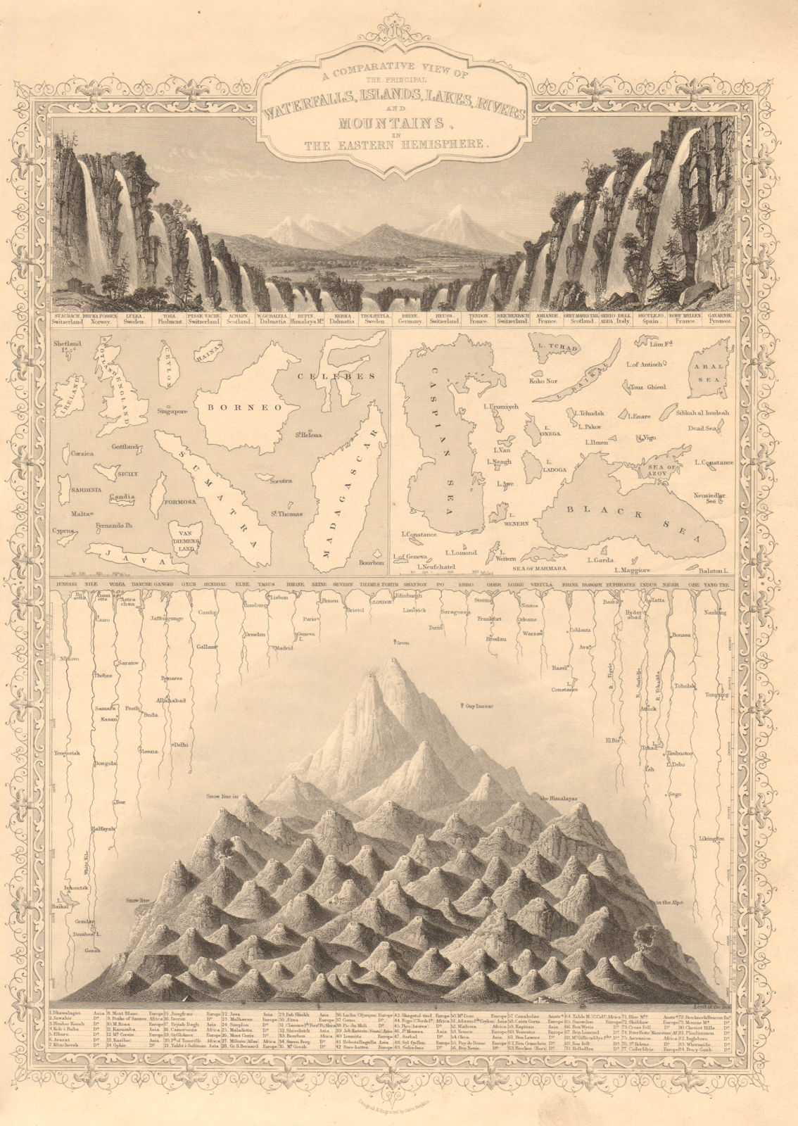
Title of map: 'A comparative view of the principal waterfalls, islands, lakes, rivers and mountains in the Eastern Hemisphere'
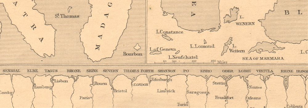
The image below shows an enlarged cross section from the centre of the map to show the level of printed detail:
Shows the snow lines, and the greatest heights reached by balloonists. The highest mountain is shown as Dhawalagiri [Dhaulagiri, which at 8167 metres is the 7th highest mountain in Asia and in the World]; Mount Everest was not surveyed until 1856. The longest river in the Easterm hemisphere is indicated to be the Ienesei (Yenisei–Angara–Selenge), which is actually the 5th longest in the world. Both the Yangtse and the Nile (prior to the discovery of the source of the Nile) are incorrectly shown as shorter.
DATE PRINTED: 1851
IMAGE SIZE: Approx 36.5 x 26.5cm, 14.5 x 10.25 inches (Large)
ARTIST/CARTOGRAPHER/ENGRAVER: Designed & engraved by John Rapkin. Published by John Tallis & Co
PROVENANCE: "Tallis's Illustrated Atlas and Modern History of the World, Geographical, Political, Commercial and Statistical", edited by R Montgomery Martin Esq., published by John Tallis and Company, London & New York [Tallis's Illustrated Atlas]
TYPE: Antique engraved map diagram by J Rapkin, published by John Tallis. Decorative border
VERSO: There is nothing printed on the reverse side, which is plain
CONDITION: Good; suitable for framing. However, please note: Blemish in margin. Please check the scan for any blemishes prior to making your purchase. Virtually all antiquarian maps and prints are subject to some normal aging due to use and time which is not obtrusive unless otherwise stated. I offer a no questions asked return policy - see below.
AUTHENTICITY: This is an authentic historic print, published at the date stated above. I do not offer reproductions. It is not a modern copy. The term 'original' when applied to a print means that it was printed at the first or original date of publication; it does not imply that the item is unique. 'Print' means any image created by applying an inked block to paper or card under pressure by any method including wood engraving, steel engraving, copperplate, wood cut and lithography.
REMARKS: FRANCE: Gravures et Cartes anciennes. DEUTSCHLAND: Alte Lankarten und Stadt ansichten. ITALIA: Stampe e Mappe antiche. ESPAÑA: Mapas antiquos y impresiones antiguas. E and OE. Force Majeure. English law shall apply.
RETURNS POLICY: I offer a no questions returns policy. All I ask is that you pay return shipping and mail back to me in original condition, suitably packed & insured, within 14 days of receipt.