[Map of Great Britain showing all the Railways & Railway stations, Canals, Navigable Rivers & Principal Roads &c. - North West Sheet]
Large antique engraved railway and transport map, on four sheets, unjoined, 1868
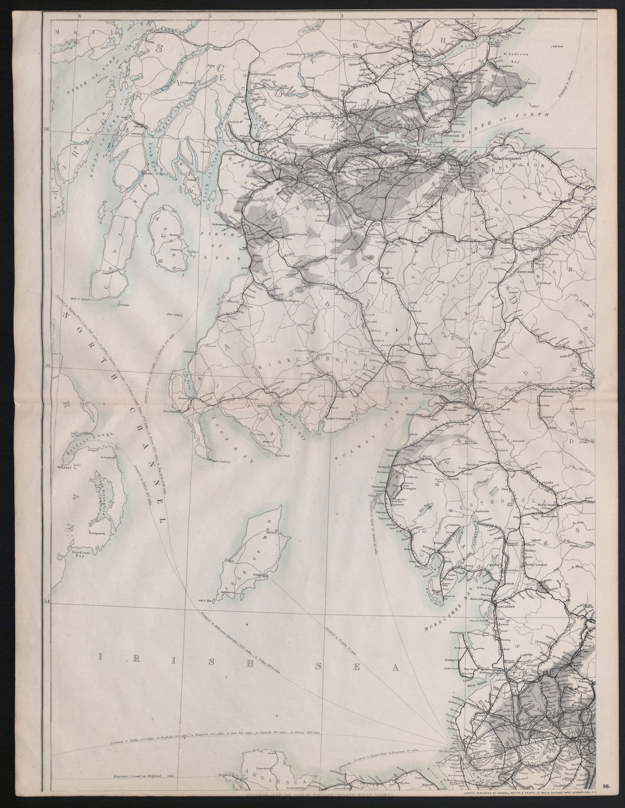
Title of map: '[Map of Great Britain showing all the Railways & Railway stations, Canals, Navigable Rivers & Principal Roads &c. - North West Sheet]'
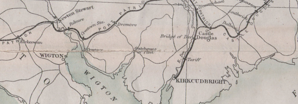
The image below shows an enlarged cross section from the centre of the map to show the level of printed detail. This map is folding hence the centrefold line may show on the image below:
DATE PRINTED: 1868
IMAGE SIZE: Approx 65.5 x 44.0cm, 25.75 x 17.25 inches (Large); Please note that this is a folding map.
ARTIST/CARTOGRAPHER/ENGRAVER: Revised by I Dower
PROVENANCE: "Cassell's Complete Atlas" (a.k.a. "The Weekly Dispatch Atlas"), Published by Cassell, Petter and Galpin, London [Cassell's Weekly Dispatch Atlas]
TYPE: Large antique engraved railway and transport map, on four sheets, unjoined
VERSO: There is nothing printed on the reverse side, which is plain
CONDITION: Good; suitable for framing. However, please note: May have a tight margin on one or more edges. Please check the scan for any blemishes prior to making your purchase. Please contact us if you would like to arrange to view this map. Virtually all antiquarian maps and prints are subject to some normal aging due to use and time which is not obtrusive unless otherwise stated. I offer a no questions asked return policy - see below.
AUTHENTICITY: This is an authentic historic print, published at the date stated above. I do not offer reproductions. It is not a modern copy. The term 'original' when applied to a print means that it was printed at the first or original date of publication; it does not imply that the item is unique. 'Print' means any image created by applying an inked block to paper or card under pressure by any method including wood engraving, steel engraving, copperplate, wood cut and lithography.
REMARKS: FRANCE: Gravures et Cartes anciennes. DEUTSCHLAND: Alte Lankarten und Stadt ansichten. ITALIA: Stampe e Mappe antiche. ESPAÑA: Mapas antiquos y impresiones antiguas. E and OE. Force Majeure. English law shall apply.
RETURNS POLICY: I offer a no questions returns policy. All I ask is that you pay return shipping and mail back to me in original condition, suitably packed & insured, within 14 days of receipt.