'Systema Ptolomei'
Antique copperplate print, 1709
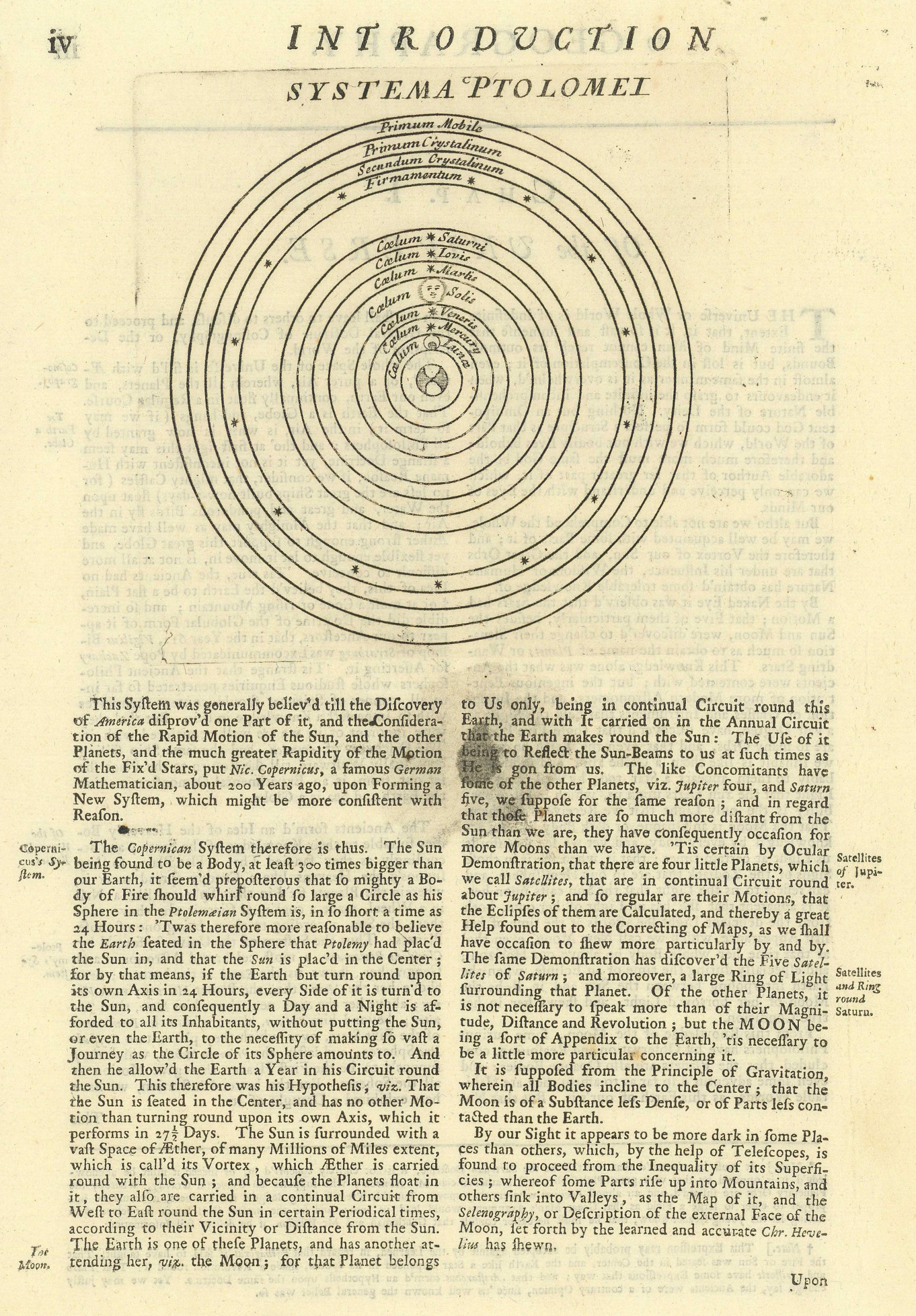
Title of map: 'Systema Ptolomei'
DATE PRINTED: 1709
IMAGE SIZE: Approx 29.5 x 19.5cm, 11.5 x 7.75 inches (Medium)
ARTIST/CARTOGRAPHER/ENGRAVER: Anonymous
PROVENANCE: "The Compleat Geographer: or, the Chorography and Topography of all the known parts of the Earth", by Herman Moll. Third edition. Printed for Awnsham and John Churchill at the Black Swan in Paternoster Row and Timothy Childe at the White Hart at the West End of St. Paul's Churchyard
TYPE: Antique copperplate print
VERSO: There is text printed on the reverse side
CONDITION: Good; suitable for framing. Please check the scan for any blemishes prior to making your purchase. Virtually all antiquarian maps and prints are subject to some normal aging due to use and time which is not obtrusive unless otherwise stated. I offer a no questions asked return policy - see below.
AUTHENTICITY: This is an authentic historic print, published at the date stated above. I do not offer reproductions. It is not a modern copy. The term 'original' when applied to a print means that it was printed at the first or original date of publication; it does not imply that the item is unique. 'Print' means any image created by applying an inked block to paper or card under pressure by any method including wood engraving, steel engraving, copperplate, wood cut and lithography.
REMARKS: FRANCE: Gravures et Cartes anciennes. DEUTSCHLAND: Alte Lankarten und Stadt ansichten. ITALIA: Stampe e Mappe antiche. ESPA�A: Mapas antiquos y impresiones antiguas. E and OE. Force Majeure. English law shall apply.
RETURNS POLICY: I offer a no questions returns policy. All I ask is that you pay return shipping and mail back to me in original condition, suitably packed & insured, within 14 days of receipt.