'Australia and New Zealand // Torres Strait on An enlarged Scale'
Antique engraved atlas map with original hand colour/color, 1860
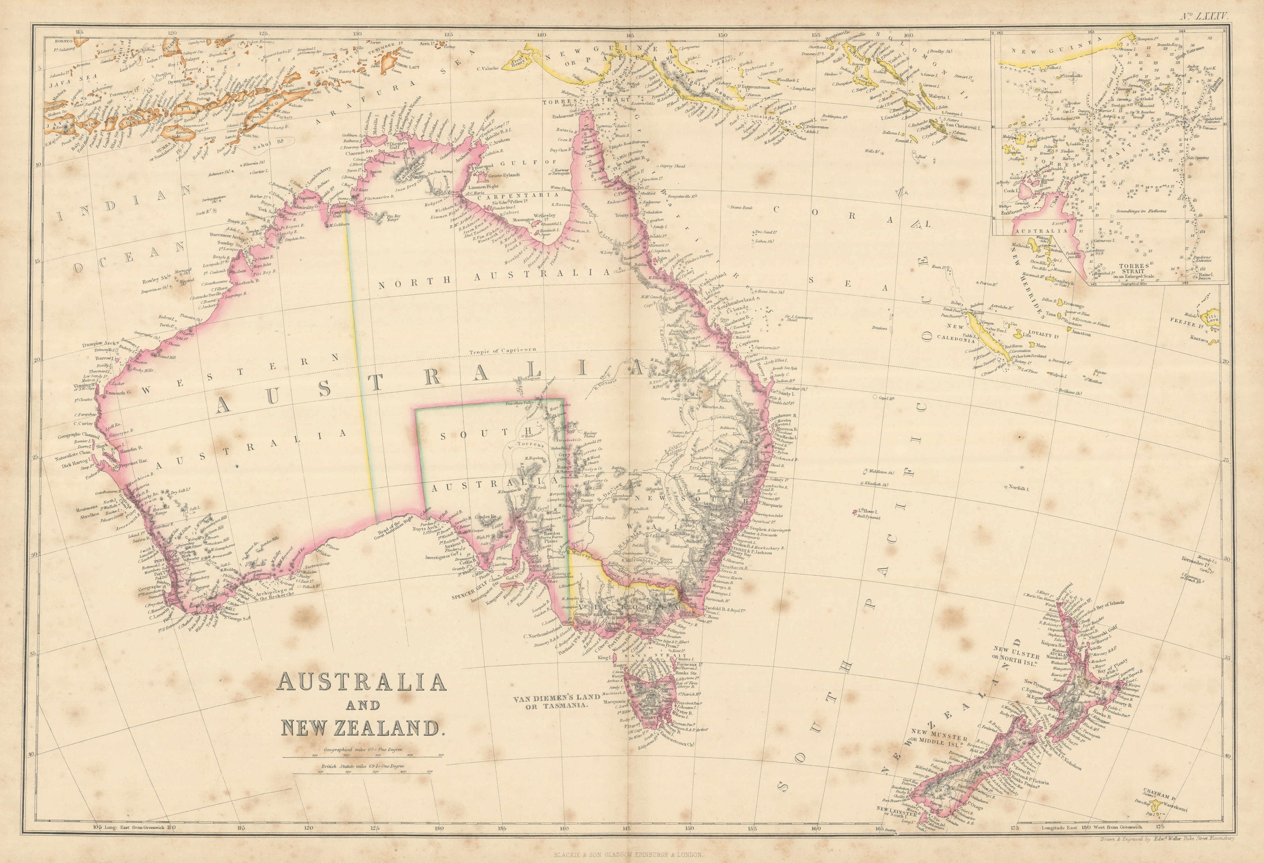
Caption below picture: 'Australia and New Zealand // Torres Strait on An enlarged Scale'
The islands of New Zealand are named with their early colonial names. Today's North Island is named as "New Ulster or North Island", today's South Island as "New Munster or Middle Island", and Stewart Island / Rakiura as "New Leinster or South Island". In 1907, the Minister for Lands gave instructions to the Land and Survey Department that the name Middle Island was not to be used in the future. The early colonial names of New Ulster, New Munster and New Leinster were established as provinces corresponding to each island by Royal Charter in 1840. The use of these names corresponding with the islands fell into disuse after the islands were subdivided into a several smaller provinces from 1853.
DATE PRINTED: 1860
IMAGE SIZE: Approx 36.0 x 53.0cm, 14.25 x 20.75 inches (Large); Please note that this is a folding map.
ARTIST/CARTOGRAPHER/ENGRAVER: Edward Weller
PROVENANCE: "The Imperial Atlas of Modern Geography", under the supervision of W..G. Blackie PhD. Blackie and Son, Paternoster Row E.C. Glasgow and Edinburgh
TYPE: Antique engraved atlas map with original hand colour/color
VERSO: There is nothing printed on the reverse side, which is plain
CONDITION: Fair: Spotting. Please note any other blemishes on the scan prior to purchasing this picture. Virtually all antiquarian maps and prints are subject to some normal aging due to use and time which is not obtrusive unless otherwise stated. I offer a no questions asked return policy - see below.
AUTHENTICITY: This is an authentic historic print, published at the date stated above. I do not offer reproductions. It is not a modern copy. The term 'original' when applied to a print means that it was printed at the first or original date of publication; it does not imply that the item is unique. 'Print' means any image created by applying an inked block to paper or card under pressure by any method including wood engraving, steel engraving, copperplate, wood cut and lithography.
REMARKS: FRANCE: Gravures et Cartes anciennes. DEUTSCHLAND: Alte Lankarten und Stadt ansichten. ITALIA: Stampe e Mappe antiche. ESPA�A: Mapas antiquos y impresiones antiguas. E and OE. Force Majeure. English law shall apply.
RETURNS POLICY: I offer a no questions returns policy. All I ask is that you pay return shipping and mail back to me in original condition, suitably packed & insured, within 14 days of receipt.