'Queenhith Ward and Vintry Ward'
Hand coloured copperplate engraved map, 1720
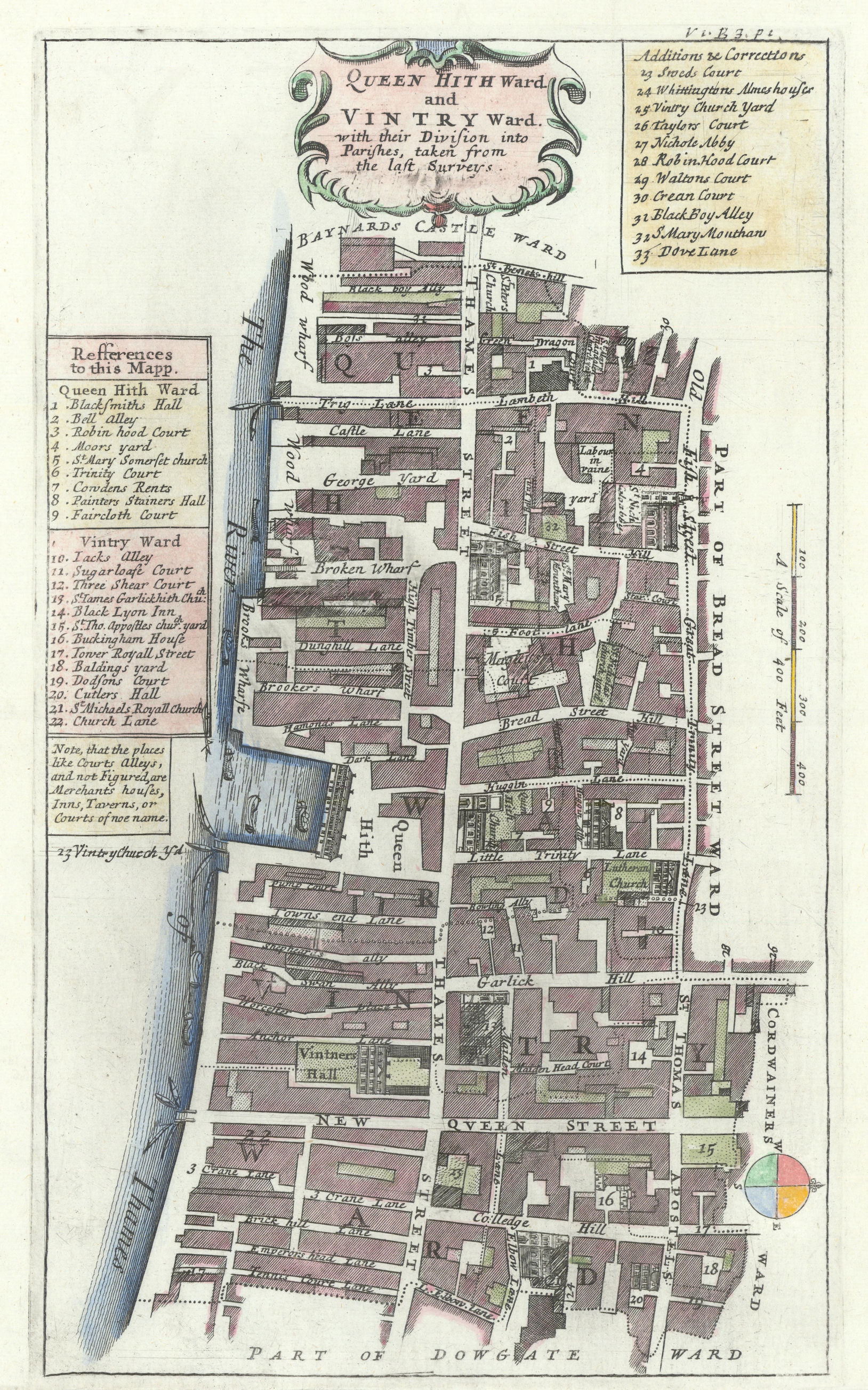
Caption below picture: 'Queenhith Ward and Vintry Ward'
This map, which is orientated towards the west, shows part of the City of London south of Cannon Street, including Upper Thames Street and the adjacent area. Streets and other places marked include Garlic Hill, Queenhithe, Great Trinity Lane, St Thomas Apostles.
DATE PRINTED: 1720
IMAGE SIZE: Approx 32.5 x 19.5cm, 12.75 x 7.75 inches (Large)
ARTIST/CARTOGRAPHER/ENGRAVER: Published by John Strype from a plate originally published by John Stow
PROVENANCE: "A survey of the cities of London and Westminster, containing the original, antiquity, increase, modern estate and government of those cities. Written at first in the year 1598, by John Stow, citizen and native of London .... Corrected, improved, and very much enlarged ... by John Strype, MA, a native also of the said city", London, printed for A. Churchill, J. Knapton, R. Knaplock, J. Walthoe, E. Horne, B. Tooke, D. Midwinter, B. Cowse, R. Robinson, and T.Ward, MDCCXX [Stow's survey of London]
TYPE: Hand coloured copperplate engraved map
VERSO: There is nothing printed on the reverse side, which is plain
CONDITION: Good; suitable for framing. Please check the scan for any blemishes prior to making your purchase. Virtually all antiquarian maps and prints are subject to some normal aging due to use and time which is not obtrusive unless otherwise stated. I offer a no questions asked return policy - see below.
AUTHENTICITY: This is an authentic historic print, published at the date stated above. I do not offer reproductions. It is not a modern copy. The term 'original' when applied to a print means that it was printed at the first or original date of publication; it does not imply that the item is unique. 'Print' means any image created by applying an inked block to paper or card under pressure by any method including wood engraving, steel engraving, copperplate, wood cut and lithography.
REMARKS: FRANCE: Gravures et Cartes anciennes. DEUTSCHLAND: Alte Lankarten und Stadt ansichten. ITALIA: Stampe e Mappe antiche. ESPA�A: Mapas antiquos y impresiones antiguas. E and OE. Force Majeure. English law shall apply.
RETURNS POLICY: I offer a no questions returns policy. All I ask is that you pay return shipping and mail back to me in original condition, suitably packed & insured, within 14 days of receipt.