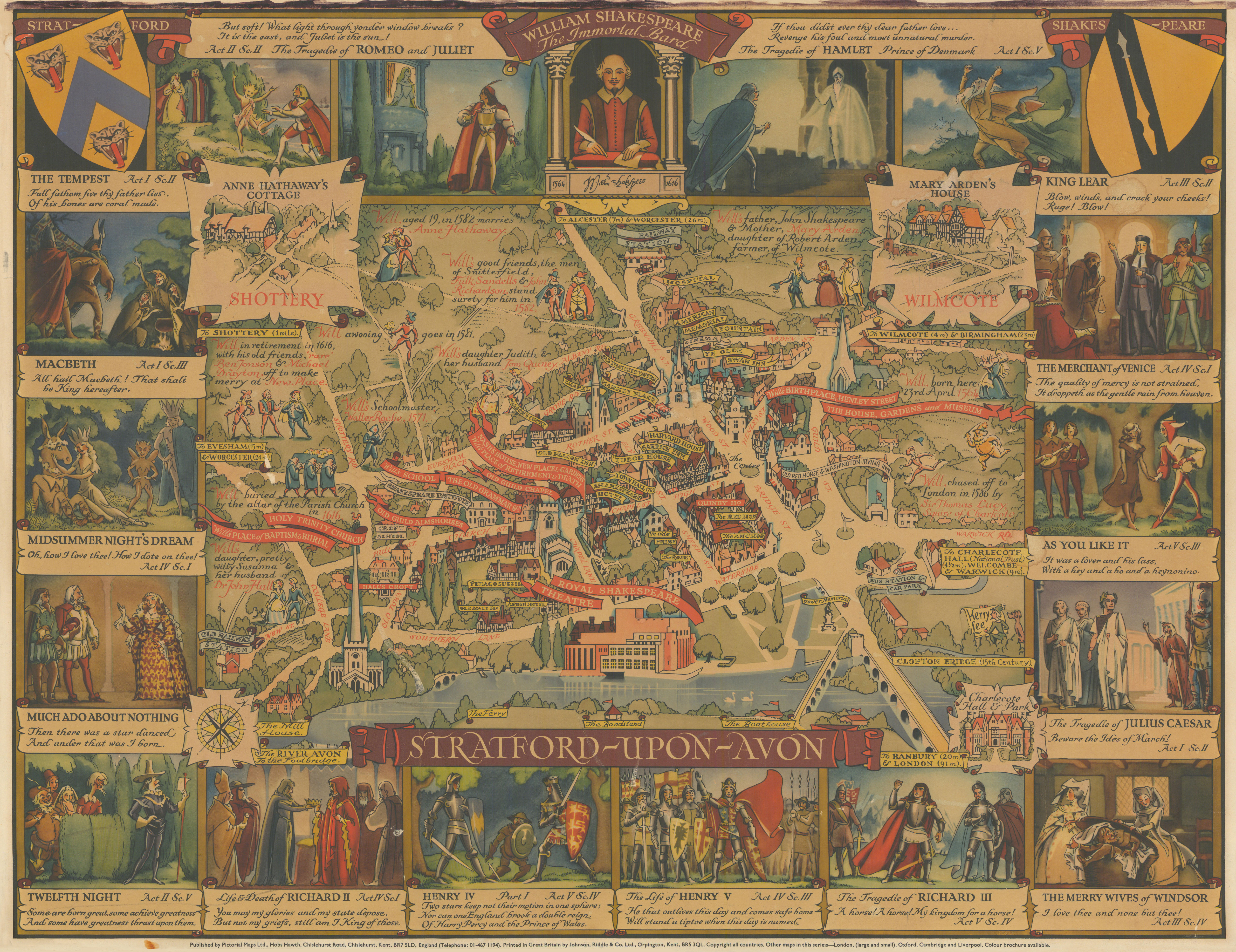
'Stratford-upon-Avon - William Shakespeare, The Immortal Bard'
20th century colour pictorial map, c1965

Caption below picture: 'Stratford-upon-Avon - William Shakespeare, The Immortal Bard'
Kerry Lee's decorative mid-century pictorial map of Stratford-upon-Avon, one of a series of posters conceived to promote tourism to Britain in the years after World War Two, originally for the Travel Association of Great Britain and Northern Ireland. The map provides a bird's-eye view of the historic centre of Stratford, with notable landmarks labelled with coloured banderoles. The map's theme is the life and works of William Shakespeare, with the red banderoles marking locations relating to the Bard. There are numerous cartoons illustrating people and events from Shakespeare's life and family, each narrated with red text. Three of the four corners of the map contain vignettes, showing Anne Hathaway's Cottage, Mary Arden's House, and Charlecote Hall & Park. The map itself is surrounded by a decorative border containing famous scenes and lines from sixteen of Shakespeare's plays. At the centre top is a stylised illustration of Shakespeare's funerary monument, with the epitaph replaced by a facsimile of his signature and flanked by his dates of birth and death. The top corners of the border feature crests of the Arms of Stratford and Shakespeare himself.
DATE PRINTED: This map was first published in 1948. This printing no earlier than 1965
IMAGE SIZE: Approx 47.5 x 61.5cm, 18.75 x 24.25 inches (Large)
ARTIST/CARTOGRAPHER/ENGRAVER: Kerry Lee
PROVENANCE: Published by Pictorial Maps Ltd., Hobs Hawth, Chislehurst Road, Chislehurst, Kent, England. Printed in Great Britain by Johnson, Riddle & Co. Ltd, Orpington
TYPE: 20th century colour pictorial map
VERSO: There is nothing printed on the reverse side, which is plain
CONDITION: Good; suitable for framing. The map has been dry mounted onto a board. Some toning. Small damp stains; not particularly obtrusive. Marks in top margin. Spot in bottom margin. Please check the scan for any blemishes prior to making your purchase. Please contact us if you would like to arrange to view this map. Virtually all antiquarian maps and prints are subject to some normal aging due to use and time which is not obtrusive unless otherwise stated. I offer a no questions asked return policy - see below.
AUTHENTICITY: This is an authentic historic print, published at the date stated above. I do not offer reproductions. It is not a modern copy. The term 'original' when applied to a print means that it was printed at the first or original date of publication; it does not imply that the item is unique. 'Print' means any image created by applying an inked block to paper or card under pressure by any method including wood engraving, steel engraving, copperplate, wood cut and lithography.
REMARKS: FRANCE: Gravures et Cartes anciennes. DEUTSCHLAND: Alte Lankarten und Stadt ansichten. ITALIA: Stampe e Mappe antiche. ESPA�A: Mapas antiquos y impresiones antiguas. E and OE. Force Majeure. English law shall apply.
RETURNS POLICY: I offer a no questions returns policy. All I ask is that you pay return shipping and mail back to me in original condition, suitably packed & insured, within 14 days of receipt.