DATE OF THIS ** ORIGINAL ** ITEM: 1932 Mount St. Helens (known as Lawetlat'la to the indigenous Cowlitz people, and Loowit or Louwala-Clough to the Klickitat) is an active stratovolcano located in Skamania County, Washington, in the Pacific Northwest region of the United States. It lies 52 miles (83 km) northeast of Portland, Oregon, and 98 miles (158 km) south of Seattle.[3] Mount St. Helens takes its English name from that of the British diplomat Alleyne Fitzherbert, 1st Baron St Helens, a friend of explorer George Vancouver who surveyed the area in the late 18th century. The volcano is part of the Cascade Volcanic Arc, a segment of the Pacific Ring of Fire. The Mount St. Helens major eruption of May 18, 1980, remains the deadliest and most economically destructive volcanic event in U.S. history. Fifty-seven people were killed; 200 homes, 47 bridges, 15 miles (24 km) of railways, and 185 miles (298 km) of highway were destroyed. A massive debris avalanche, triggered by a magnitude 5.1 earthquake, caused a lateral eruption that reduced the elevation of the mountain's summit from 9,677 ft (2,950 m) to 8,363 ft (2,549 m), leaving a 1 mile (1.6 km) wide horseshoe-shaped crater. The debris avalanche was 0.6 cubic miles (2.5 km3) in volume. The 1980 eruption disrupted terrestrial ecosystems near the volcano. By contrast, aquatic ecosystems in the area greatly benefited from the amounts of ash, allowing life to multiply rapidly. Six years after the eruption, most lakes in the area had returned to their normal state. After its 1980 eruption, the volcano experienced continuous volcanic activity until 2008. Geologists predict that future eruptions will be more destructive, as the configuration of the lava domes requires more pressure to erupt. However, Mount St. Helens is a popular hiking spot and it is climbed year-round. In 1982, the Mount St. Helens National Volcanic Monument was established by President Ronald Reagan and the U.S. Congress. Mount St. Helens is 34 miles (55 km) west of Mount Adams, in the western part of the Cascade Range. Considered "brother and sister" mountains, the two volcanoes are approximately 50 miles (80 km) from Mount Rainier, the highest of the Cascade volcanoes. Mount Hood, the nearest major volcanic peak in Oregon, is 60 miles (100 km) southeast of Mount St. Helens. Mount St. Helens is geologically young compared with the other major Cascade volcanoes. It formed only within the past 40,000 years, and the summit cone present before its 1980 eruption began rising about 2,200 years ago. The volcano is considered the most active in the Cascades within the Holocene epoch, which encompasses roughly the last 10,000 years. Prior to the 1980 eruption, Mount St. Helens was the fifth-highest peak in Washington. It stood out prominently from surrounding hills because of the symmetry and extensive snow and ice cover of the pre-1980 summit cone, earning it the nickname, by some, "Fuji-san of America". Its ice cover just prior to the 1980 eruption included eleven named glaciers: Wishbone, Loowit, Leschi, Forsyth, Nelson, Ape, Shoestring, Swift, Dryer, Toutle, and Talus. Of these eleven, only the Shoestring Glacier revived somewhat post-eruption. The peak rose more than 5,000 feet (1,500 m) above its base, where the lower flanks merge with adjacent ridges. The mountain is 6 miles (9.7 km) across at its base, which is at an elevation of 4,400 feet (1,300 m) on the northeastern side and 4,000 feet (1,200 m) elsewhere. At the pre-eruption tree line, the width of the cone was 4 miles (6.4 km). Streams that originate on the volcano enter three main river systems: The Toutle River on the north and northwest, the Kalama River on the west, and the Lewis River on the south and east. The streams are fed by abundant rain and snow. The average annual rainfall is 140 inches (360 cm), and the snowpack on the mountain's upper slopes can reach 16 feet (4.9 m). The Lewis River is impounded by three dams for hydroelectric power generation. The southern and eastern sides of the volcano drain into an upstream impoundment, the Swift Reservoir, which is directly south of the volcano's peak. Although Mount St. Helens is in Skamania County, Washington, access routes to the mountain run through Cowlitz County to the west, and Lewis County to the north. State Route 504, locally known as the Spirit Lake Memorial Highway, connects with Interstate 5 at Exit 49, 34 miles (55 km) to the west of the mountain.? That north–south highway skirts the low-lying cities of Castle Rock, Longview and Kelso along the Cowlitz River, and passes through the Vancouver, Washington–Portland, Oregon metropolitan area less than 50 miles (80 km) to the southwest. The community nearest the volcano is Cougar, Washington, in the Lewis River valley 11 miles (18 km) south-southwest of the peak. Gifford Pinchot National Forest surrounds Mount St. Helens. During the winter of 1980–1981, a new glacier appeared. Now officially named Crater Glacier, it was formerly known as the Tulutson Glacier. Shadowed by the crater walls and fed by heavy snowfall and repeated snow avalanches, it grew rapidly (14 feet (4.3 m) per year in thickness). By 2004, it covered about 0.36 square miles (0.93 km2), and was divided by the dome into a western and eastern lobe. Typically, by late summer, the glacier looks dark from rockfall from the crater walls and ash from eruptions. As of 2006, the ice had an average thickness of 300 feet (100 m) and a maximum of 650 feet (200 m), nearly as deep as the much older and larger Carbon Glacier of Mount Rainier. The ice is all post-1980, making the glacier very young geologically. However, the volume of the new glacier is about the same as all the pre-1980 glaciers combined. From 2004, volcanic activity pushed aside the glacier lobes and upward by the growth of new volcanic domes. The surface of the glacier, once mostly without crevasses, turned into a chaotic jumble of icefalls heavily criss-crossed with crevasses and seracs caused by movement of the crater floor. The new domes have almost separated the Crater Glacier into an eastern and western lobe. Despite the volcanic activity, the termini of the glacier have still advanced, with a slight advance on the western lobe and a more considerable advance on the more shaded eastern lobe. Due to the advance, two lobes of the glacier joined in late May 2008 and thus the glacier completely surrounds the lava domes.[] In addition, since 2004, new glaciers have formed on the crater wall above Crater Glacier feeding rock and ice onto its surface below; there are two rock glaciers to the north of the eastern lobe of Crater Glacier. Gifford Pinchot National Forest is a National Forest located in southern Washington, managed by the United States Forest Service. With an area of 1.32 million acres (5300 km2), it extends 116 km (72 mi) along the western slopes of Cascade Range from Mount Rainier National Park to the Columbia River. The forest straddles the crest of the South Cascades of Washington State, spread out over broad, old growth forests, high mountain meadows, several glaciers, and numerous volcanic peaks. The forest's highest point is at 12,276 ft (3,742 m) at the top of Mount Adams, the second tallest volcano in the state after Rainier. Often found abbreviated GPNF on maps and in texts, it includes the 110,000-acre (450 km2) Mount St. Helens National Volcanic Monument, established by Congress in 1982. Gifford Pinchot National Forest is one of the older national forests in the United States. Included as part of the Mount Rainier Forest Reserve in 1897, 941,440 acres (3,809.9 km2) was set aside as the Columbia National Forest on July 1, 1908. In 1855, the US government commissioned Washington Territory to negotiate land cession treaties with tribes around the forest. The Yakama tribe signed a treaty agreement that stipulated their moving to a reservation while maintaining off-reservation resource rights; however, the original treaty was then broken in 1916 when the Washington State Supreme Court ruled that Yakamas' hunting off the reservation had to subscribe to state fish and game laws. Many tribes in the area have continued to use the area's resources while encountering non-Native hunters, fishers, and recreation users It was later renamed the Gifford Pinchot National Forest on June 15, 1949, in honor of Gifford Pinchot, one of the leading figures in the creation of the national forest system of the United States. His widow and fellow conservationist, Cornelia Bryce Pinchot, was one of the speakers who addressed the audience assembled that day In 1985 the non-profit Gifford Pinchot Task Force formed to promote conservation of the forest. Travel merged with the competing magazine Holiday in 1977, BECOMING TRAVEL HOLIDAY.
**For multiple purchases please ASK FOR + wait for our combined invoice. Shipping discount are ONLY available with this method. Thank You.
YOU ARE LOOKING AT AN ORIGINAL MAGAZINE COVER - SO LOOK CAREFULLY AT PHOTO FOR SIZE AND CONDITION!
ILLUSTRATOR/ARTIST:
SPECIAL CHARACTERISTICS/DESCRIPTIVE WORDS: TRAVEL, was an American travel magazine, published from 1901 to 2003.
PUBLISHED BY ROBERT M MCBRIDE AND COMPANY. THe magazine was first published in 1901 as the Four-Track News by the New York Central Railroad. It was sold in 1906, and went bankrupt in 1946. The title was bought out of bankruptcy by Herman Shane.
ADVERT SIZE: SEE RULER SIDES IN PHOTO FOR DIMENSIONS ( ALL DIMENSIONS IN INCHES)
Our AD's and COVER'S are ORIGINAL and 100% guaranteed --- (we code all our items to insure authenticity) ---- we stand behind this.
As graphic collectors ourselves, we take great pride in doing the best job we can to preserve and extend the wonderful historic graphics of the past.
PLEASE LOOK AT OUR PHOTO CLOSELY AS IT IS (ALBEIT LOWER RESOLUTION) THE PRODUCT BEING SOLD.....NOT STOCK IMAGES
**NOTE** : PAGES MAY SHOW AGE WEAR AND IMPERFECTIONS TO MARGINS, WITH CLOSED NICKS AND CUTS, WHICH DO NOT AFFECT AD IMAGE OR TEXT WHEN MATTED AND FRAMED. SOMETIMES THE PAGES HAVE BEEN TRIMMED.. PLEASE NOTE THE ACTUAL SIZE OF SELLING AD IN THE ATTACHED PHOTO IMAGE... WHAT YOU SEE IS WHAT YOU GET...
We ship via United States Postal Service. We have a 3 day handling time not including weekends or holidays but normally we have all orders processed, packed and shipped within 48 hrs.
A Note to our international buyers (Including Canada). Please read before placing a bid or buying an item:
**Import taxes, duties and charges are not included in the item price or shipping charges. These charges are the buyer's responsibility. Please check with your country's customs office to determine what these additional costs will be prior to bidding/buying on items. These charges are normally collected by the shipping company or when you pick the item up, this is not an additional shipping charge. We are not responsible for shipping times to international buyer's. Your country's customs may hold the package for a month or more.
**We pride ourselves on quality products, great service, accurate gradations and fast shipping.**
BRANCHWATER BOOKS

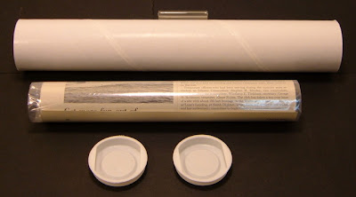
YOUR AD WILL BE SHIPPED ROLLED IN A PROTECTIVE PLASTIC BAG IN AN 80mm (TWICE USPS RECOMMENDED) THICK, 2 INCHES IN DIAMETER (SO AS NOT TO STRESS THE PAPER) SHIPPING TUBE WITH PRESS TIGHT PLASTIC END CAPS.
FC2501


Powered by SixBit's eCommerce Solution