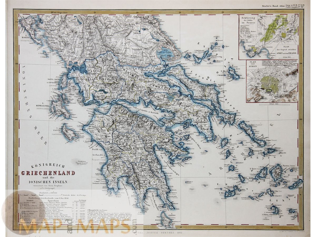


Kingdom Greece Ionian Islands Athens Pireos Stieler atlas 1861
Title: Königreich Griechenland und die Ionishen Insels.
Antique map of Greece with inlay maps of Athens and Piraeus.
An overview of the population with an indication of the ancient places, and the 10 Greek islands scented the year 1845 give a beautiful picture of Greece in the 19th century.
The entire map is executed in outline hand coloring.
Original steel plate engraving published by Justus Perthes Gotha 1861.
Origin: Stieler Hand Atlas.
Map is Absolutely Guaranteed authentic original map and dated 1861.
A Certificate of Authenticity will be on request forwarded for each individual map or print.
Size:
Sheet app.: 41 x 33 cm. 16.25 x 13 inches.
Image app: 36.8 x 30.3 cm. 14.2 x 12 inches.
Condition: Very good.
![]()

MapandMaps.
For the complete Map and Print collection see our online site.
MapandMaps Cartography of the World.
Always real antique maps - Always original - Never reproductions.
Europe buyers; we accept payment in Euro.