|
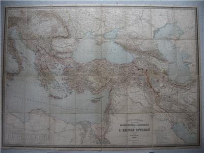
ORIGINAL late 19th century map
CARTE GENERALE DES PROVINCES EUROPEENNES ET ASIATIQUES
DE L'EMPIRE OTTOMAN
second edition, revised 1892
by
Henri Kiepert
- Lithography printed in color with hand colored outlines
- Dissected and backed to linen
- With slip case
Image size
Map 35.2" x 49.4" (89.5 x 125.5 cm), with margins 36.4" x 50.4" (92.5 x 128 cm).
Shipping / Handling
Priority airmail with registration $25.00
Multiple items are shipped together
ALL ITEMS ARE GENUINE
Thanks for interest
|