Department of Land Transfer Info
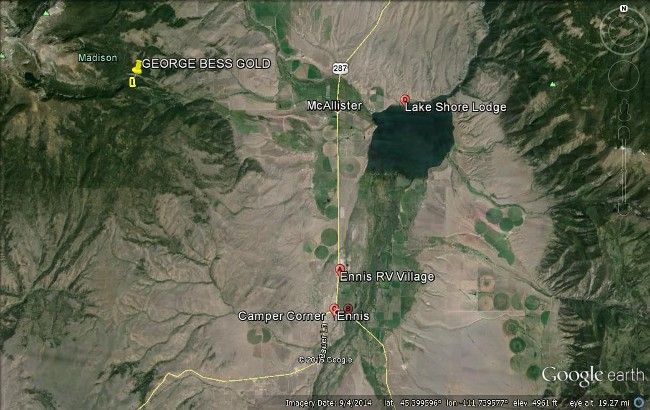
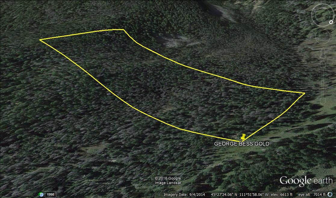
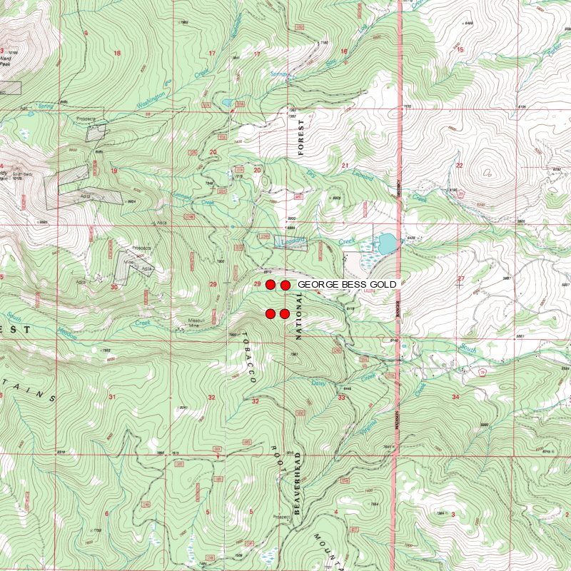
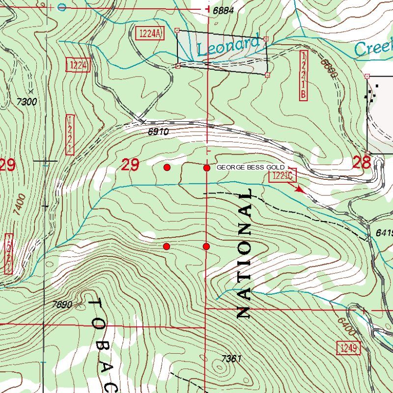
GEORGE BESS GOLD Mine
20 Acre Unpatented Placer Mining Claim on Federal Land Montana
|
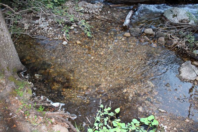
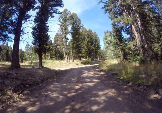
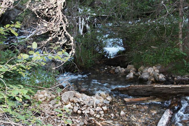
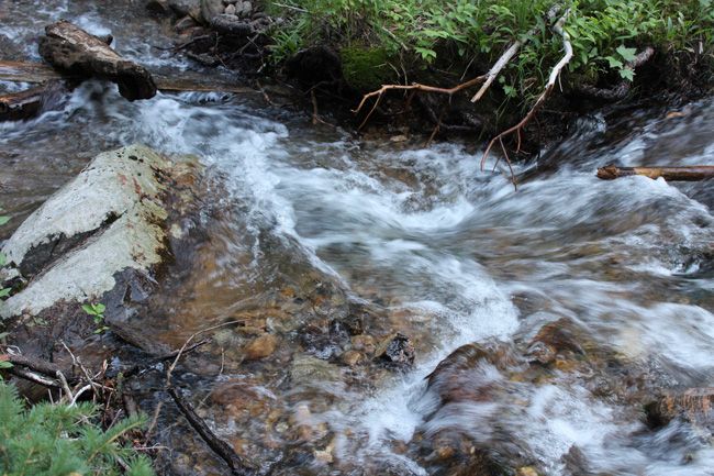
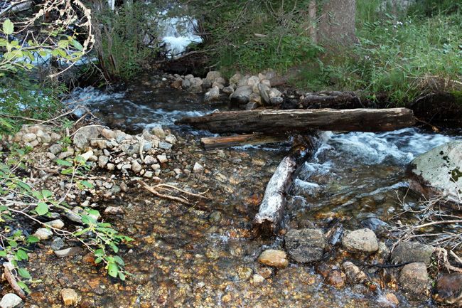
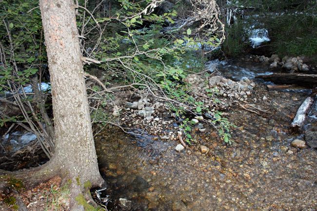
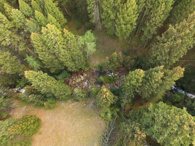
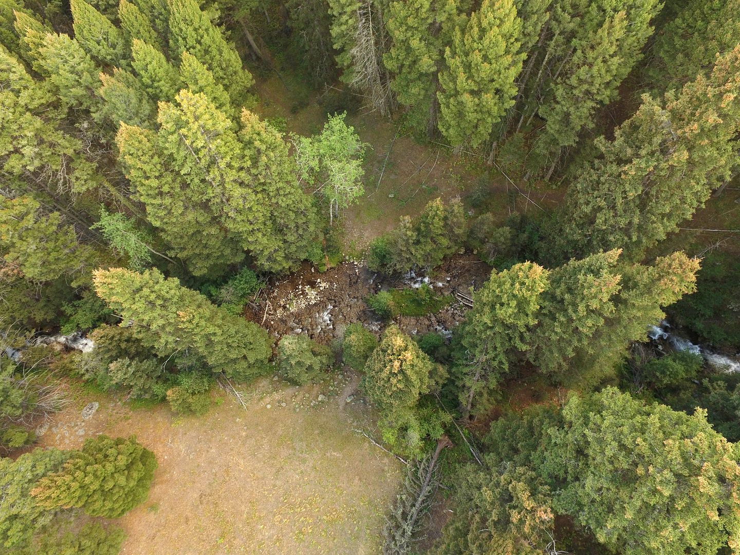
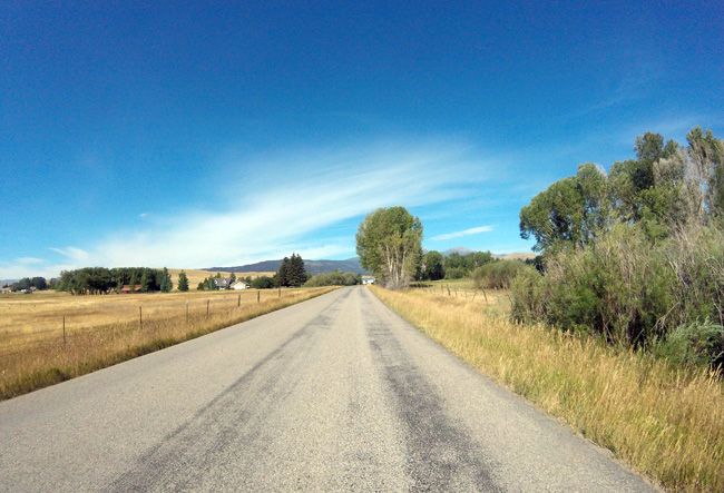
South Meadow Creek is a stream in Madison County, MT with an elevation of 4,826 feet, or 1,471 meters above sea level. This place is also known as South Fork, Meadow Creek aka McAllister aka Bald Mountain (sub-district). This placer gold mine totals over 737 feet of creek. With this claim you will be getting the exclusive mineral rights to 20 acres on an excellent spot on the creek for you to work at your leisure. The access to the claim is fairly easy and 2WD will be sufficient to get you to the mine. The main road is located about 400-500 feet away from the claim. There is a dirt road/trail that comes off the main road, and leads you into the claim. There is room to park your vehicles, camp, and stage equipment. Due to the location of the claim, always check the road conditions and weather before heading out to the mine. Commodities (Major) - Gold Deposit Type: Placer |
(Fairly easy 2WD) |
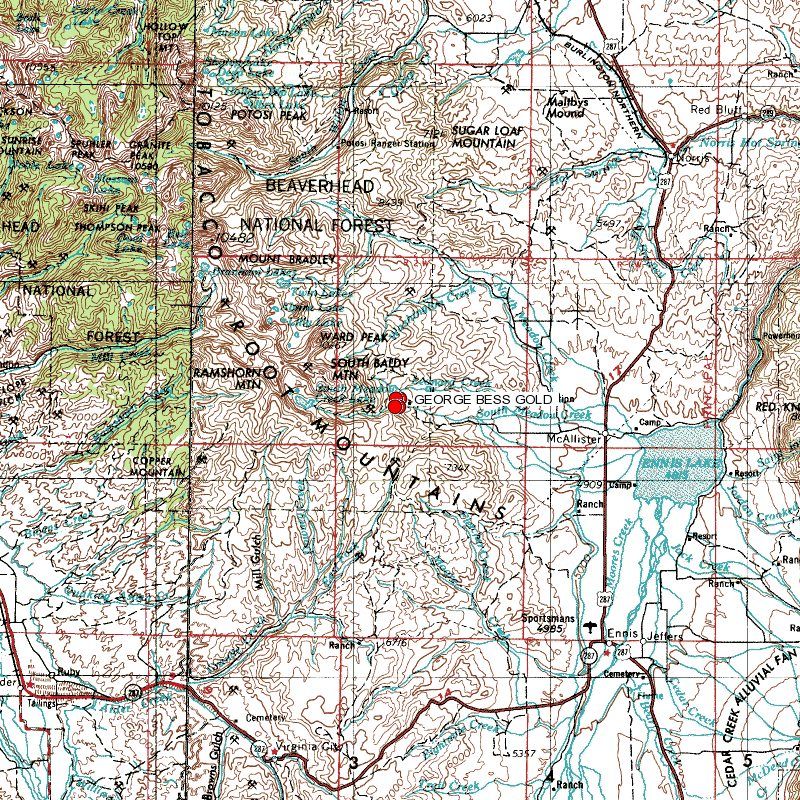
The Washington mining district is in the Tobacco Root Mountains and includes the head-waters of Washington, South Meadow and Leonard Creeks. The placers of Washington Bar, a gravel deposit at the mouth of Washington Creek, were discovered in 1864. Placering occurred on Washington Creek and Hogum Gulch, both later worked by hydraulic methods. By 1888 the two creeks had produced half a million dollars in gold from these placer operations. Around 1888, the immense gravel banks were in the hands of the Montana Hydraulic Mining Company which held patents on seven miles of gulches, some 4,500 acres. The gravel assayed at 50 cents per cubic yard and it was estimated that 50 million dollars of gold remained to be recovered. The company constructed a four foot flume and a 30 inch flume to provide water for three hydraulic giants (Cope 1888).
|
|
South Meadow Creek, like its northern counterpart, begins in the southern portion of the Tobacco Root Mountains. Located in the upper portion of this drainage is South Meadow Lake. This naturally occurring lake has now been modified to increase its water storage capacity. Like North Meadow Creek, this stream also originates in thick timber stands, and makes its way down into the valley. Once in the valley, it flows through lush hay meadows and pastureland before reaching its confluence with North Meadow Creek, just west of Ennis Lake. | 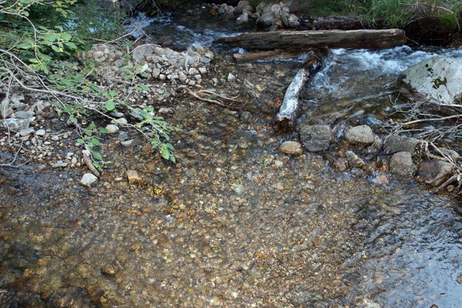 |


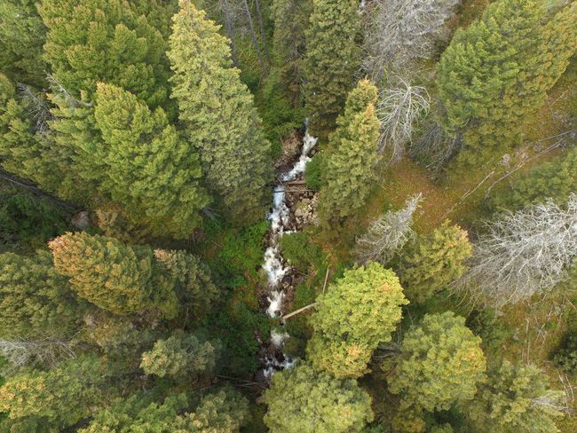
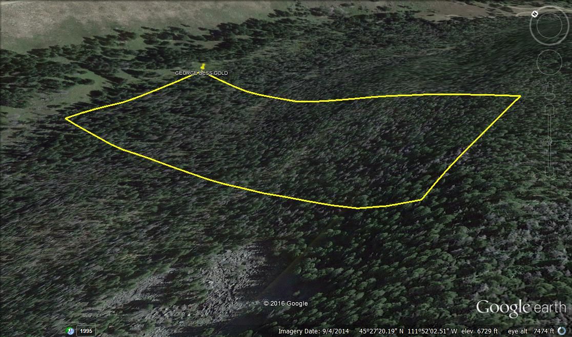
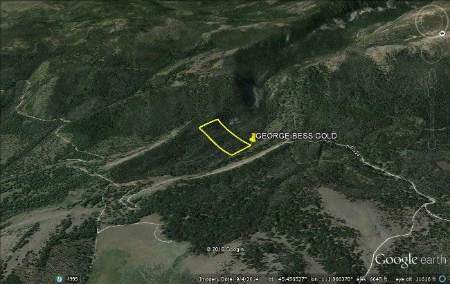
Views from above and of surrounding area
There is lodging and camping facilities nearby)
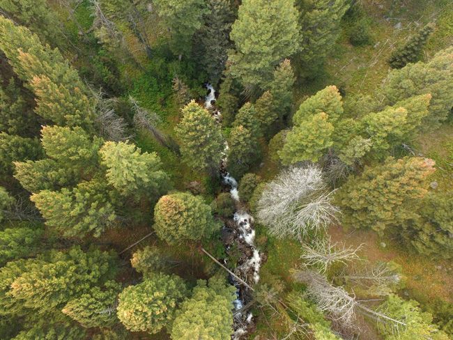
Overhead Views
Buyer will receive the following with their completed transaction:
- Quitclaim deed showing full ownership of the claim. This will be stamped, recorded and verified with the County and the BLM offices.
- Welcome packet with all of the rules and regulations as they relate to the State and BLM where the claim is located.
- Educational documents to annually renew your mining claim with the BLM.
- A CD of all of the documented images of the claim including maps of the site.
- Map of claim marked and GPS coordinates.
- Multiple maps showing claim location and surrounding areas for access.
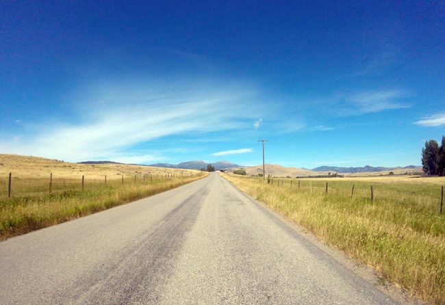
(Fairly good 2-WD Road)


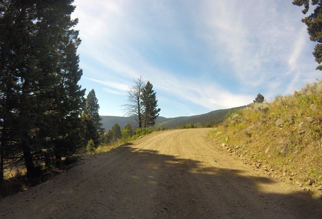
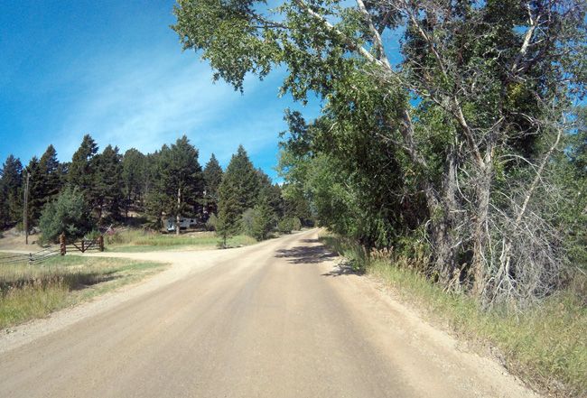
(Last few miles turns into a dirt road)
The gold production of Madison County is exceeded in Montana only by that of Silver Bow and Lewis and Clark Counties. Most of its gold was produced before 1904 from the placer deposits of Alder Gulch, by far the richest placers in the State (Lyden, 1948, p. 80-95). After 1904, lodes became increasingly important gold sources. Most of the gold lodes and other auriferous deposits are near the contacts of Precambrian metamorphic and Paleozoic sedimentary rocks with the Tobacco Root batholith and other smaller intrusives and satellite stocks that are probably related to the Boulder batholith (Hart, in Tansley and others, 1933, p. 23-55). Some deposits are in the igneous rocks. The more productive lode areas are the Norris, Pony, Renova, Sheridan, Silver Star-Rochester, Tidal Wave, and Virginia City districts. The total gold production of the county through 1959 was at least 3,746,000 ounces - 2,605,000 from placers and 1,141,000 from lodes. This must be considered a conservative figure, for as Lyden noted (1948, p. 80), estimates of the Alder Gulch placer production ranged from $50,612,000 to $125 million. |
Come to Hike, Camp, Ride and Shoot - or come to pull some shiny rock$ out of the ground;-)
ABOUT THE MINING DISTRICT
Upper North Meadow Creek--the northern part of this area is underlain by granite and the southern by Cherry Creek gneisses and schists, cut by a dike-like intrusion of hypersthene gabbro. Most of the ore deposits occur as veins in the gneiss, but those of the Frisbie mine are mostly in the gabbro near the gneiss. A few silver veins are known to cut the granite.; Lower Meadow Creek--the country rock is granite and gneiss. Ore deposits occur as low grade gold-quartz stringer veins in the altered contact gneiss zone. The ores are oxidized. Upper South Meadow Creek--the ore shoots generally occur in synclines resulting from minor folding. Alder gulch, just over the hill to the west of Meadow Creek fueled Montana’s most exciting placer gold rush, and the Revenue hill, with its rich gold mines bordering the Meadow Creek area to the north, were attractive destinations for migrating land and gold seekers. Meadow Creek, situated in between those two industrious areas, did not go unnoticed by the ambitious settlers. |
| Hidden in the Tobacco Root Range of the Montana Rockies is the historic gold mining town of Pony, Montana.
It languishes in the beauty of the Deer Lodge National Forest at the base of Hollowtop Mountain. Less than one hundred families live in Pony today. It's hard to imagine that during the gold prospecting days, over 5,000 people lived here.
In 1860-1870, settlers coming west for the gold rush found this beautiful spot. One was a man named Tecumseh Smith, nicknamed 'Pony' because of his small stature. Gold mining in Pony between 1870-1880 was profitable. Five million dollars in ore was taken out. An eastern syndicate believing a large deposit of ore was high grade, built a 100-stamp processing mill. The ore body turned out to be low grade and consequently the massive mill never turned a wheel. The historic 'brick office', assay office, is still standing and part of the town's character. The Tobacco Root Mountains and surrounding areas are familiar grounds for the elk, moose, deer, antelope, bear and mountain lion. And the bird hunting is great too: duck, geese, quail, turkey, pheasant, and more. |
This auction is for full/all interest in this 20 acre placer mining claim. This claim covers the entire site, 1,320 ft. by 660 ft., and includes full rights to all minerals, gems and just about whatever else you may find on the property. The winner of this auction will receive a notarized quitclaim deed to the full claim and all associated documentation showing full ownership of the claim.
Maintenance on all BLM mining claims is $155.00, per 20 acre parcel, annually. This must be paid on or before September 1st, every year unless you do more than $100 per year in improvements to the property, in which case you can file for and receive a waiver of the maintenance fee.
NOTE: If you own fewer than 10 claims nationwide, we can assist you in filing the paperwork to waive the maintenance fee every year. That means you can only plan on paying $10 per year for your maintenance fee instead of $155.
And let me just re-state once more the answer to the one question that I get asked the most often; you are bidding for full claim ownership, not just a down payment or a part of this claim. Auction end price is the final price for the entire site – there are no phony transfer fees or handling costs of any kind!
Transfers of Ownership in Mining Claims;
Interest in a properly recorded mining claim or site may be transferred in part or its entirety. So you can will, gift, sell or lease your interest in this claim at any time in the future. A quitclaim deed or recordable conveyance document is required and if you do sell the claim, the transfer documents should be filed within 60 days after the transfer.
With regard to transferring this claim initially into your name, we take care of all the paperwork at our expense. You do not have to worry about anything – we handle the BLM transfer documentation and the recording. Then if you ever want to will or sell your claim in the future, we will gladly assist you on the paperwork for no charge.
Can you camp / build on your mining claim?
Without an approved plan of operations, you have the same rights and restrictions as the public. If the area is open to camping to the public, then it is permissible. However, you need to check with the BLM Field Office or the local District Ranger for areas open to camping. Under Federal law in order to occupy the public lands under the mining laws for more than 14 calendar days in any 90 day period, a claimant must be involved in certain activities that (a) are reasonably incident; (b) constitute substantially regular work; (c) are reasonably calculated to lead to the extraction and beneficiation of minerals; (d) involve observable on-the-ground activity that can be verified; and (e) use appropriate equipment that is presently operable, subject to the need for reasonable assembly, maintenance, repair or fabrication of replacement parts. All five of these requirements must be met for occupancy to be permissible.
Proud Member of:
We offer a lifetime guarantee should the BLM take back the land.
As the largest company in the mining industry selling legitimate and valuable historic claims, you can rest easy that there is no fine print on any of our claim auctions telling you will have to deal with any games like being charged phony fees or having to pay inflated “processing” or “transfer” fees. The final auction price for this mine when the auction ends is ALL you will pay.
Our in-house legal counsel will complete all of the paperwork and documentation for recording and transferring FULL ownership of this mine into your name if you win the auction, AND we will ship you everything in one to two business days of receipt of your payment in full (usually just one day!). So you can plan to visit (and start working) your claim the next day without the lengthy delay you will experience with other companies selling claims –and you will not have to pay any extra costs, fees or other poor excuses for extra profit that normally just go into a seller’s pocket.
BID WITH CONFIDENCE- we are a very reputable eBay seller, eBay I.D. Verified AND PayPal Verified with over 18,000 payments received, and not a single Paypal complaint or dispute.
-PLUS-
We'll take care of all the paperwork and arrangements so you can enjoy your claim immediately after payment and we keep you informed through the entire process with confirmations when payment is received, when your paperwork has been shipped.

While we cannot physically ship land to you as it doesn't quite fit into the mail box ;)
We will ship all paperwork/maps upon payment clearing we ship same business day (if payment is received by 1PM P.S.T.) We always provide tracking information so you are always informed.
Your payment of this eBay item gives you 100% ownership of this entire claims, all fees and other costs for the transfer of ownership is included. This is NOT an auction for the down payment, this is NOT a partnership arrangement where someone else will own part of the claim with you, and there are NO fees or costs for the transfer of this claim in your name.
PayPal does not allow payments for real estate or land purchases, and mining claims are considered real estate - so we are unable to accept payments through PayPal at this time. Should PayPal ever change that policy, we will accept payments for mining claims through PayPal. We DO accept: Personal and Business Checks, Cashier's checks, Personal checks, Bank Wires, ACH payments as well as all major Credit Cards (American Express, Visa, Master Card & Discover).
We provide financing plans with no interest or fees. Financing terms are minimum of $500** down and the balance due within 90-days.
For longer term financing, please touch base with us, as we may be able to provide automatic credit card billing for terms up to 12 months.
*Please contact us first should you decide on a payment plan.
**If there is less than 90 days until August 1st and automatic $155 will be added bringing the down to $655 to cover the maintenance fees.