Green Basics

1940 Vintage Atlas Map Page - Mississippi on one side and Missouri on the other side

1940 Vintage Atlas Map Page - Mississippi on one side and Missouri on the other side

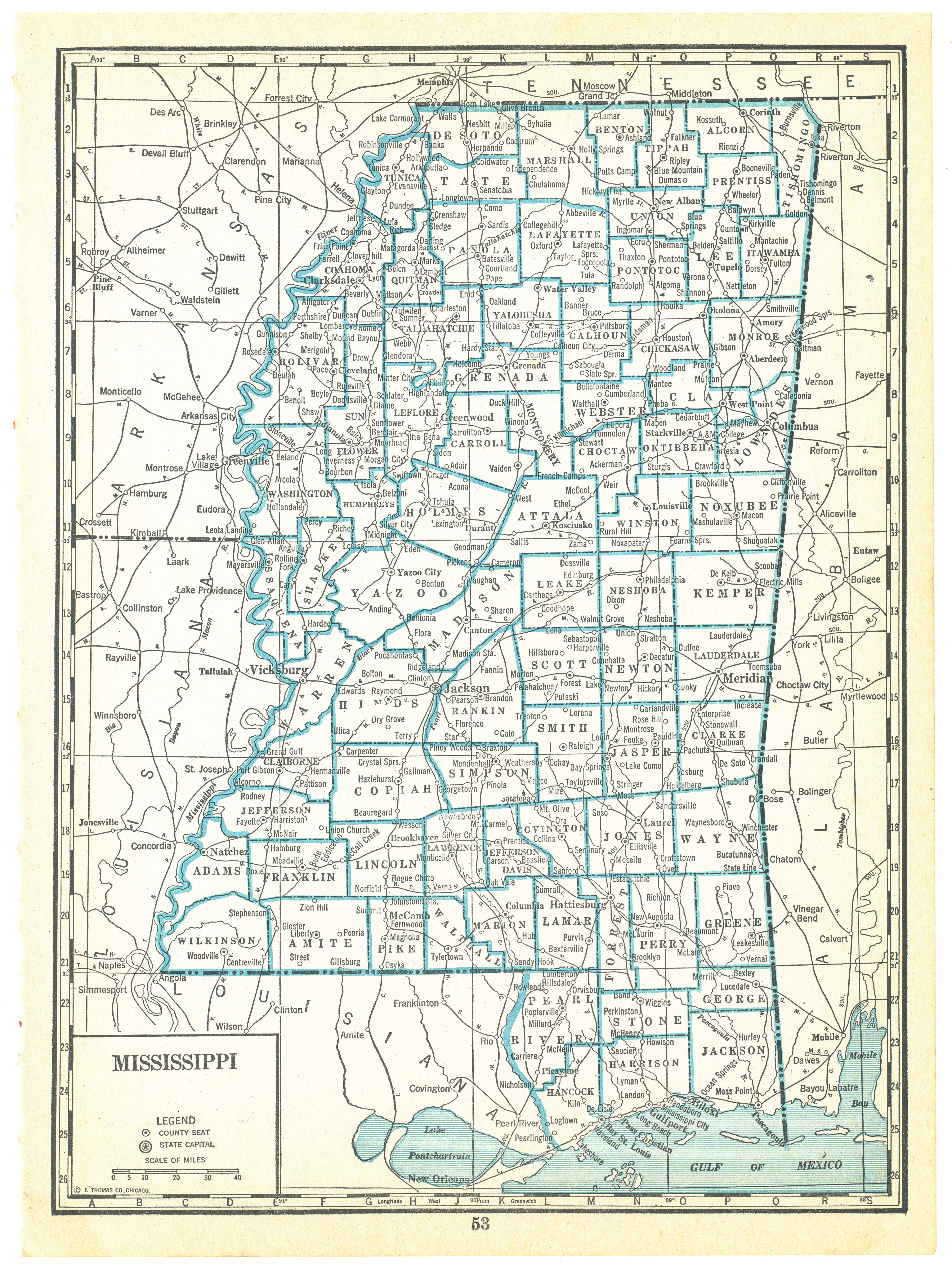
Vintage map page rescued from a deteriorating 1940 Capper’s Atlas.
The map would look fantastic framed or be a cool addition to an art or scrapbooking project.
The page measures approximately 10″ x 7 1/4″. The map images are smaller than the page (approximately 9 1/4″ x 6 1/2″). The map shows typical natural aging and wear from use with a ragged edge where it was removed from the atlas.
If you have any questions, would like additional photos, need a specific state, country or region, or need bulk pricing, please contact me at info [at] greenbasics [dot] com. Don’t forget, this is a vintage item with some wear.
 

Shipping

Shipping cost:
Most maps are shipped for a flat rate via standard USPS 1st Class Mail. If you would like to upgrade shipping (expedited service or another shipper), please contact me for an updated shipping cost.

Delivery time:
I do my best to pack and ship your map in 1 - 3 business days. Delivery time in the US is typically 3-5 days depending on your distance from Washington.

Payment

We accept eBay's current payment service.

Please contact us if you have any questions.

Service

After I scan or photograph the maps, the images are NOT enhanced to provide you as close as possible representation of the item. Please keep in mind these are vintage or antique items and will have the usual wear, yellowing, possible stains or small tears and/or folds common in paper items this age.

If you are interested in purchasing multiple items, please contact me for a possible quantity discount (info [at] greenbasics [dot] com)