|
 |
|
|

|
|
|
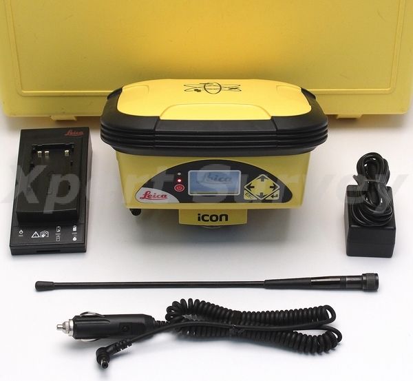
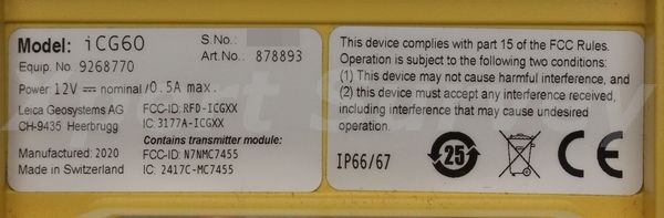
* Leica iCON iCG60 GNSS Antenna Rover Receiver [ID- -L/T*]
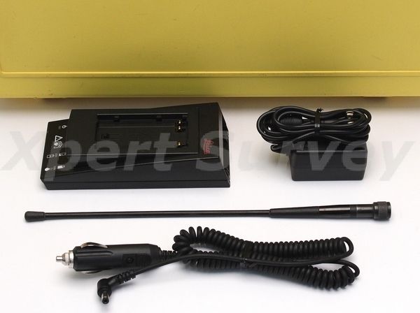
* Battery Charger
* Battery Pack
* Antenna
* Carrying Case
|
|
Condition: Refurbished
Warranty: 90 Day Exchange
|
|
|
|

|
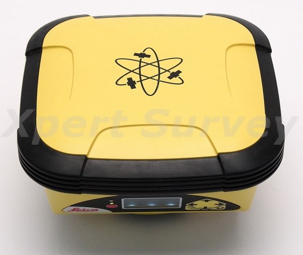
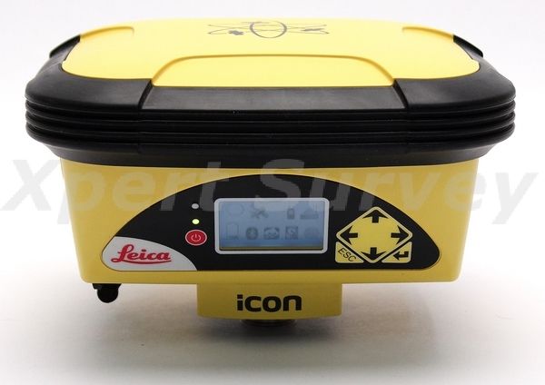
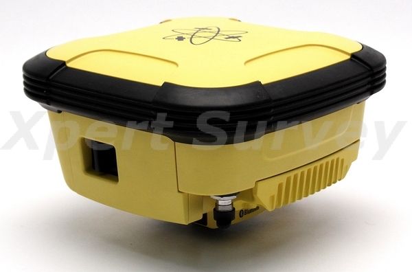
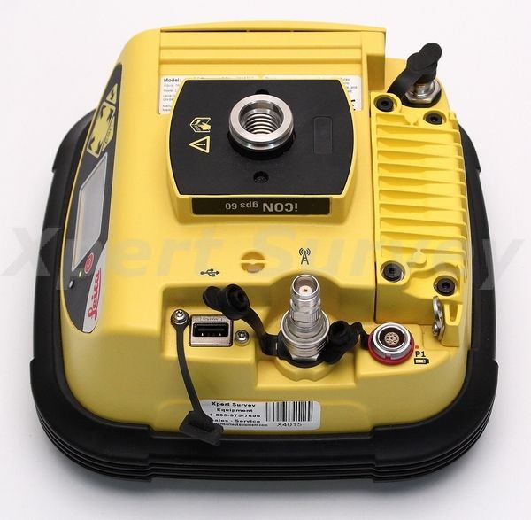
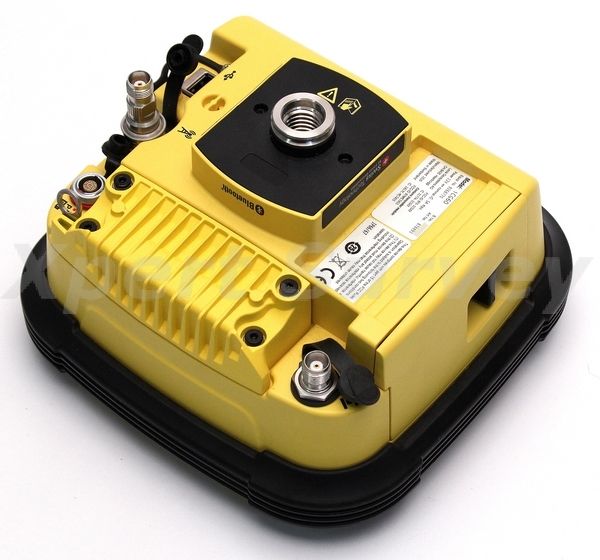
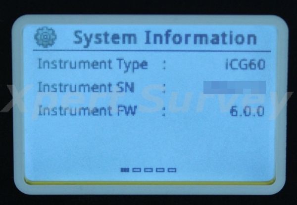
Leica iCON iCG60 GNSS Antenna Rover Receiver
Leica iCON iCG60 Smart Antenna
Leica iCON gps 60 is a versatile SmartAntenna for all construction positioning tasks. Featuring superior GNSS technology and various integrated communication options, it meets all your requirements for reliable and accurate measurements. Its intuitive display shows full status information of the instrument, simplifying operation and configuration. Leica iCON gps 60 also offers exceptional network capabilities allowing you to use RTK network services (Leica SmartNet and other networks) for highly reliable, improved GPS positions.
- Superior GNSS Technology for maximum accuracy and reliability. Features Leica SmartTrack+ and SmartCheck+ and Leica xRTK.
- Future-proof satellite tracking. Works with all existing and future satellite systems.
- SmartLink – bridges RTK communication gaps up to 10 minutes
- Multi-purpose GPS solution. Can be used as construction site GNSS Base, Rover or NetRover, in supervisor vehicle on site and entry level machine control mounted inside a machine to increase machine productivity
- Unique communication flexibility, featuring integrated radio, modem and Bluetooth®.
- System integration made easy through use of platform independent SDK (Software Development Kit) bringing swift configuration to all
- Integrated NTRIP Server and Caster for Internet based Reference Station.
- No controller required for base station set-up means you need less hardware.
- Unique flexible software licencing and feature upgrade concept. You can order packages or individual licences when you need them, investing when you need to.
Specifications:
| GNSS PERFORMANCE |
| GNSS technology |
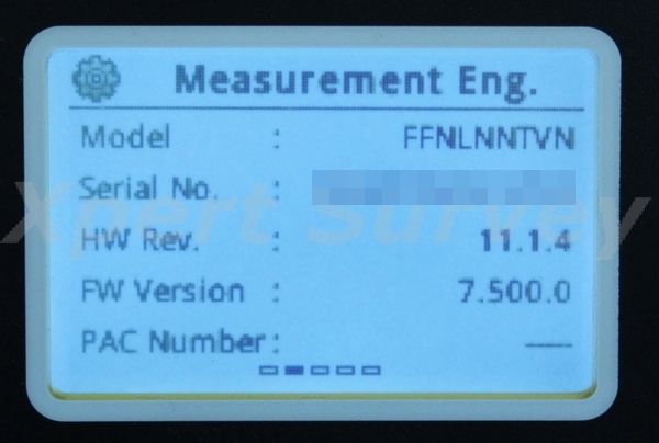
Leica patented SmartTrack+ technology:
• Advanced measurement engine
• Jamming resistant measurements
• High precision pulse aperture multipath correlator for pseudorange measurements
• Minimum acquisition time |
| Number of channels |
555 channels |
| Maximum simultaneous tracked satellites |
Up to 60 satellites simultaneously on two frequencies |
| Satellite signals tracking |
• GPS: L1, L2, L2C, L5
• GLONASS: L1, L2
• Galileo (Test): GIOVE-A, GIOVE-B
• Galileo: E1, E5a, E5b, Alt-BOC
• BeiDou B1, B2 |
| GNSS measurements |
Fully independent code and phase measurements of all frequencies:
• GPS: carrier phase full wave length, Code (C/A, P, C Code)
• GLONASS: carrier phase full wave length, Code (C/A, P narrow Code)
• Galileo: carrier phase full wave length, Code
• BeiDou: carrier phase full wave length, Code |
| Reacquisition time |
< 1 sec |
| GNSS ANTENNA |
| GNSS antenna options |
• Fully integrated GNSS antenna
• External GNSS antenna connector (Type TNC) |
| External GNSS antenna options |
• CGA60: GPS L1/L2/L5, GLONASS L1/L2, Galileo E1, E5a, E5b, Alt-BOC, BeiDou B1, B2 |
| MEASUREMENT PERFORMANCE & ACCURACY |
| Accuracy (rms) with real-time (RTK) |
Single baseline (< 30km): Horizontal: 8 mm + 1 ppm (rms), Vertical: 15 mm + 1 ppm (rms) |
| Accuracy (rms) with post processing |
Static (phase) with long observations: Horizontal: 3 mm + 0.5 ppm (rms), Vertical: 3.5 mm + 0.5 ppm (rms)
Static and rapid static (phase): Horizontal: 3 mm + 1 ppm (rms), Vertical: 5 mm + 1 ppm (rms) |
| On-the-fly (OTF) initialisation |
RTK technology: Leica SmartCheck+ technology
Reliability of OTF initialisation: Better than 99,99%
Time for initalisation: Typically 4 sec |
| Network RTK |
Network technology: Leica SmartRTK technology
Supported RTK network solutions: iMAX, VRS, FKP
Supported RTK network standards: MAC (Master Auxiliary Concept) approved by RTCM SC 104 |
| HARDWARE |
| Weight & Dimensions |
Weight (iCG60): 1450 g (3.19 lb)
Weight: 3200g (7,05 lb) Standard RTK Network Rover, incl. iCG60, CC80 Controller with Bracket, Pole, Battery
Dimensions: 197 mm x 197 mm x 130 mm (7,76 in x 7,76 in x 5,12 in) |
| Environmental specifications |
Operating temperature: –40°C to +60°C (–40°F to +140 °F)
Storage temperature: –40°C to +85°C (–40°F to +185°F)
Humidity: 100%, compliance with ISO9022-12-04 and MIL STD 810F – 507.4-I
Proof against: water, sand and dust: IP67 according IEC60529 and MIL STD 810F – 506.4-I, MIL STD 810F – 510.4-I and MIL STD 810F – 512.4-I, Protected against blowing rain and dust, Protected against temporary submersion into water (max. depth 1 m)
Vibration: MIL-STD-810F, Figure 514.5C-3
Shock: 40g - 6msec; compliance ISO 9022-31-06, No loss of lock to satellite signal when used on a pole set-up and submitted to pole bumps up to 150 mm
Drops: Withstands 1.2 m drop onto hard surfaces
Topple over: Withstands topple over from a 2m pole onto hard surfaces |
| Power & Electrical |
Supply voltage: Nominal 24 V DC, Range 9.0 – 28 V DC
Power consumption: Typically 6 W
Internal power supply: 1x recharge & removable LI-Ion battery, 2.6 Ah, 4.4 Ah or 6.0 Ah / 7.4 V, fit into receiver
Internal power supply, operation time: • 5:20 h receiving RTK data with standard radio 3) • 4:40 h transmitting RTK data with standard radio 3) • 5:00 h RTK via built-in HSPA connection 3)
External power supply: Rechargeable external NiMh battery 9 Ah / 12 V; with voltage peak protection, Fullfils EN13309
Certifications: Compliance to: FCC/IC Class B, CE, EN13309, RCM, ARIB STD-T66, RoHS, WEEE, ACPEIP |
| MEMORY & DATA RECORDING |
| Memory |
Internal memory: Built-in memory, 466 MB
Data capacity: 466 MB is typically sufficient for about GPS & GLONASS (8+4 satellites) 3’100 h raw data logging at 15 s rate |
| Data recording |
Type of data: Onboard recording of RINEX data
Recording rate: Up to 20 Hz |
| INTERFACE |
| Buttons |
• ON / OFF button • 6 function buttons (arrow keys – up/down/left/right, Enter, Esc) |
| Display |
High resolution, 1.8" gray scale display with adjustable backlight: • Provides full receiver status on main screen (position, satellite, radio, modem, battery, Bluetooth®, telematics, memory) • Several submenues for additional details • Various configurations in submenues, e.g. radio channel • Start Base Station with "Here" or type in coordinate • Start and configure raw data logging |
| LED status indicator |
1 × LED for detailed power status |
| Additional functionality |
BasePilot functionality (stores up to different 100 base station locations and configurations for quick daily start up without user interaction) |
| COMMUNICATION |
| Communication ports |
1x serial RS232 Lemo, PWR in, 12V PWR out
1x USB Host
1x UART serial & USB (for removable internal RTK devices)
1x TNC for external GNSS Antenna
1x Bluetooth® port, Bluetooth® v2.00+ EDR, class 2 |
| Number of simultaneous data links |
Up to 3 real-time output interfaces via independent ports, providing identical or different RTK/RTCM formats |
| Built In data links |
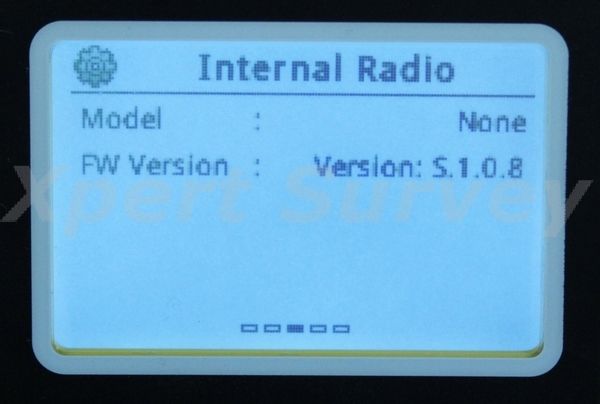
Radio modems: • Optional additional fully integrated, fully sealed receive / transmit radios • User exchangeable device • SATEL M3 TR4: 403 – 470 MHz; up to 1.0 W output power; Pac-crest 4FSK; GMSK & FST; Trimble T & P; Satel 3AS, 8FSK & 16FSK modulation • Intuicom; 902–928 MHz (license free in North America); up to 1.0 W output power
Radio modem antenna: External antenna connector (Type QN)
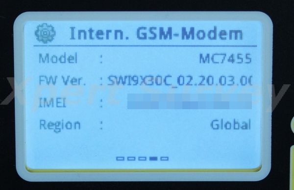
4G LTE / 3G DC-HSPA+ / HSPA+ / HSPA / UMTS (WCDMA): • Built-in cellular modem as default • User exchangeable SIM card • 5-Band LTE: Band 1, 3, 7, 8, 20 • 6-Band DC-HSPA+ / HSPA+ / HSPA / UMTS (WCDMA): Band 1, 2, 3, 4, 5, 8 • Up to 100 mbps downlink speed
4G LTE / 3G HSPA / UMTS / GSM cellular modem antenna: Integrated GSM / UMTS / HSPA / LTE antenna |
| External data links |
Radio modems: • Support of any suitable serial RS232 UHF / VHF radios |
| Communication protocols |
Real-time data formats for data transmission: Leica, Leica 4G, CMR, RTCM 3.1, RTCM 3.2 MSM 3 & 5
Real-time data formats for data reception: Leica, Leica 4G, Leica Lite, CMR, CMR+, RTCM v2.3, RTCM 3.1, RTCM 3.2 MSMx 3 & 5
Web based protocol: NTRIP: receive network corrections; built-in NTRIP Server and Caster to stream local corrections to multiple RTK rovers |
|
|
|
|
|
|

|
|
We will attempt to ship your item(s) within 24 hours after payment has been received.
Many countries impose their own customs, duties, tariffs, taxes, etc. on items being shipped from a foreign country. We do not cover those cost's and we recommend that you contact your countries customs agency for that information.
|
|
|
|
 |
|

|
|
We accept credit card payment transactions via the online checkout system! The checkout process is designed so that it communicates with the merchant to confirm that payment has been made and cleared. Other methods of payment are outlined through the online checkout process. Winning bidders must contact us within 3 days after auction close if special payment arrangements are needed.
Thank you
|
|
|