Item For Sale
Information
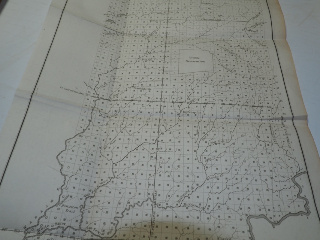
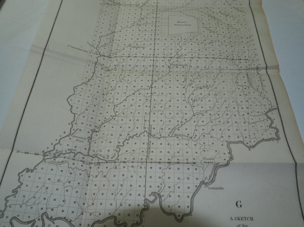
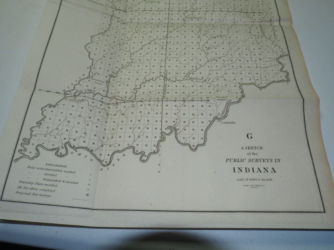
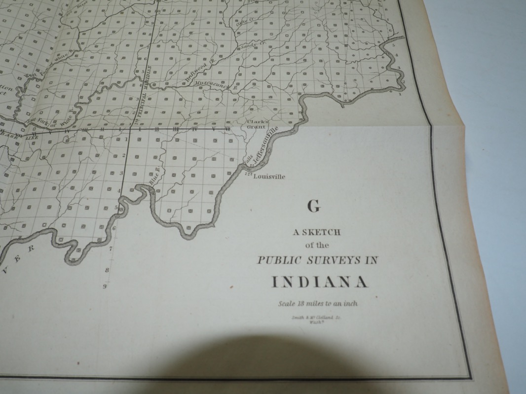
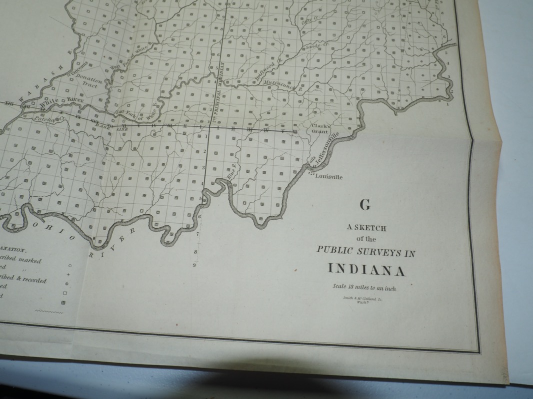
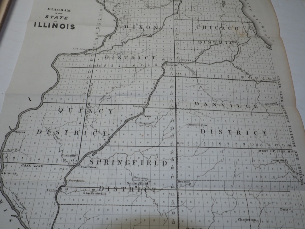
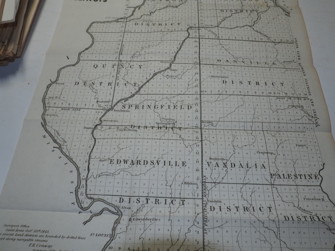
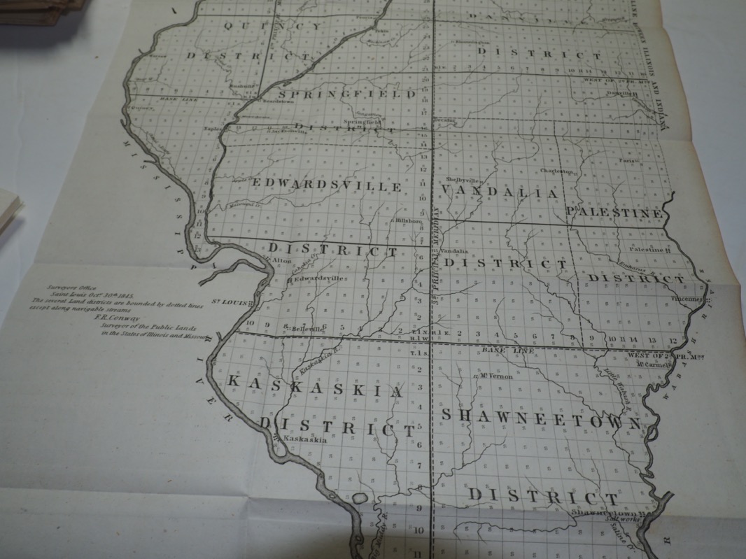
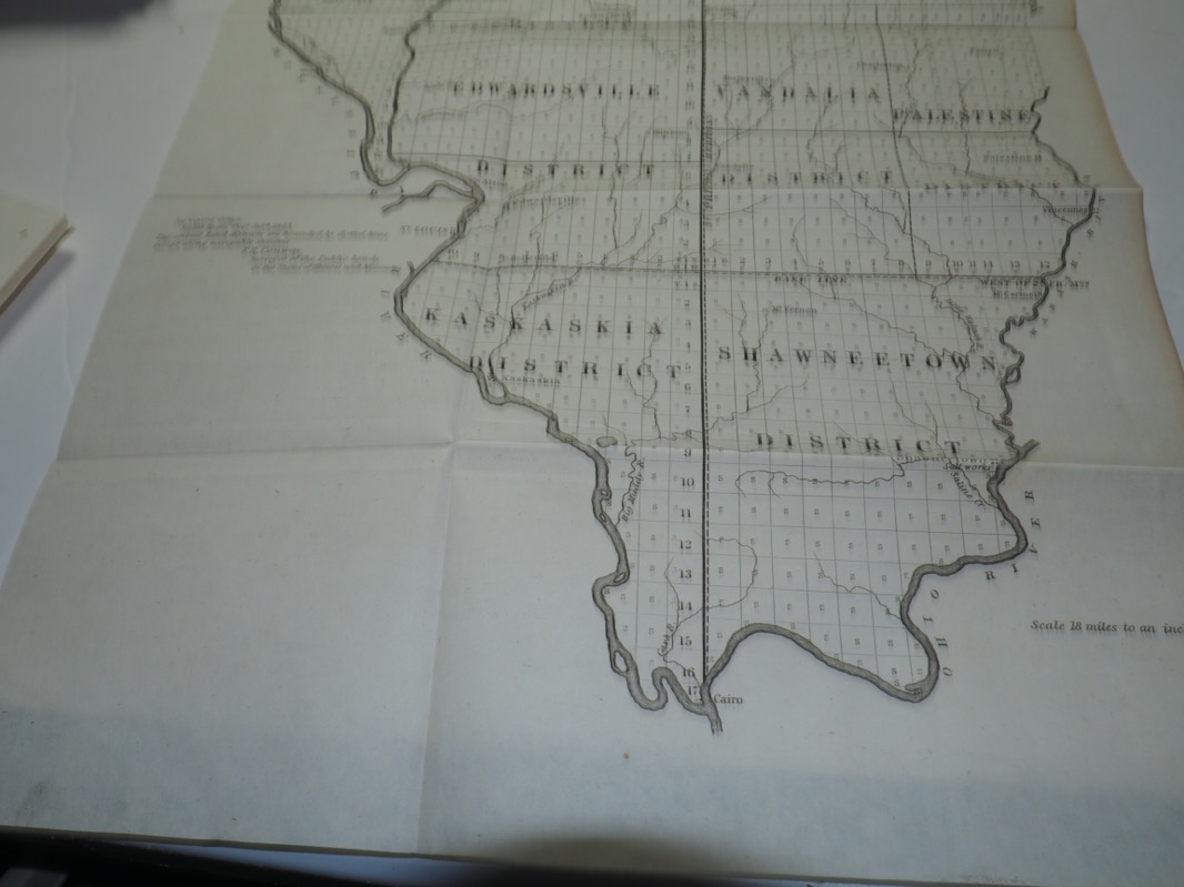
"G A Sketch of the Public Surveys in Indiana"
Taken from the Annual Report of the Commissioner of the General Land Office
29th Congress, 1st Session
1845
Uncolored Map
Lots of pictures, most will be at the bottom of the listing.
Size of Map: 10.0 by 17.5 inches
We do combine shipping on all our orders. Please ask or wait for an invoice, eBay can not
calculate the correct combined shipping. On prints and maps, it is usually an
additional $.50 after the first print or map.
Map Condition: All of our maps are old and very fragile, we handle with extreme care.
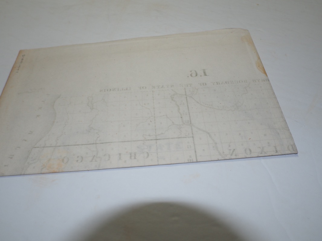
This map has light toning and fold lines.
Information
"G A Sketch of the Public Surveys in Indiana"
Taken from the Annual Report of the Commissioner of the General Land Office
29th Congress, 1st Session
1845
Uncolored Map
Lots of pictures, most will be at the bottom of the listing.
Size of Map: 10.0 by 17.5 inches
We do combine shipping on all our orders. Please ask or wait for an invoice, eBay can not
calculate the correct combined shipping. On prints and maps, it is usually an
additional $.50 after the first print or map.
Map Condition: All of our maps are old and very fragile, we handle with extreme care.
This map has light toning and fold lines.
Payment: Accepting eBay's managed payment system, gives you lots of options on how to pay.
Shipping: Item will be shipped USPS Ground Advantage for only $5.50 and will come with a tracking number.
Returns: We do accept returns, no questions asked.
Questions: Ask, we will answer all.
Shipping: Item will be shipped USPS Ground Advantage for only $5.50 and will come with a tracking number.
Returns: We do accept returns, no questions asked.
Questions: Ask, we will answer all.