Item For Sale
Information
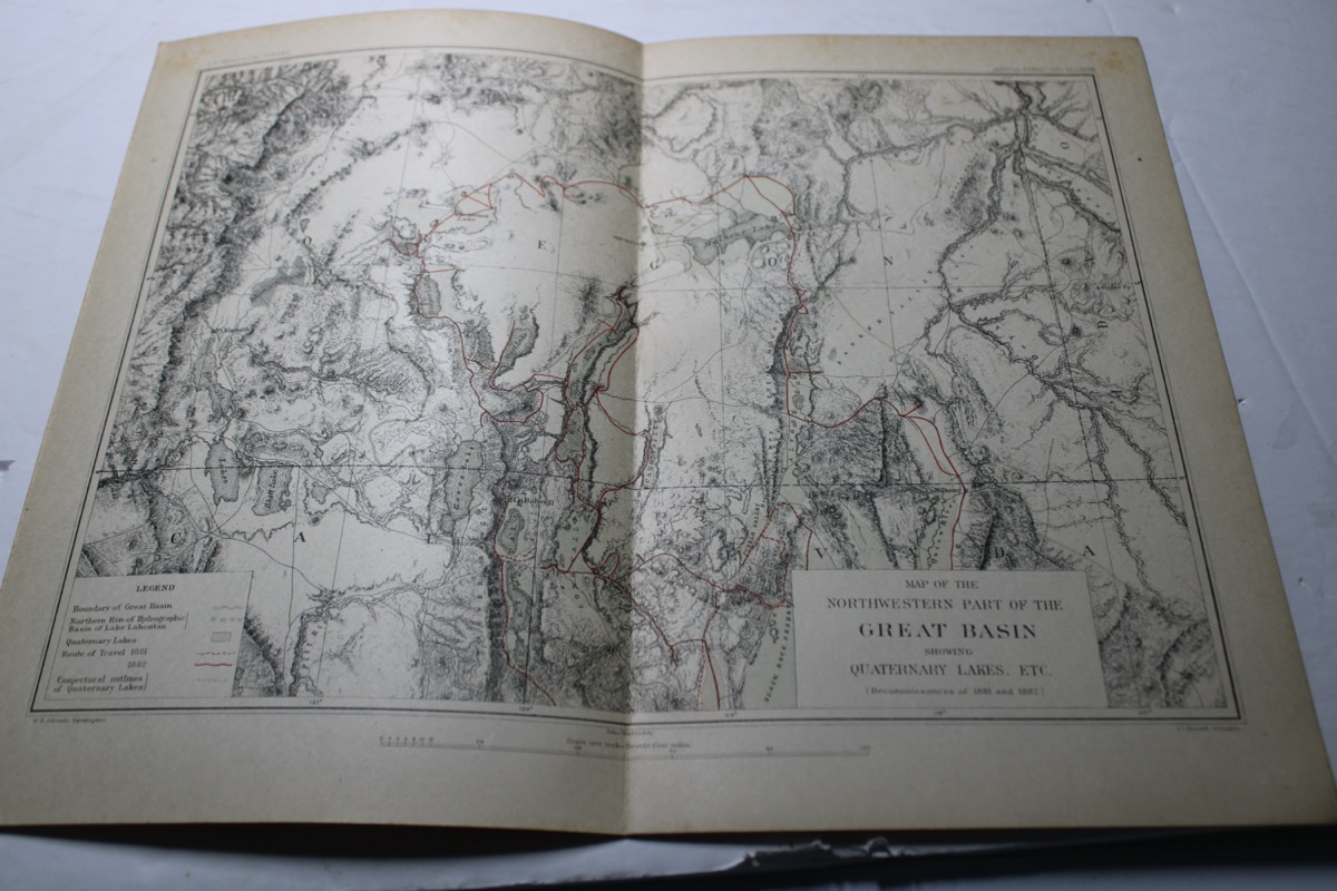
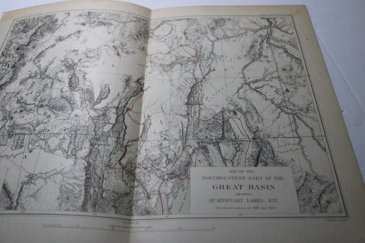
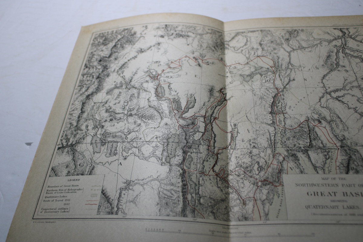
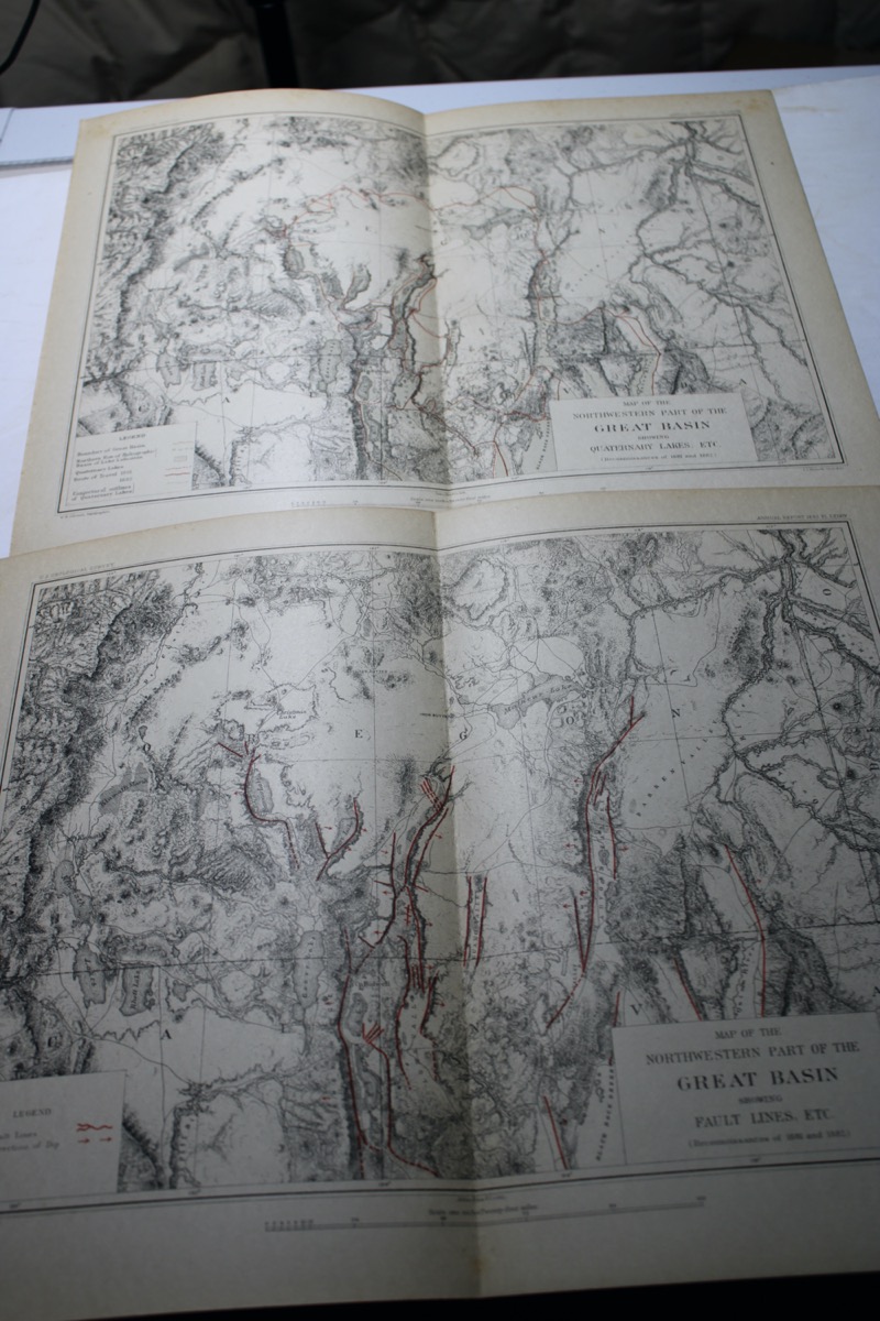
Two maps from Israel Russell’s Geological Reconnaissance of Southern Oregon, 1883: Map of the Southwestern Part of the Great Basin Showing Quarternary Lakes, etc. Route of the expedition shown in color.
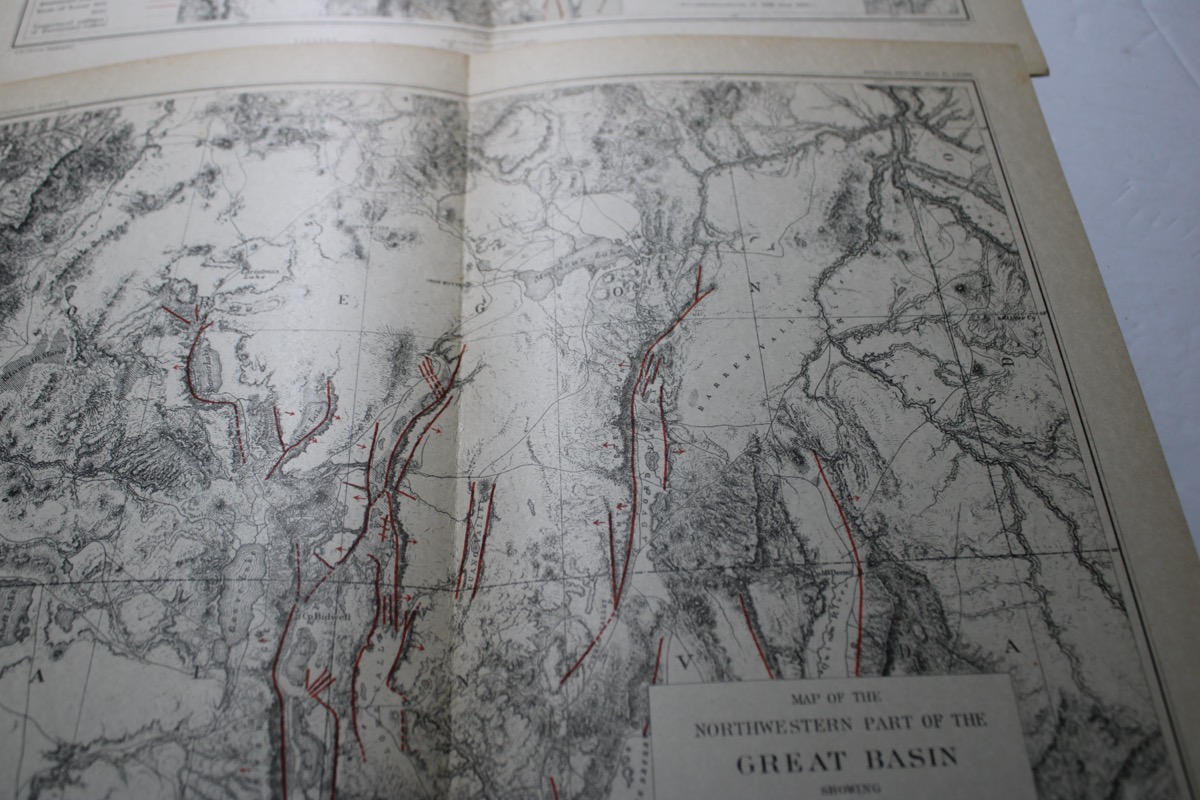
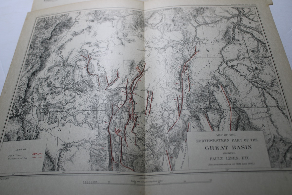
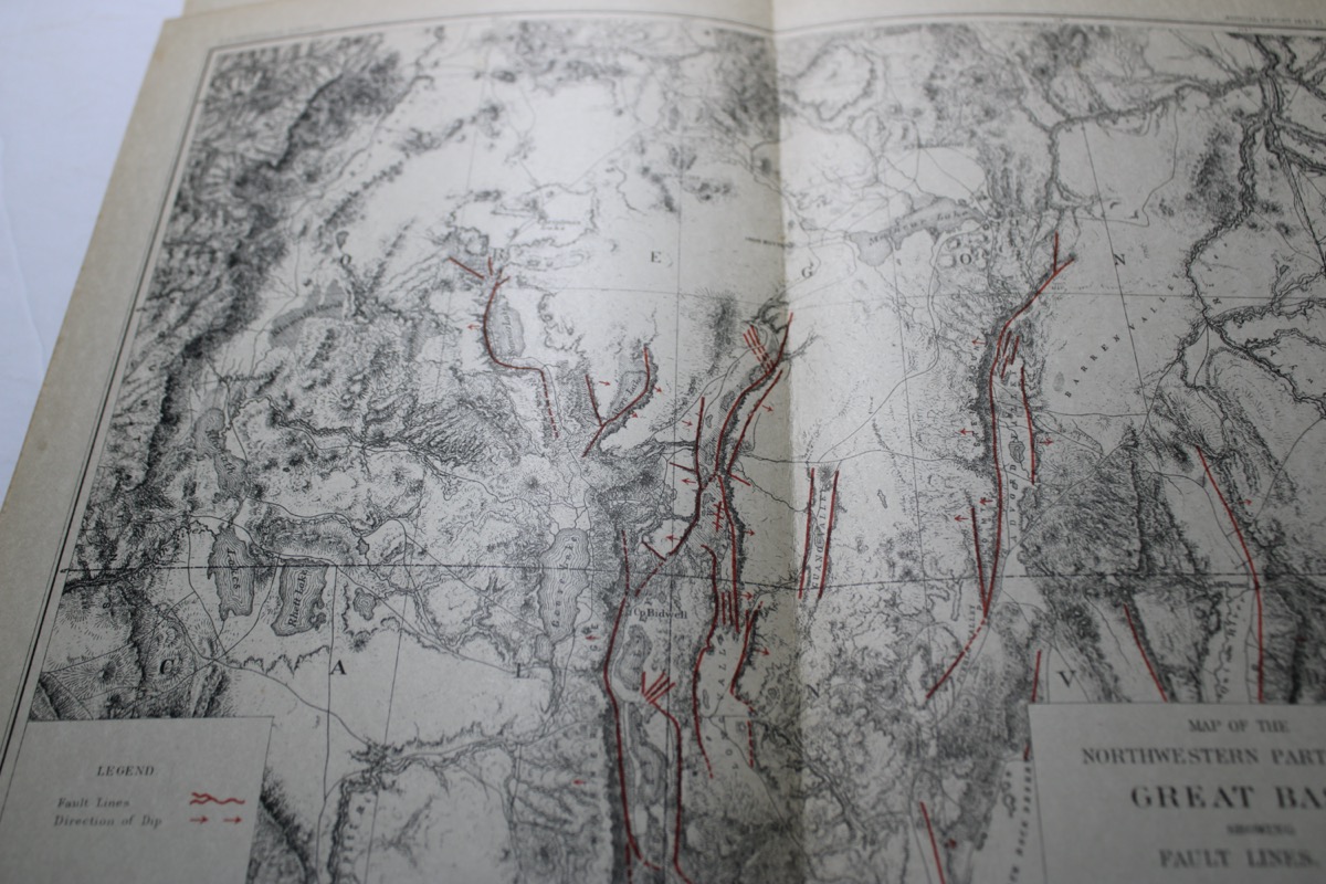
Map of the Northwestern Part of the Great Basin Showing Fault Lines, etc. Fault lines and dip shown in color. Both maps are 10 x 12 ¾ inches and show detailed topography.
Fine condition.
Lots of pictures at the bottom of this listing.
We do combine shipping!
Check out our other items, we have lots of specials, buy one get one free,
some items are free shipping, lots of great deals.
Information
Two maps from Israel Russell’s Geological Reconnaissance of Southern Oregon, 1883: Map of the Southwestern Part of the Great Basin Showing Quarternary Lakes, etc. Route of the expedition shown in color.
Map of the Northwestern Part of the Great Basin Showing Fault Lines, etc. Fault lines and dip shown in color. Both maps are 10 x 12 ¾ inches and show detailed topography.
Fine condition.
Lots of pictures at the bottom of this listing.
We do combine shipping!
Check out our other items, we have lots of specials, buy one get one free,
some items are free shipping, lots of great deals.
Payment: Accepting eBay's managed payment system, gives you lots of options on how to pay.
Shipping: Item will be shipped ground advantage mail for Free and will come with a tracking number.
Returns: We do accept returns, no questions asked.
Questions: Ask, we will answer all.
Returns: We do accept returns, no questions asked.
Questions: Ask, we will answer all.