1769 Bellin Map of Tahiti 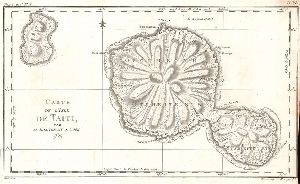 WE SELL ONLY ORIGINAL ANTIQUE MAPS - NOT REPRODUCTIONS Title: Carte de l'Isle de Taiti, Par le Lieutenant J. Cook. Description: This is a 1769 Jacques-Nicolas Bellin map of Tahiti in French Polynesia. The map depicts both Tahiti and Mo'orea. Created by Bellin from James Cook's charts of the island from his first voyage, numerous locations are identified. Depth soundings are noted around the island's coastline, and small trees and topography are also illustrated throughout. This map was created by Jacques-Nicolas Bellin for inclusion in Abbé Prévost's Histoire Générale des Voyages. Size: Printed area measures 10 inches high by 16 inches wide. Condition: Very good. Even overall toning. Slight loss along bottom right border. Blank on verso. Shipping: Shipping rates are not negotiable. Items are shipped within three business days of receiving payment. We are happy to consolidate shipping where possible. The following shipping options are available: 1. FedEx Overnight (45 USD). USA Only. Signature Required. Customs: International buyers are responsible for paying duty and taxes on delivery. DHL or FedEx will contact the buyer by telephone to arrange tax payment if it is levied. Duty varies by country and we cannot predict the amount you will be charged. Some countries are duty free, others are not. Typically, a customs duty and/or VAT tax will be assessed on all parcels to continental Europe. Sometimes duty or tax is due in China, but is seems very random. Hong Kong, Singapore, Korea, and Taiwan have never assessed duty on a map we shipped. Maps shipped to the UK should be duty free as educational materials, but from time to time duty of 5% is assessed incorrectly by the UK customs agents. Insurance: All shipments are insured privately against loss and damage. All of our shipments require a signature for insurance purposes. If you have any questions please feel free to email us through eBay. Other Services Conservation Framing: Geographicus recommends basic conservation framing services for any antique paper. We do not offer this service. |
