1690 Coronelli Map of the Rhine River Between Wesel and Koblenz, Germany 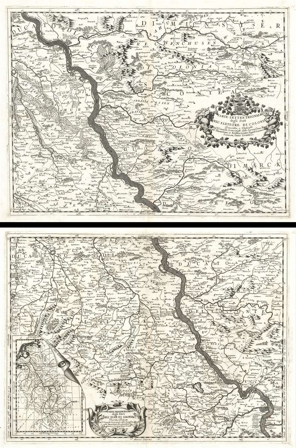 WE SELL ONLY ORIGINAL ANTIQUE MAPS - NOT REPRODUCTIONS Title: Parte Settentrionale degli Stati Dell'Elettore di Colonia. / Parte Meridionale degli Stati Dell'Elet. Di Colonia. Description: This is a 1690 Vincenzo Maria Coronelli map of the Rhine River in northwest Germany in what was then known as the Electorate of Cologne. Presented on two sheets that can function independently, the map depicts the region along the river from Wesel to Koblenz. Numerous cities, towns, and villages are labeled along the river's course and on both sides, including Wesel, Orsoy, Cologne (Colonia), Homberg, and others. Each settlement is marked by a dot or a small collection of buildings, allowing the viewer to have some understanding of the relative size of each population center. The terrain is shown pictorially, with mountains and forests providing some idea of what the country looks like. Beautiful title cartouches are illustrated on each of the maps. An inset map of the entire course of the Rhine is situated in the bottom left corner of the lower sheet. The Electorate of CologneThe Electorate of Cologne was an ecclesiastical principality of the Holy Roman Empire beginning in the 10th century until the early 19th century. Based around the power of the Archbishop of Cologne, the Archbishop ruled over his temporal possessions or Hochstift as a prince-elector. Germanic tribesmen first began living at the site that became Cologne in 38 BCE, and the Romans founded Colonia Agrippina at the site in 50 AD. After nearly a millenia, Emperor Otto I of Germany appointed his brother, Bishop Bruno, as a duke, handing the archbishops of Cologne their first taste of secular power. Otto endowed his brother and his successors with the powers of secular princes. Cologne served as the capital of the electorate until 1288, when, during the Battle of Worringen, when Archbishop Siegfried of Westerberg was captured by the citizenry of Cologne and forced to declare Cologne a Free Imperial cCity to regain his freedom. After this trying experience, the archbishop fled to Bonn. Both Bonne and Cologne were occupied by France in 1794.Publication History and CensusThis map was created and published by Vincenzo Coronelli in 1690. Only one example of each sheet is recorded in the OCLC and they are part of the collection of the Bibliothèque nationale de France in Paris.Size: Printed area measures 18.5 inches high by 25 inches wide. Condition: Very good. Two separate sheets. Both sheets exhibit light wear and toning along original centerfold. Both exhibit closed margin tears that have been professionally repaired on verso. Both are blank on verso. Shipping: Shipping rates are not negotiable. Items are shipped within three business days of receiving payment. We are happy to consolidate shipping where possible. The following shipping options are available: 1. FedEx Overnight (45 USD). USA Only. Signature Required. Customs: International buyers are responsible for paying duty and taxes on delivery. DHL or FedEx will contact the buyer by telephone to arrange tax payment if it is levied. Duty varies by country and we cannot predict the amount you will be charged. Some countries are duty free, others are not. Typically, a customs duty and/or VAT tax will be assessed on all parcels to continental Europe. Sometimes duty or tax is due in China, but is seems very random. Hong Kong, Singapore, Korea, and Taiwan have never assessed duty on a map we shipped. Maps shipped to the UK should be duty free as educational materials, but from time to time duty of 5% is assessed incorrectly by the UK customs agents. Insurance: All shipments are insured privately against loss and damage. All of our shipments require a signature for insurance purposes. If you have any questions please feel free to email us through eBay. Other Services Conservation Framing: Geographicus recommends basic conservation framing services for any antique paper. We do not offer this service. |
