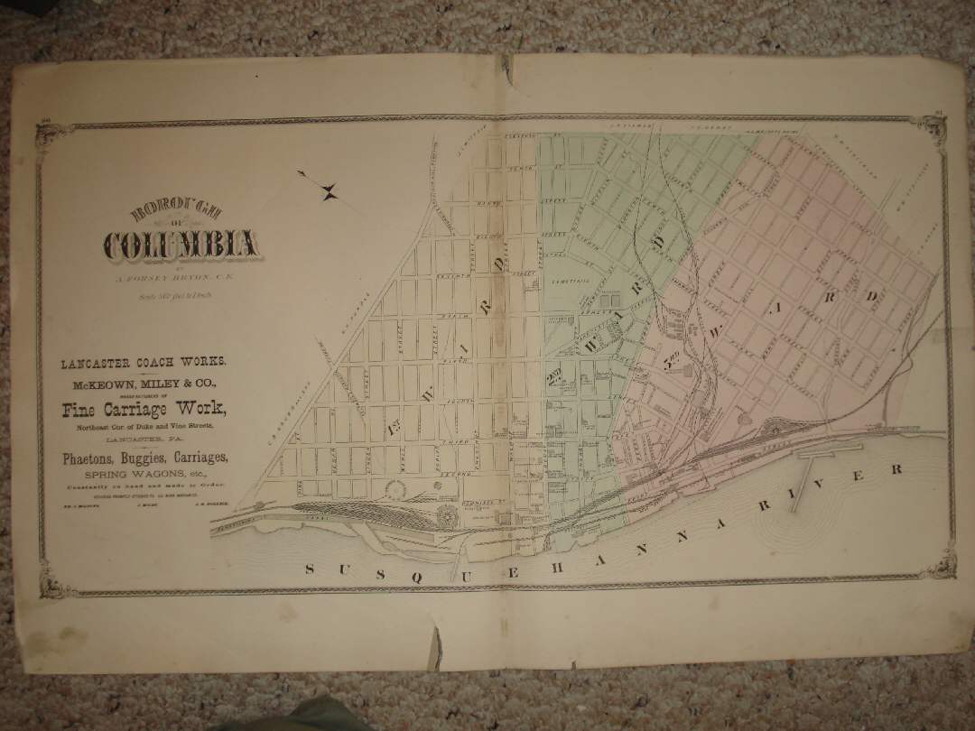
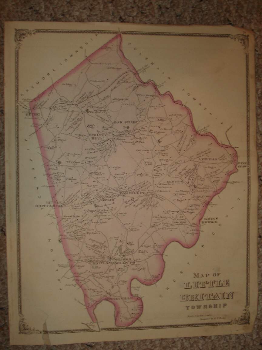
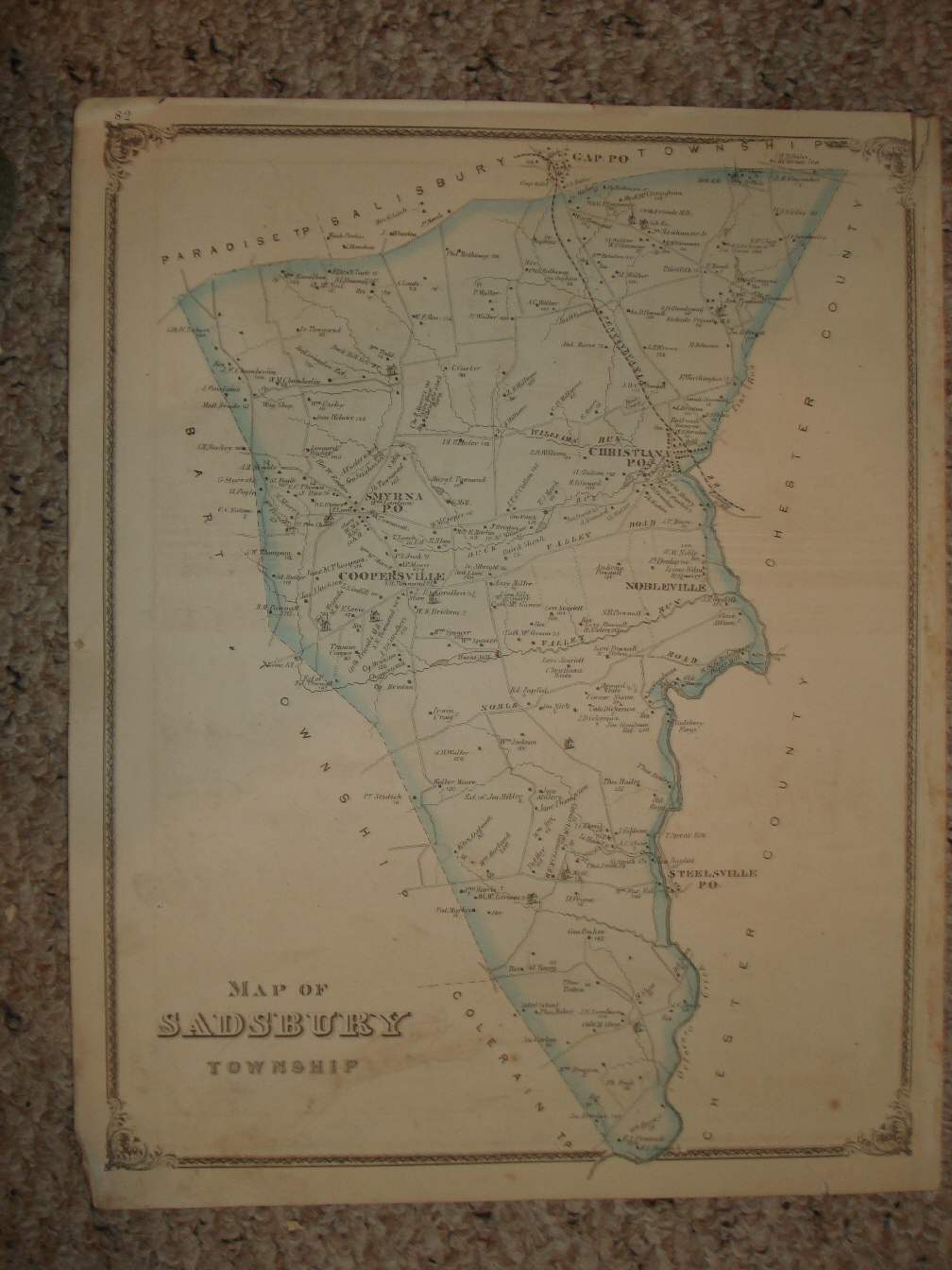
Vintage antique 1875 handcolored map. The map is 4 pages and any side would frame and display nicely. The first page is Map of Little Britain Township, I see Spring Hill , Oak Share Po , Oak Hill PO , Elim , Little Brittain PO , I believe this is now Little Britain , Ashville , Kirks Bridge , Kirks Mills PO , Eastland , Kinseyville and more. Small tear lower left hand side. The next 2 pages is a large and superb map titled Borough of Columbia , by A. Forsey Brion, titled in beautiful antique lettering. Beautiful map. 2 small tears at extreme edges, but if framed would be covered, overall map is in nice shape. The last page is fine antique map titled Map of Sadsbury Township . I see Smyrna PO , Coppersville , Christiana PO , Nobleville , Steelsville Po and more. The photo wont show the full beauty of the map or print. This is an antique map and not a reprint or reproduction. The handcoloring on the map is period to the map, this is before color printing. The map is from the very rare 1875 Everts and Stewart Atlas of Lancaster County Pennsylvania. The map is a fascinating and historic period look at this area at this time. The map shows the home and land owners, the business and industry, the few roads, railroads etc that existed at that time. The size of the single page map is 13.5" by 17", and the double page map is 17" by 27". Winning bidder pays $3.75 shipping domestic, more foreign.
Payment
I accept the following forms of payment:
- PayPal
Preferred Checkout
Shipping & Handling
$3.75 USPS
| FREE image hosting (including supersized) with Vendio Sales Manager. |
Listing automation and FREE scheduled listings by Vendio.
