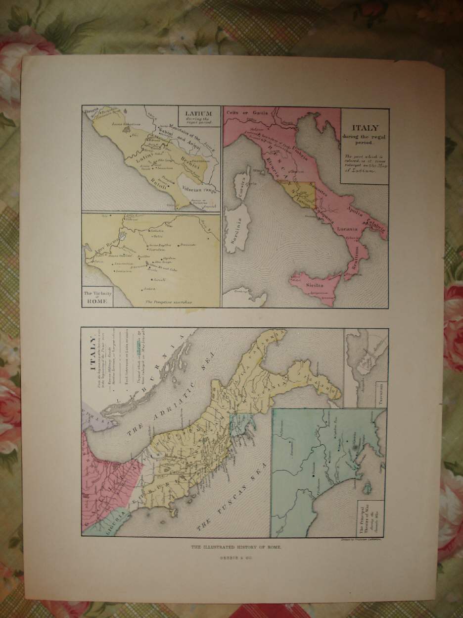
ANY SHADOW ON THE PHOTO IS NOT ON THE MAP, THATS THE PHOTO ONLY. Beautiful, antique handcolored map, titled at bottom middle The Illustrated History of Rome, Gebbie & Co. This map is circa 1850. There are 5 maps, upper left is Latium, then Vicinity of Rome, then Italy during the Regal Period , then Italy , from the beginning of the Samnite wars to the beginning of the Punic wars, below the title is a handcolored chart corresponding to the map itself. Then The Principal Theatre of War during the Samnite Wra, Tarentum. The conditon of the map is excellent. Very nicely produced map, printed on fine paper, with superb period handcoloring, this is before color printing was invented. The size of the map is 15" by 11.5". Rare. Winnibg bidder pays $3.25 shipping domestic more foreign.
Payment
I accept the following forms of payment:
- PayPal
Preferred Checkout
Shipping & Handling
$3.25 USPS
| FREE image hosting (including supersized) with Vendio Sales Manager. |
Listing automation and FREE scheduled listings by Vendio.
