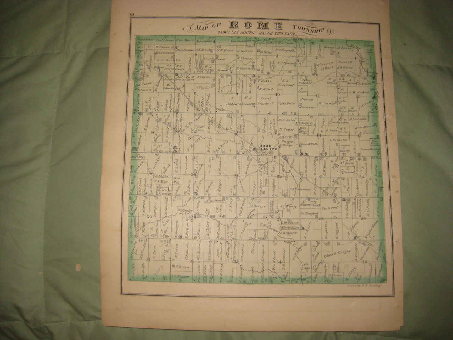
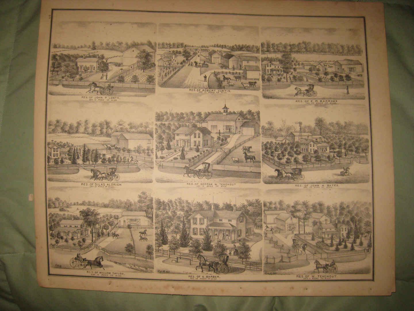
Vintage antique 1874 handcolored map. The map is 2 sided and either side would frame and display quite nicely. One side is Map of Rome Township. I see Rome Center and much more. The map shows the named home and land owners, roads, business and industry of the period and much more. On verso are fine lithograph views, showing 9 superb views at Rome Township. This reminds me of a Currier & Ives lithograph , yet the subject matter is Lenawee County Michigan. Both the map side and the print side is very sharp, not fuzzy like the photos. The photos wont show the full beauty of the map, they might appear fuzzy, the map is sharp and in beautiful condition. Beautiful period 1874 map of this area. This is an antique map and not a reprint or reproduction. The handcoloring on the map is period to the map, this is before color printing. The map is from the very rare 1874 Everts and Stewart Atlas of Lenawee County Michigan . The map is a fascinating and historic period look at this area at this time. The handcoloring is superb. The size of the map is 14.5" by 17". Winning bidder pays $3.75 shipping domestic, more foreign.
Payment
I accept the following forms of payment:
- PayPal
Shipping & Handling
US Shipping |
International Shipping |
| FREE scheduling, supersized images and templates. Get Vendio Sales Manager. |
FREE scheduling, supersized images
and templates. Get Vendio Sales Manager.