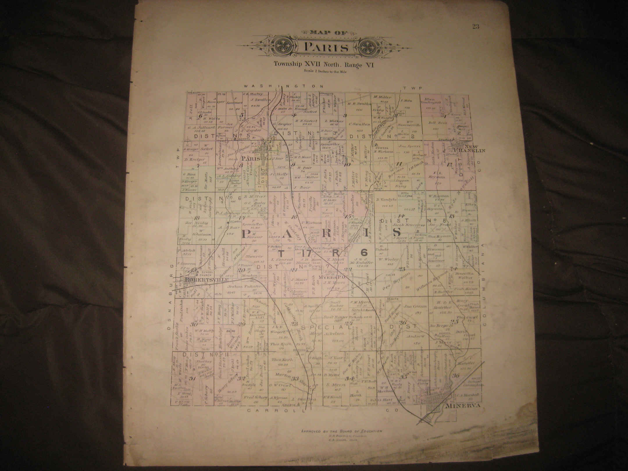
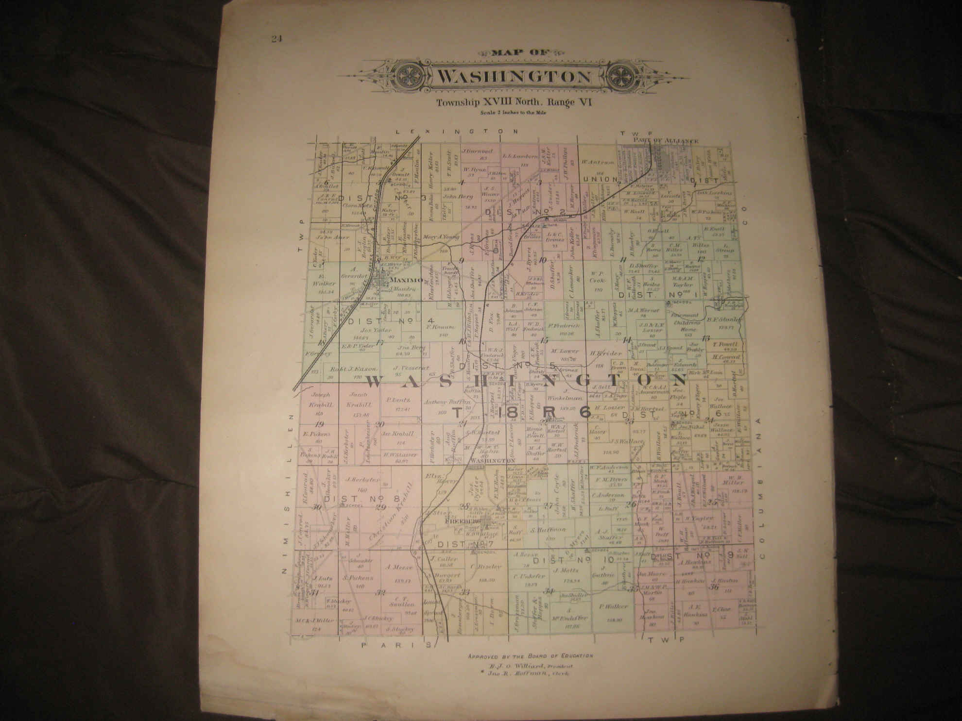
Vintage antique 1896 handcolored map. The map is printed on fine thick paper. The map is 2 sided and either side would frame and display quite nicely. One side is titled, in fancy antique lettering, Map of Washington, I see Maximo, Part of Alliance, Washington, Freeburg, the named home and land owners, the named railroads and much more of this period. Reverse is Map of Paris Township. The map shows Myers PO, Paris, New Franklin, Minerva, Robertsville, the named home and land owners, the railroads and much more. This is an antique map and not a reprint or reproduction. The handcoloring on the map is period to the map, this is before color printing. The map is from the very rare 1896 Ohio Map and Atlas Company Atlas of Stark County Ohio . The map is a fascinating and historic period look at this area at this time. The photo wont show the full beauty of the map. The size of the map is 15" by 18.5". Winning bidder pays $4.00 shipping domestic, more foreign.
Payment
I accept the following forms of payment:
- PayPal
Shipping & Handling
US Shipping |
International Shipping |
| FREE scheduling, supersized images and templates. Get Vendio Sales Manager. |
FREE scheduling, supersized images
and templates. Get Vendio Sales Manager.