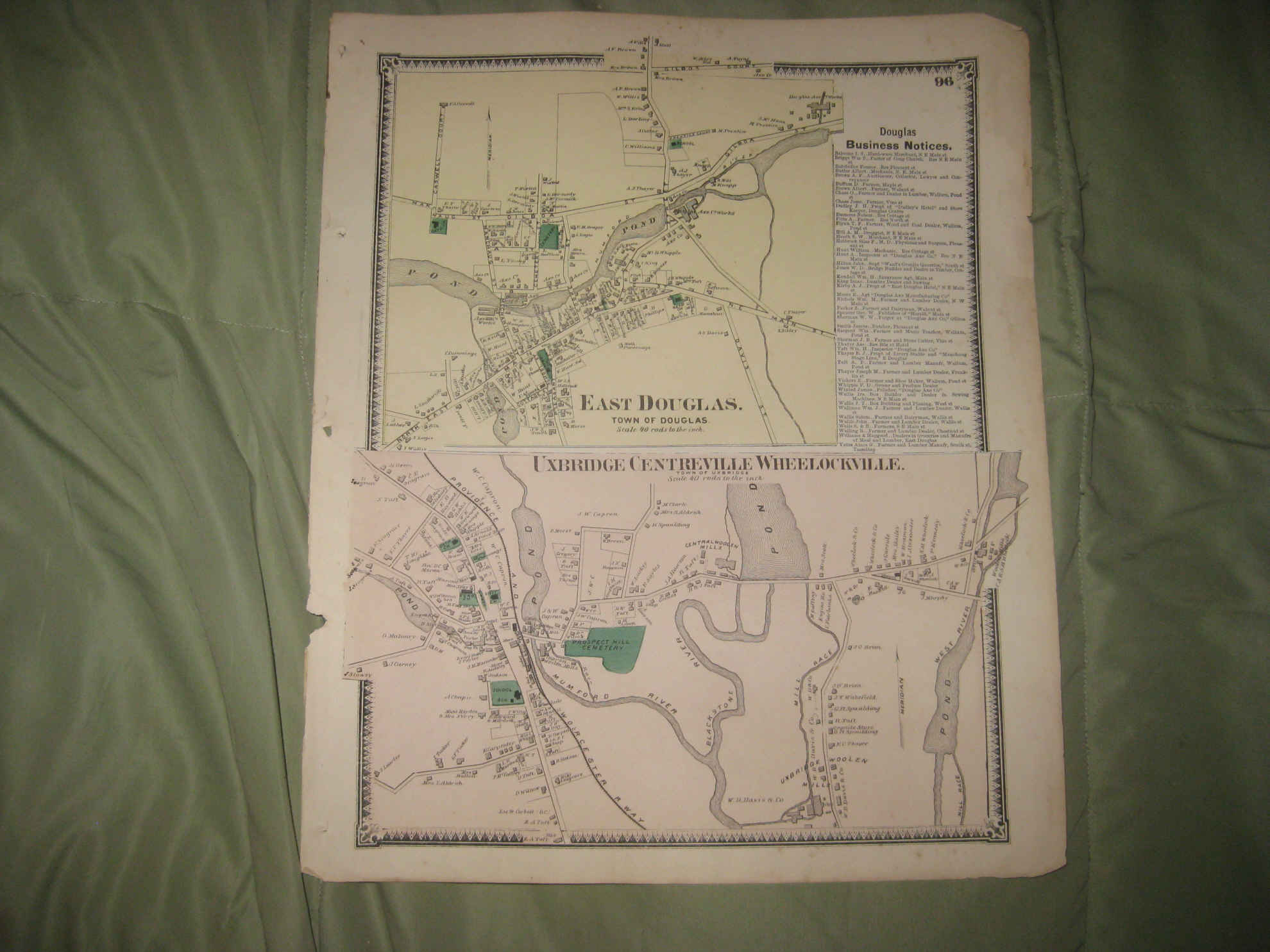
Vintage antique 1870 handcolored map. The map is titled East Douglas , Town of Douglas , at top and at bottom, Uxbridge , Centrevile and Wheelockville. Many fascinating areas on the map, superb antique map. This is an antique map and not a reprint or reproduction. The handcoloring on the map is period to the map, this is before color printing. The map is from the very rare 1870 Beers Atlas of Worcester County Massachusetts . The map is a fascinating and historic period look at this area at this time. The map shows the home and land owners, the business and industry, the few roads, railroads etc that existed at that time. This is a fascinating historical portrait of this area, in 1870. The photo wont show the full beauty of the map, it is beautiful. The map is in nice shape and would frame and display quite beautifully. The size of the map is 15.5" by 13" . Winning bidder pays $3.75 shipping domestic, more foreign.
Payment
I accept the following forms of payment:
- PayPal
Shipping & Handling
US Shipping |
International Shipping |
| FREE scheduling, supersized images and templates. Get Vendio Sales Manager. |
FREE scheduling, supersized images
and templates. Get Vendio Sales Manager.