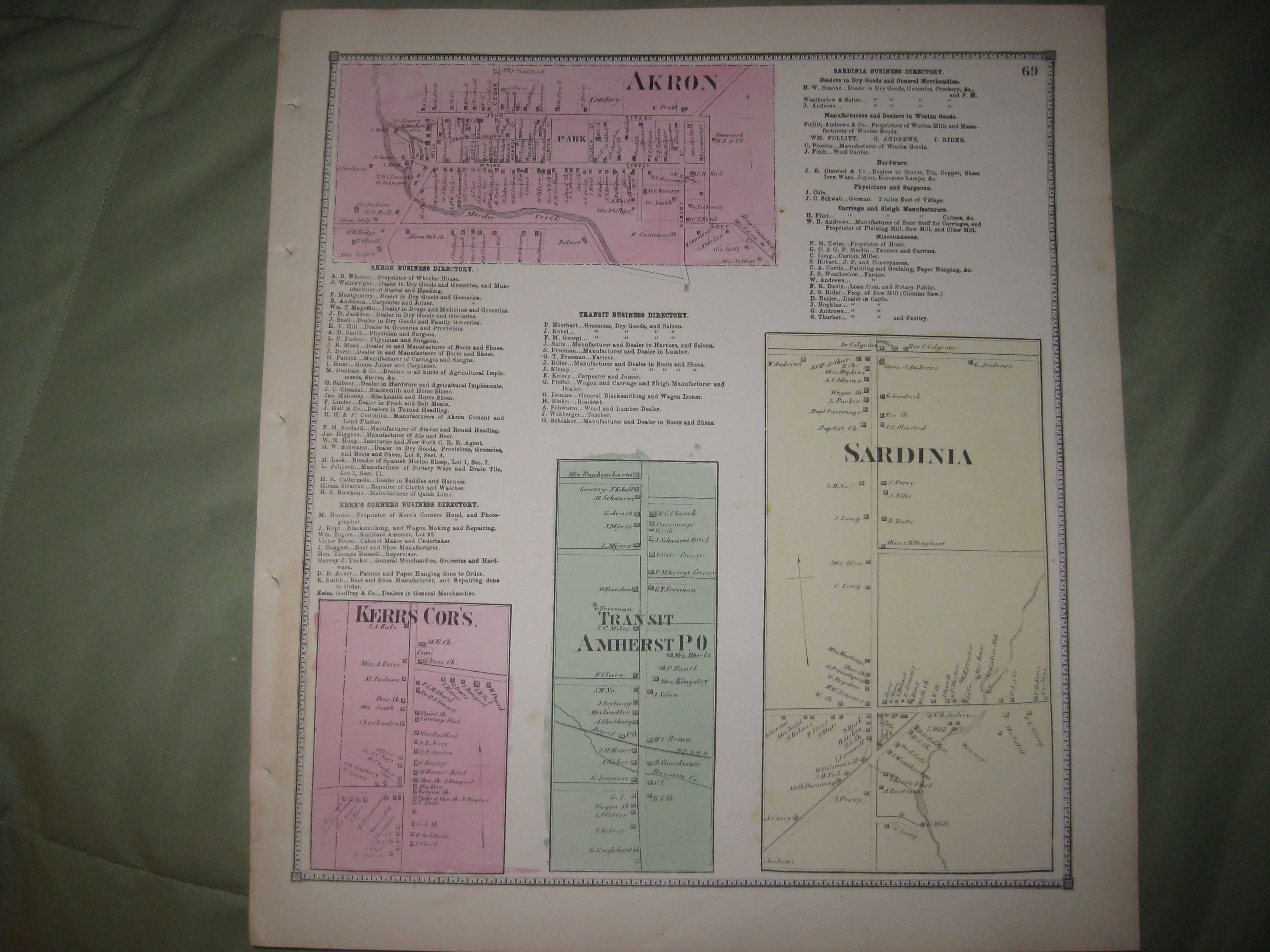
Vintage antique 1866 handcolored map, the condition of the map is amazing. The map is titled Sardinia, Akron, Transit, Amherst PO and Kerrs Corners. The map shows the named home and land owners, location of buildings, named business and industry, named creeks, named railroads, named patents, and much more. The map is in excellent very fine conditon, and would frame and display nicely, amazing condition, especially given the age. The map is printed on thick paper, with no printing on reverse. Many fascinating areas on the map, superb antique map. This is an antique map and not a reprint or reproduction. The handcoloring on the map is period to the map, this is before color printing. The map is from the very rare 1866 Stone and Stewart Atlas of Erie County New York. Rare county atlas. The map is a fascinating and historic period look at this area at this time. The photo wont show the full beauty of the map. The size of the map is 13.5" by 15". Winning bidder pays $4.00 shipping domestic, more foreign.
Payment
I accept the following forms of payment:
- PayPal
Shipping & Handling
US Shipping |
International Shipping |
| FREE scheduling, supersized images and templates. Get Vendio Sales Manager. |
FREE scheduling, supersized images
and templates. Get Vendio Sales Manager.