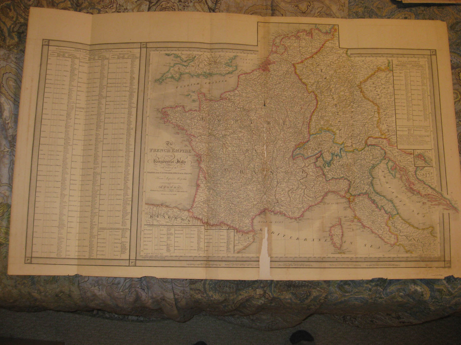
Huge, rare, gorgeous, folio sized important antique 1844 handcolored map, titled in fine fancy antique lettering, The French Empire, and the Kingdom of Italy with Part of the States of the Confederacy of the Rhine, From Lapie's Map 1811, London, Published by Jas. Wyld, Geographer to Her Majesty, Charing Cross East 1844. This dates the map nicely. James Wyld was a very important and highly regarded mapmaker of this period. Very interesting, detailed and attractive period map of these areas at this time, with fascianting text boxes related to these areas as well. Nice outside ornate border as well. Printed on very thick fine paper, with no printing on reverse. The map has an archival tape on reverse at bottom middle, along the fold, and a small bit of loss there, but map is overall in nice shape, and would frame and display beautifully. The size of the map is a very large 22.5" by 36.5". Winning bidder pays $4.25 shipping domestic, more foreign.
Payment
I accept the following forms of payment:
- PayPal
Shipping & Handling
US Shipping |
International Shipping |
| FREE scheduling, supersized images and templates. Get Vendio Sales Manager. |
FREE scheduling, supersized images
and templates. Get Vendio Sales Manager.