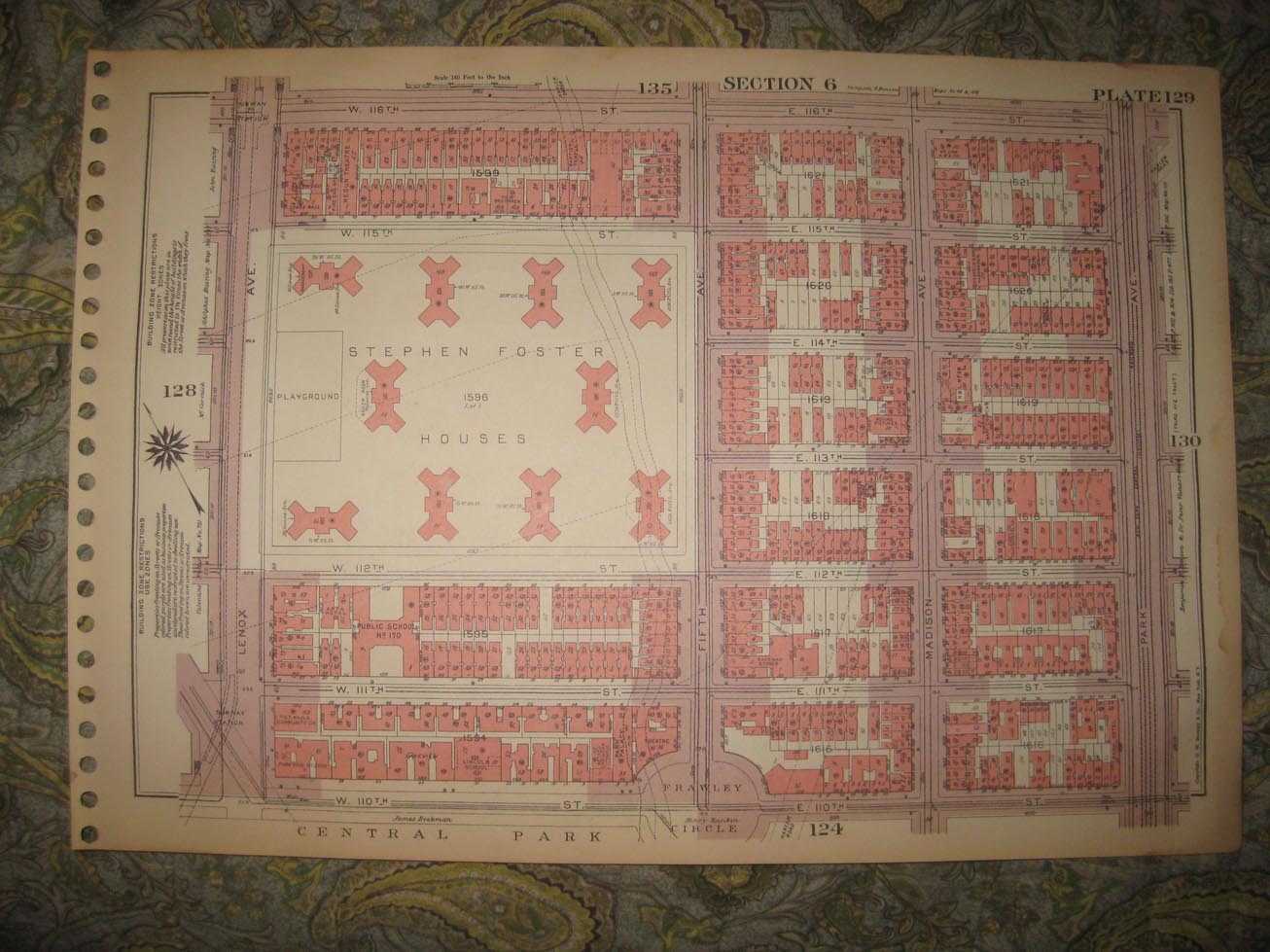
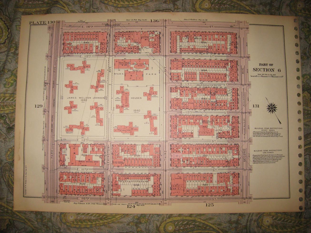
Vintage antique 1955 superbly color lithographed 2 sided map, either side would frame nicely. Both sides show Harlem, one side shows James Weldon Johnson Houses, and more, reverse shows Stephen Foster Houses , Frawley Circle and more. The maps are very detailed, with named streets, trolley lines, named schools, named churches, named buildings, railroads lines, size and locations of buildings, named business and industry, and much more of this era, the detail is amazing. This is an antique map and not a reprint or reproduction. The map is from the very rare 1955 Bromley Atlas of the City of New York. Bromley made some of the most attractive antique map of this variety ever made. The map is a fascinating and historic period look at this area at this time. The map is in nice shape and would frame and display quite beautifully. The size of the map is 11.5" by 16.5". Winning bidder pays $3.75 shipping domestic, more foreign.
Payment
I accept the following forms of payment:
- PayPal
Shipping & Handling
US Shipping |
International Shipping |
| FREE scheduling, supersized images and templates. Get Vendio Sales Manager. |
FREE scheduling, supersized images
and templates. Get Vendio Sales Manager.