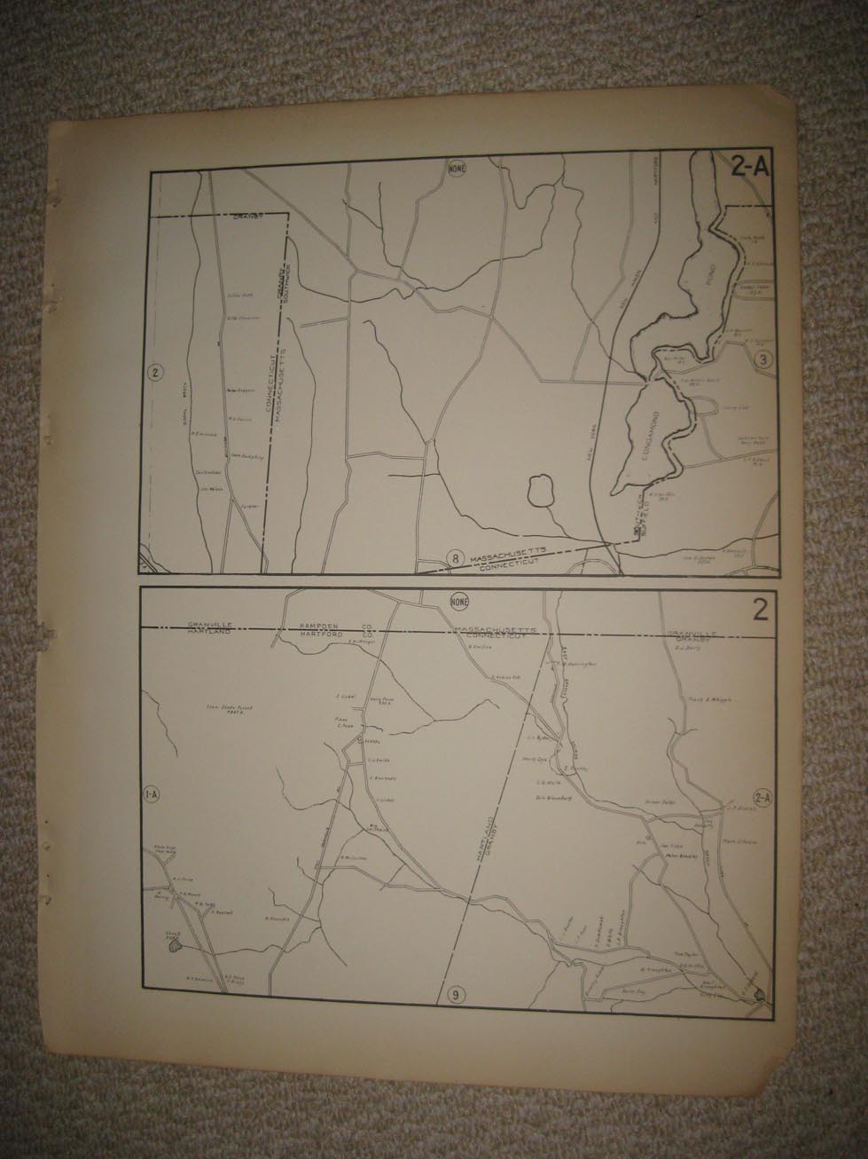
Fine, very rare, attractive, large antique 1931 lithographed map, showing the Massachusetts Connecticut border, Hartland, Granby, Granville, Southwick, and more. The map is very detailed, with the period named home and land owners, locations of buildings, named period streets, unfinished areas, named points, names coves, named railroads, and much more of this period, the detail is amazing. Printed on very thick paper, with no printing on reverse. Very finely produced period map. This is from the extremely rare 1931 Dolph and Stewart Atlas of Hartford County Connecticut. The map is in excellent condition and would frame and display nicely. The size of the map is 16" by 20.5". Rare. Winning bidder pays $4.00 shipping domestic, more foreign.
Payment
I accept the following forms of payment:
- PayPal
Shipping & Handling
US Shipping |
International Shipping |
| FREE scheduling, supersized images and templates. Get Vendio Sales Manager. |
FREE scheduling, supersized images
and templates. Get Vendio Sales Manager.