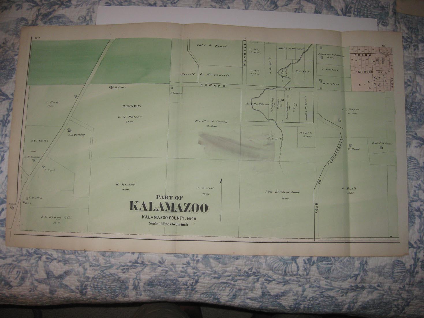
Vintage antique 1873 handcolored map. The map is large and printed in fine horizontal format, the map is titled Part of Kalamazoo, Kalamazoo County,Mich. Te map has a light brown spot near the middle. Printed on fine paper, with no printing on reverse. This is an antique 1873 map and not a reprint or reproduction. The map is in very fine superb condition. Many fascianting areas on this antique 1873 map. The map shows the land owners, named railroads, cities, towns, districts and much more. The superb handcoloring on the map is period, this is before color printing, the map is overall in excellent conditon, and would frame and display quite nicely. This is an antique map and not a reprint or reproduction. The handcoloring on the map is period to the map, this is before color printing. The map is from the very rare 1873 Beers Atlas of Kalamazoo County Michigan . The map is a fascinating and historic period look at this area at this time. The size of the map is 15.5" by 27.5". Winning bidder pays $4.00 shipping domestic, more foreign.
Payment
I accept the following forms of payment:
- PayPal
Shipping & Handling
US Shipping |
International Shipping |
| FREE scheduling, supersized images and templates. Get Vendio Sales Manager. |
FREE scheduling, supersized images
and templates. Get Vendio Sales Manager.