1753 Vaugondy Map of Picardy (Picardie) and Artois 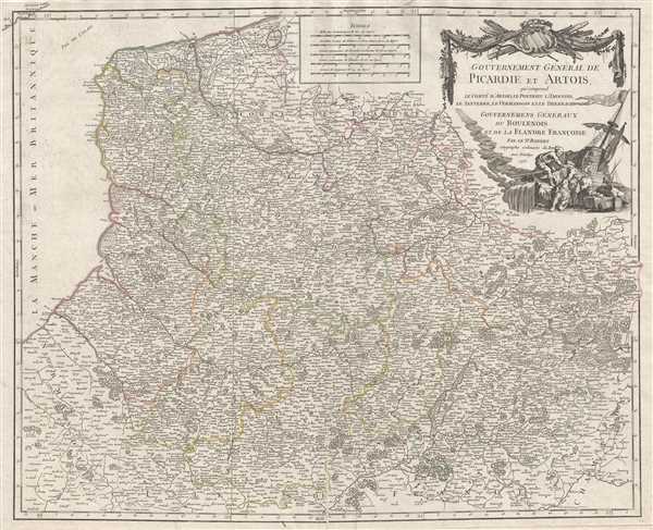 WE SELL ONLY ORIGINAL ANTIQUE MAPS - NOT REPRODUCTIONS Title: Gouvernement Général de Picardie et Artois qui comprend le Comté d'Artois, le Ponthieu l'Amienois, le Santerre, le Vermandois et le Theirrache. Gouvernemens Généraux du Boulenois et de la Flandre Francoise. Par le Sr. Robert Geographe ordinaire du Roi, Avec Privilege Description: This is a beautiful old color 1753 Robert de Vaugondy map of Picardy and Artois. This map covers the regions of Picardy (Picardie) and Artois, as well as parts of Normandy (Normandie), l'Ile de France (Isle de France), and Champagne. The Pas de Calais and the English Channel (La Manche) are also labeled. This map was published by Gilles Robert de Vaugondy for his 1573 Atlas Universel. Historically, Picardy has a proud and strong regional heritage. They have their own dialect, Picard, extraordinary Gothic churches, distinctive local cuisine, beer, traditional games, sports, and dances and music. Size: Printed area measures 28 inches high by 49 inches wide. Condition: Very good. Blank on verso. Shipping: Shipping rates are not negotiable. Items are shipped within three business days of receiving payment. We are happy to consolidate shipping where possible. The following shipping options are available: 1. FedEx Overnight (45 USD). USA Only. Signature Required. Customs: International buyers are responsible for paying duty and taxes on delivery. DHL or FedEx will contact the buyer by telephone to arrange tax payment if it is levied. Duty varies by country and we cannot predict the amount you will be charged. Some countries are duty free, others are not. Typically, a customs duty and/or VAT tax will be assessed on all parcels to continental Europe. Sometimes duty or tax is due in China, but is seems very random. Hong Kong, Singapore, Korea, and Taiwan have never assessed duty on a map we shipped. Maps shipped to the UK should be duty free as educational materials, but from time to time duty of 5% is assessed incorrectly by the UK customs agents. Insurance: All shipments are insured privately against loss and damage. All of our shipments require a signature for insurance purposes. If you have any questions please feel free to email us through eBay. Other Services Conservation Framing: Geographicus recommends basic conservation framing services for any antique paper. We do not offer this service. |
